Near Tendoy in Lemhi County, Idaho — The American West (Mountains)
Crossing the Great Divide
Corps of Discovery

Photographed By Barry Swackhamer, June 24, 2017
1. Crossing the Great Divide Marker
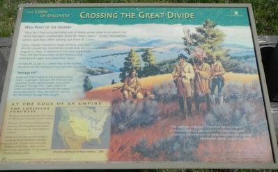
Captions: (map, lower left) Political Boundaries in North America - 1803; (background on right) "The road was still plain, I therefore did not despair of shortly finding a passage over the mountains and of tasting the waters of the great Columbia this evening." - Meriwether Lewis, August 12, 1805, "At Lemhi" by Robert F. Morgan.
"thus far I had accomplished one of those great objects on which my mind has been unalterably fixed for many years.," wrote Meriwether Lewis, 456 days after setting out from St. Louis.
Lewis, George Drouillard, Hugh McNeal, and John Shields crossed the Continental Divide here on August 12, 1805, in advance of the main expedition. They left the headwaters of the Missouri and entered the upper Columbia River Basin.
At 7,373 ft. (2,247 m.) Lemhi Pass is the highest elevation on the westward route of Lewis and Clark.
Lewis and Clark hoped to find a practical land route - a portage - between the Missouri and Columbia Rivers. Optimistically, they called this place "Portage Hill." Later, after five weeks of arduous travel through the rugged Rocky Mountains they learned this was not the Northwest Passage they sought.
Today you stand at the border of two states. In 1805, it was the boundary between two nations.
Purchase of the Louisiana Territory from France in 1803 strengthened the United States' drive to span the North American continent.
British and U.S. interests were racing to occupy the Pacific Northwest, wanting control of the valuable trade routes and commerce in the region. Both countries failed to fully acknowledge the sovereignty of resident Indian nations.
Erected by Beaverhead-Deerlodge & Salmon-Chaillis National Forest.
Topics and series. This historical marker is listed in these topic lists: Exploration • Natural Features. In addition, it is included in the Lewis & Clark Expedition series list. A significant historical date for this entry is August 12, 1805.
Location. 44° 58.5′ N, 113° 26.679′ W. Marker is near Tendoy, Idaho, in Lemhi County. Marker can be reached from Lemhi Pass Road near Lewis and Clark Highway (Forest Road 013), on the right when traveling south. Touch for map. Marker is in this post office area: Tendoy ID 83468, United States of America. Touch for directions.
Other nearby markers. At least 8 other markers are within walking distance of this marker. From Route ... To Road (a few steps from this marker); "Most Distant Fountain" of the Mighty Missouri (approx. 0.3 miles away in Montana); The Beginning of the "Endless Missouri" (approx. 0.3 miles away in Montana); Lemhi Pass (approx. 0.3 miles away); Agency Creek (approx. 0.3 miles away); Sacajawea Memorial Area (approx. 0.3 miles away); Sacajawea (Memorial Area)
(approx. 0.3 miles away); A Communication Across the Continent by Water (approx. 0.4 miles away). Touch for a list and map of all markers in Tendoy.
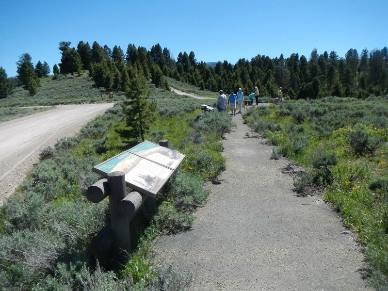
More about this marker. This marker is at the Lemhi Pass summit on a short trail paralleling Lemhi Pass Road.
This marker is on the Lewis and Clark National Back Country Byway and Adventure Road. The Byway is a 36 mile loop from Tendoy, Idaho to Lemhi Pass and back to Tendoy over gravel roads with a 4000 foot gain and loss in elevation. There are 10 designated stops with pullouts on the Byway and over two dozen information panels and markers on route. Estimated travel time is about 3 hours.
Credits. This page was last revised on November 2, 2017. It was originally submitted on November 2, 2017, by Barry Swackhamer of Brentwood, California. This page has been viewed 385 times since then and 21 times this year. Photos: 1, 2. submitted on November 2, 2017, by Barry Swackhamer of Brentwood, California.
