Near Carmen in Lemhi County, Idaho — The American West (Mountains)
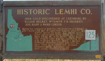
Historic Lemhi Co.
Photographed by Barry Swackhamer, June 24, 2017
1. Historic Lemhi Co. Marker
Mining has continued in Lemhi Co. with production of $30 Mil. in gold & nearly $35 Mil. in copper, lead, tungsten, silver, etc. 63 mineral species are found.
Aug. 1805 - Lewis & Clark entered Lemhi Valley 20 Mi. So. & crossed Idaho 75 Mi. No. to the Pacific.
1832 - Bonneville occupied valley 4 Mi. No. representing the U.S. in Oregon Territory.
1855 - a Mormon settlement established at Fort Lemhi near the place where Lewis and Clark first encamped: abandoned 1858.
Agriculture and stock raising established in 1870.
Erected by Idaho Department of Transportation. (Marker Number 125.)
Topics and series. This historical marker is listed in these topic lists: Agriculture • Exploration • Industry & Commerce. In addition, it is included in the Idaho State Historical Society, and the Lewis & Clark Expedition series lists. A significant historical year for this entry is 1866.
Location. 45° 14.628′ N, 113° 53.67′ W. Marker is near Carmen, Idaho, in Lemhi County. It is on Casey Road (U.S. 93) near
this page online

Regionally, this marker is in Central Idaho — Sawtooth Range. It is also in the American Mountain West and in the Lewis & Clark Corridor. Globally, it is in North America, the Rocky Mountains, the Western Hemisphere, the Western World, and the Anglosphere.
Other nearby markers. At least 8 other markers are within 6 miles of this marker, measured as the crow flies: Fort Bonneville (within shouting distance of this marker); The McNutt Building (approx. 4.7 miles away); William Clark's Campsite, August 21 and 25, 1805 (approx. 4.7 miles away); Tower Rock: William Clark's "Clift" (approx. 4.7 miles away); The Bluff (approx. 4.8 miles away); Tower Creek (approx. 5½ miles away); The Dog of Discovery (approx. 5.6 miles away); Sacajawea (approx. 5.6 miles away). Touch for a list and map of all markers in Carmen.
Photographed by Barry Swackhamer, June 24, 2017
2. Historic Lemhi Co. Marker
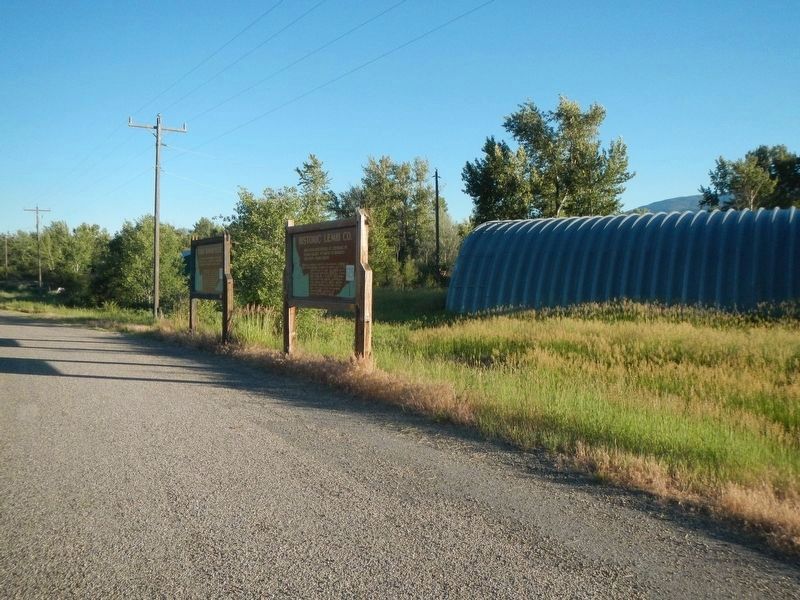
This marker is closest to the viewer.
Credits. This page was last revised on November 6, 2017. It was originally submitted on November 6, 2017, by Barry Swackhamer of Brentwood, California. This page has been viewed 664 times since then and 46 times this year. Photos: 1, 2. submitted on November 6, 2017, by Barry Swackhamer of Brentwood, California.
