Near Grace in Caribou County, Idaho — The American West (Mountains)
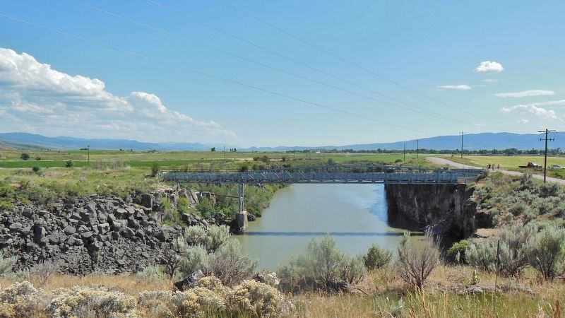
Last Chance Canal
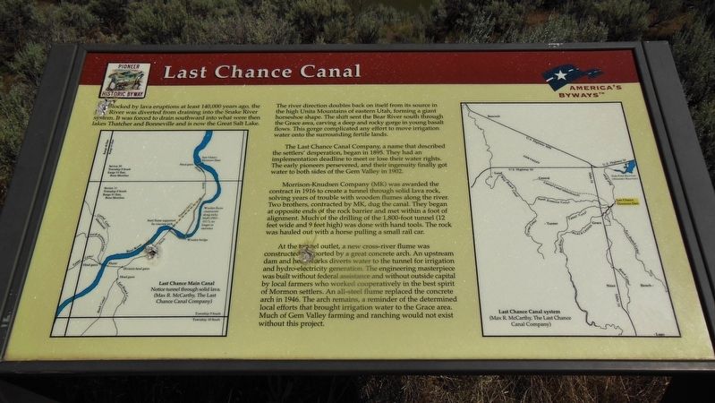
Blocked by lava eruptions at least 140,000 years ago, the Bear River was diverted from draining into the Snake River system. It was forced to drain southward into what were then lakes Thatcher and Bonneville and is now the Great Salt Lake.
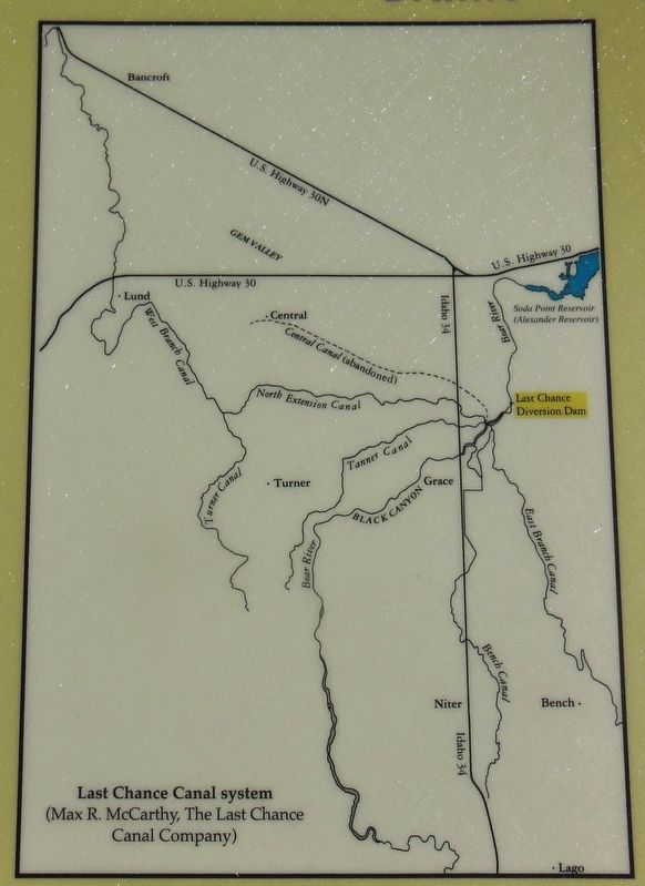
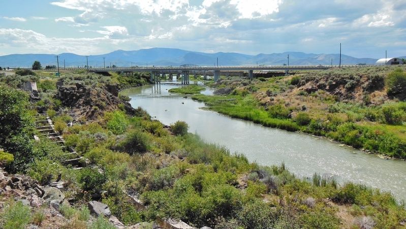
The river direction doubles back on itself from its source in the high Uinta Mountains of eastern Utah, forming a giant horseshoe shape. The shift sent the Bear River south through the Grace area, carving a deep and rocky gorge in young basalt flows. The gorge complicated any effort to move irritation water onto the surrounding fertile fields.
The Last Chance Canal Company, a name that described the settlers’ desperation, began in 1895. They had an implementation deadline to meet or lose their water rights. The early pioneers persevered, and their ingenuity finally got water to both sides of the Gem Valley in 1902.
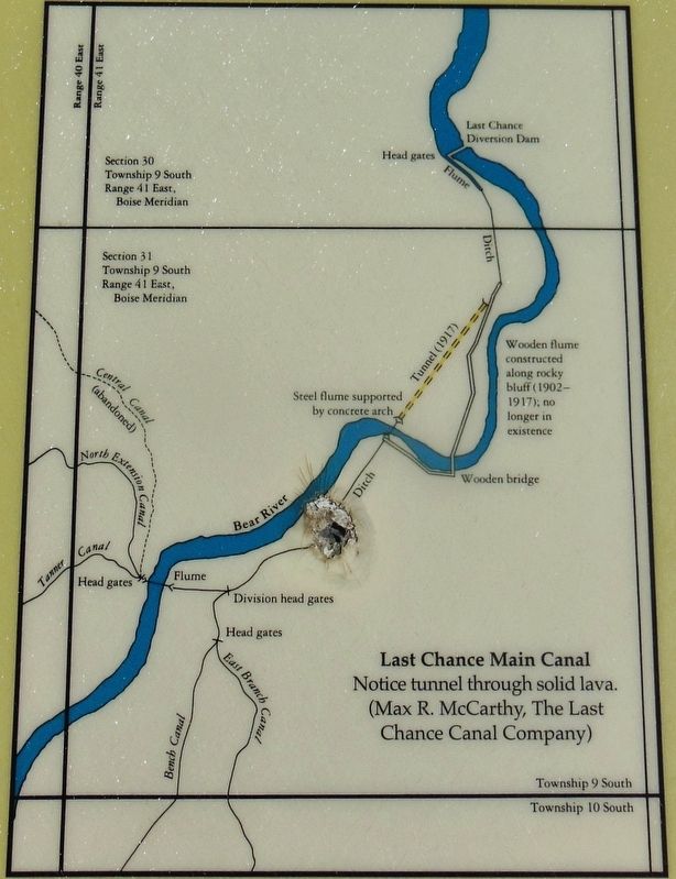
Morrison-Knudsen Company (MK) was awarded the contract in 1916 to create a tunnel through solid lava rock, solving years of trouble with wooden flumes along the river. Two brothers, contracted by MK, dug the canal. They began at opposite ends of the rock barrier and met within a foot of alignment. Much of the drilling of the 1,800-foot tunnel (12 feet wide and 9 feet high) was done with hand tools. The rock was hauled out with a horse pulling a small rail car.
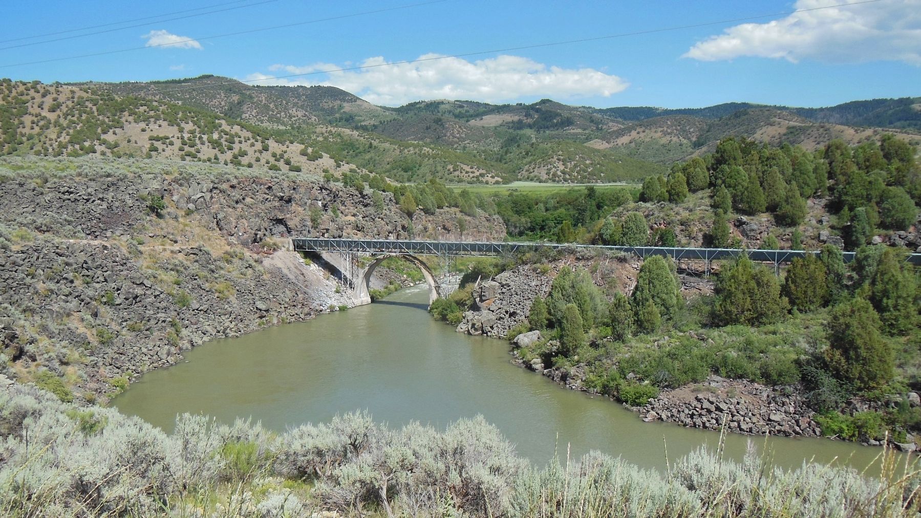
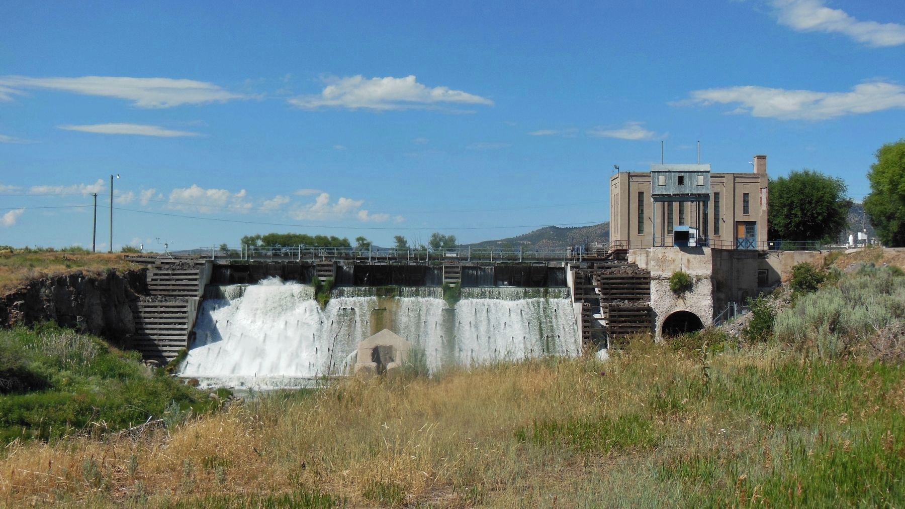
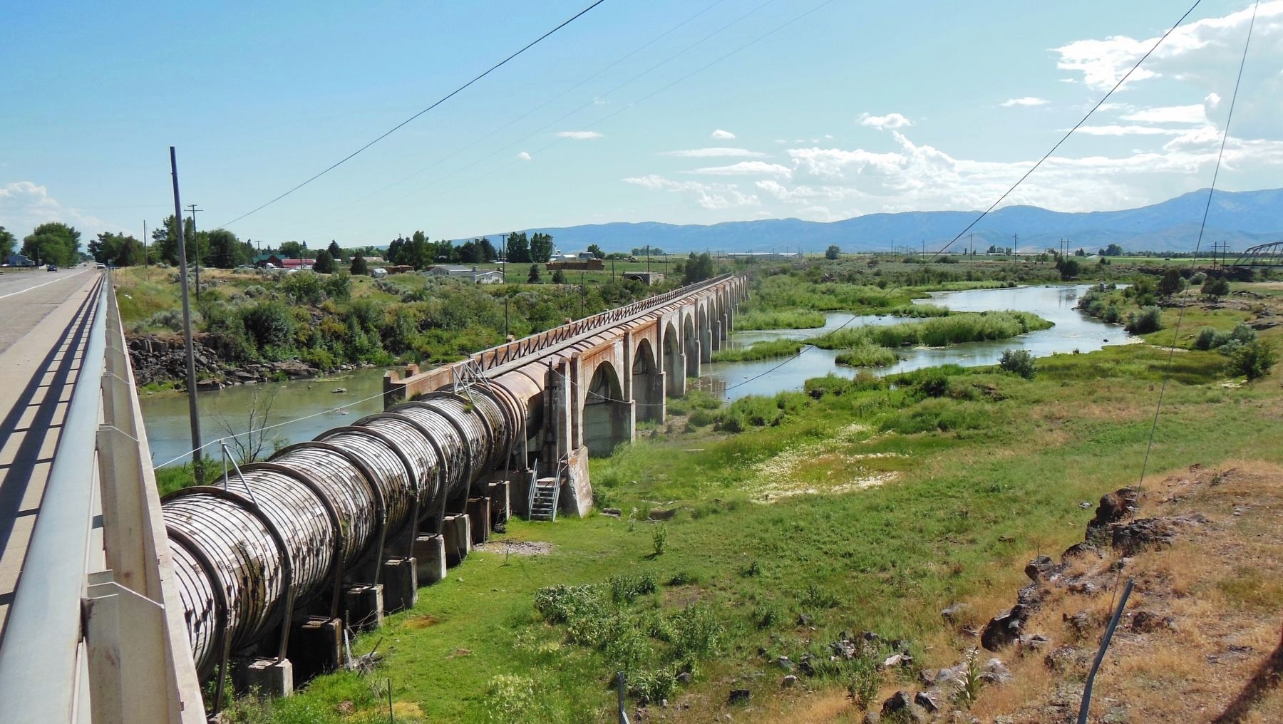
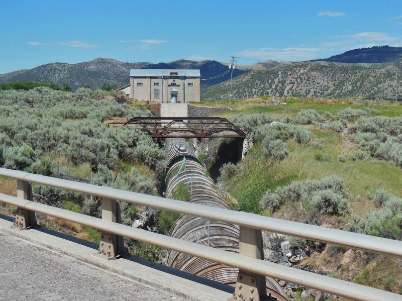
At the tunnel outlet, a new cross-river flume was constructed and supported by a great concrete arch. An upstream dam and headworks diverts water to the tunnel for irrigation and hydro-electricity generation. The engineering masterpiece was built without federal assistance and without outside capital by local farmers who worked cooperatively in best spirit of Mormon settlers. An all-steel flume replaced the concrete arch in 1946. The arch remains, a reminder of the determined local efforts that brought irrigation water to the Grace area. Much of Gem Valley farming and ranching would not exist without this project.
Topics. This historical marker is listed in these topic lists: Agriculture • Industry & Commerce • Waterways & Vessels.
Location. 42° 36.029′ N, 111° 42.648′ W. Marker is near Grace, Idaho, in Caribou County. Marker is on Last Chance Lane, 1.3 miles west of State Highway 34, on the right when traveling west. Marker overlooks the subject canal from a pull-out on the west side of Last Chance Lane. The intersection of Idaho Highway 34 and Last Chance Lane is about a mile north of Center Street in Grace, Idaho. Touch for map. Marker is at or near this postal address: 2164 Last Chance Lane, Grace ID 83241, United States of America. Touch for directions.
Other nearby markers. At least 8 other markers are within 4 miles of this marker, measured as the crow flies. Last Chance Canal Co. Ltd. (approx. 1.8 miles away); Black Canyon Gorge (approx. 2.6 miles away); Lava Flows and Wagon Trains (approx. 3.2 miles away); California dreaming in 1841 (approx. 3.2 miles away); Horatio's Journey (approx. 3.3 miles away); Hudspeth Cutoff (approx. 3.3 miles away); Idaho's Emigrant Trails (approx. 3.3 miles away); Guiding Landmark... (approx. 3.3 miles away). Touch for a list and map of all markers in Grace.
Also see . . .
1. Last Chance Canal. Southeast Idaho High Country website entry (Submitted on December 26, 2022, by Larry Gertner of New York, New York.)
2. Last Chance Canal Company. Website homepage (Submitted on December 26, 2022, by Larry Gertner of New York, New York.)
3. Bear River Heritage Area. Website homepage:
Without the extensive networks of irrigation canals created by settlers of this region, farming as it now exists would have been impossible in this arid area. Residents created cooperatives to organize the use of the water, with families owning shares that gave them the right to irrigate their land on a scheduled basis. The water shares were usually sold with the land, though later, it became common for developers and others to try to buy up water shares from people who weren’t using them. An engineering masterpiece for its time, the Last Chance Canal was completed in the early 1900s (Submitted on November 11, 2017, by Cosmos Mariner of Cape Canaveral, Florida.)
Credits. This page was last revised on December 26, 2022. It was originally submitted on November 11, 2017, by Cosmos Mariner of Cape Canaveral, Florida. This page has been viewed 1,005 times since then and 82 times this year. Photos: 1, 2, 3, 4, 5, 6. submitted on November 11, 2017, by Cosmos Mariner of Cape Canaveral, Florida. 7, 8, 9. submitted on November 18, 2017, by Cosmos Mariner of Cape Canaveral, Florida. • Bill Pfingsten was the editor who published this page.
