Mer Rouge in Morehouse Parish, Louisiana — The American South (West South Central)
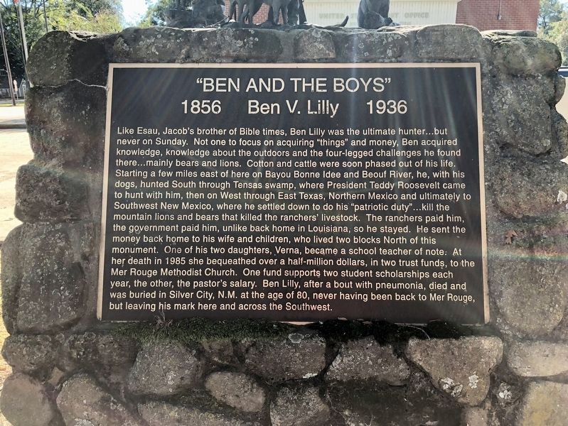
"Ben and the Boys"
Ben V. Lily
| — | 1856 - 1936 | — |
Photographed by Mark Hilton, October 25, 2017
1. "Ben and the Boys" Marker
this page online
Topics and series. This historical marker is listed in these topic lists: Agriculture • Animals • Religion & Religious Structures • Settlements & Settlers. In addition, it is included in the Former U.S. Presidents: #26 Theodore Roosevelt series list. A significant historical year for this entry is 1985.
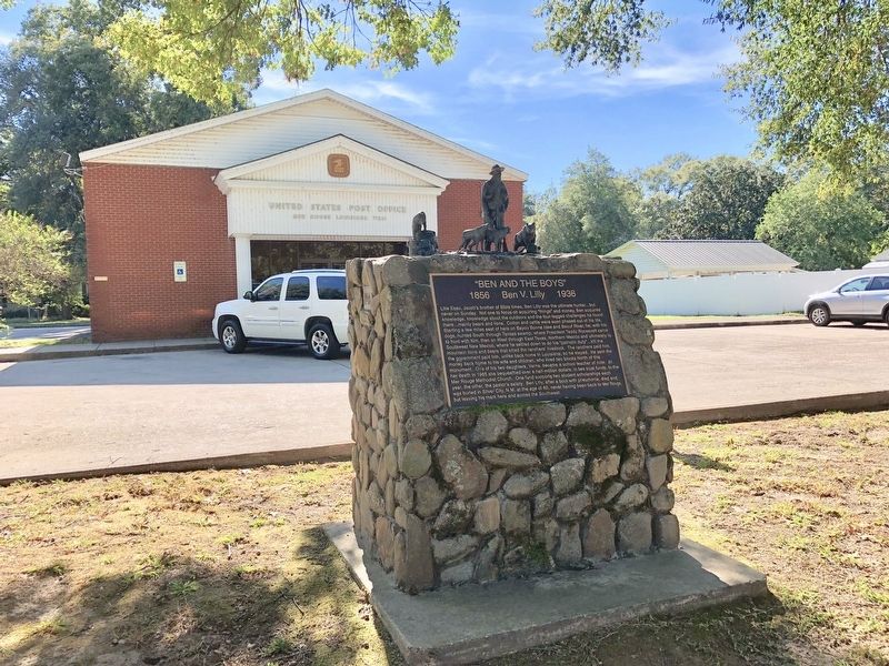
Location. 32° 46.609′ N, 91° 47.733′ W. Marker is in Mer Rouge, Louisiana, in Morehouse Parish. It is on Davenport Avenue (U.S. 165) east of South 22nd Street, on the right when traveling east. Located in front of the Mer Rouge Post Office. Touch for map. Marker is at or near this postal address: 405 Davenport Avenue, Mer Rouge LA 71261, United States of America. Touch for directions.

Regionally, this marker is in North Louisiana. It is also in the American South and specifically in the Deep South. Globally, it is in North America, a Gulf of Mexico state, the Western
Photographed by Mark Hilton, October 25, 2017
2. "Ben and the Boys" Marker in front of the post office.
Other nearby markers. At least 5 other markers are within 9 miles of this marker, measured as the crow flies: Hoss Logan (approx. 0.2 miles away); Luther E. Hall (approx. 5.8 miles away); Mable John (approx. 6.9 miles away); Morehouse Parish Training School (approx. 7½ miles away); Point Pleasant (approx. 9 miles away).
Credits. This page was last revised on November 14, 2024. It was originally submitted on November 16, 2017, by Mark Hilton of Montgomery, Alabama. This page has been viewed 1,209 times since then and 67 times this year. Photos: 1, 2. submitted on November 16, 2017, by Mark Hilton of Montgomery, Alabama.
