Keauhou in Hawaii County, Hawaii — Hawaiian Island Archipelago (Pacific Ocean)
Kauikeaouli and Nāhi'ena'ena
Inscription.
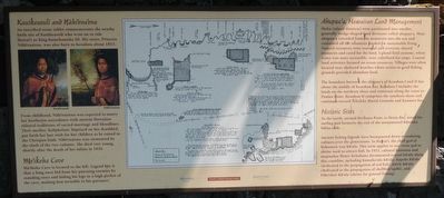
Kauikeaouli and Nāhi'ena'ena
An inscribed stone tablet commemorates the nearby birth site of Kauikeaouli who went on to rule Hawai'i as King Kamehameha III. His sister, Princess Nāhi'ena'ena, was also born in Keauhou about 1815,
From childhood, Nāhi'ena'ena was expected to marry her brother in accordance with ancient Hawaiian cultural traditions of sacred marriage and bloodlines. Their mother, Keōpūolani, baptized on her deathbed, put forth her last wish for her children to be raised in the Christian faith. Nāhi'ena'ena was tormented by the clash of the two cultures. She died very shortly after the death of her infant in 1936.
Mo'ikeha Cave
Mo'ikeha Cave was located to the left. Legend has it that a king once hid from his pursuing enemies by standing erect and hiding his legs in a high pocket of the cave, making him invisible to his pursuers.
Ahupua'a, Hawaiian Land Management
Moku (island districts) were partitioned into smaller, generally wedge-shaped land divisions called ahupua'a. Most ahupua'a extended from the mountain into the sea and contained all the resources needed for sustainable living. Natural resources were essential and everyone shared resources and cared for the land. Upland field systems, where water was more accessible, were cultivated for crops, Coastal and activities focused on ocean resources. Villages were often located near sheltered beaches where access to good fishing grounds provided abundant food.
The boundary between the ahupua'a of Keauhou I and II lies about the middle of Keauhou, Bay. Keauhou I includes the lands on the northern shore and continues along the coast to Paniau Point. Keauhou II comprises the southern shore and continues toward Lekeleke Burial Grounds and Kuamo'o Bay.
Historic Sites
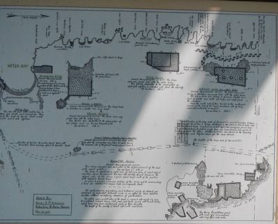
To the north, around Ha'ikaua Point is He'eia Bay noted for surfing and formerly the end of the monumental Kāneaha hōlua slide.
Ancient fishing legends have been passed down in seafaring cultures over the generations. In Hawai'i the chief god of fishermen was Kūula. This term applies to any stone god or shrine used to attract fish. In 1953, cultural historian and mapmaker Henry Kekahuna documented several kūula along this coastline, including Kumaha'ula Kūula, Kapehe Kūula (dedicated to the propagation of red fish), Kōele Kūula (dedicated to the propagation of shellfish/opihi) and Pāhe'ehe'e Kūula (shrine for general fishing).
Erected by Keauhou Resort and Hawai'i Tourism.
Topics. This historical marker is listed in these topic lists:
Animals • Anthropology & Archaeology • Churches & Religion • Government & Politics. A significant historical year for this entry is 1815.
Location. 19° 33.681′ N, 155° 57.703′ W. Marker is in Keauhou, Hawaii, in Hawaii County. Marker can be reached from Kaleiopapa Street near Ehukai Street, on the right when traveling north. Touch for map. Marker is at or near this postal address: 78-7130 Kaleiopapa Street, Keauhou HI 96739, United States of America. Touch for directions.
Other nearby markers. At least 8 other markers are within walking distance of this marker. The Kamehameha Dynasty (a few steps from this marker); Birthplace of Kauikeaouli (within shouting distance of this marker); Kauikeaouli, Kamehameha III (within shouting distance of this marker); Keauhou Bay (within shouting distance of this marker); Royal Center at Keauhou Bay (within shouting distance of this marker); Keauhou - Kahalu'u Heritage Corridor (approx. half a mile away); Inikiwai Ku'ula Heiau (approx. ¾ mile away); Lonoikamakahiki Residence (approx. 0.9 miles away). Touch for a list and map of all markers in Keauhou.
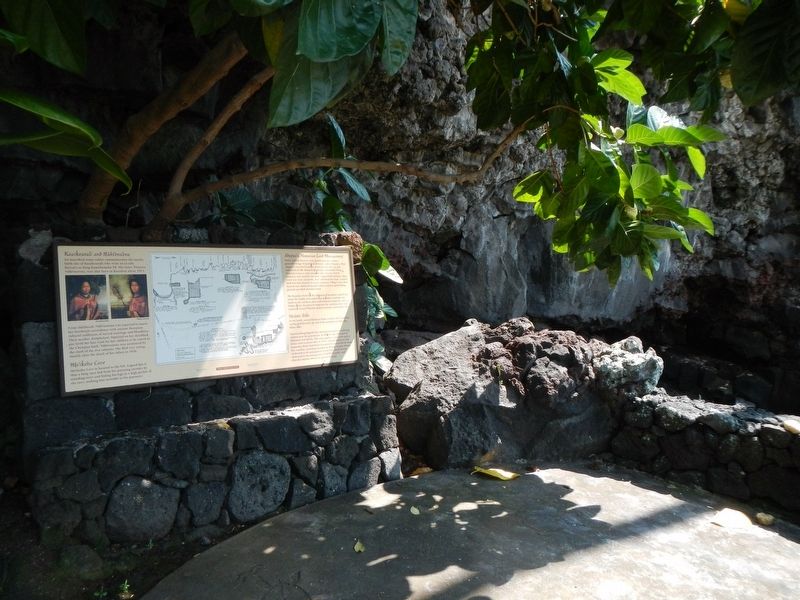
More about this marker. This marker is opposite the Keauhou Harbor parking lot.
This marker
is on the Keauhou-Kahalu'u Heritage Corridor.
Credits. This page was last revised on November 17, 2019. It was originally submitted on November 19, 2017, by Barry Swackhamer of Brentwood, California. This page has been viewed 396 times since then and 42 times this year. Photos: 1, 2, 3. submitted on November 19, 2017, by Barry Swackhamer of Brentwood, California.


