Fredericksburg, Virginia — The American South (Mid-Atlantic)
Fredericksburg Campaign
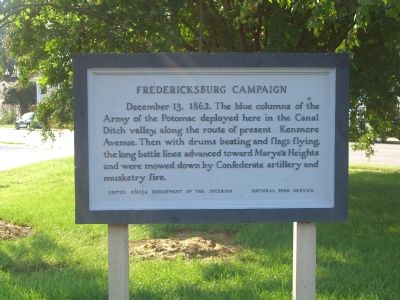
Photographed by Kevin W., September 15, 2007
1. Fredericksburg Campaign Marker
Erected by United States Department of the Interior, National Park Service.
Topics. This historical marker is listed in this topic list: War, US Civil. A significant historical date for this entry is December 13, 1804.
Location. Marker has been reported missing. It was located near 38° 17.945′ N, 77° 27.891′ W. Marker was in Fredericksburg, Virginia. It was at the intersection of Hanover Street and Kenmore Avenue, on the right when traveling east on Hanover Street. Touch for map. Marker was in this post office area: Fredericksburg VA 22401, United States of America. Touch for directions.

Regionally, this marker was in the Washington Metropolitan Area and in Northern Virginia. It was also in the American South and specifically in the Upper South. Globally, it was in North America, the Western Hemisphere, the Western World,
this page online
Other nearby markers. At least 8 other markers are within walking distance of this location: A different marker also named Ravaged Town (a few steps from this marker); a different marker also named Marye's Heights (a few steps from this marker); a different marker also named The Canal Ditch (a few steps from this marker); Eyewitness To Battle (within shouting distance of this marker); 1849 (about 300 feet away, measured in a direct line); The Rowe House (about 400 feet away); Barton Street Confederate Monument (about 500 feet away); The Barton Street Potter's Field (about 700 feet away). Touch for a list and map of all markers in Fredericksburg.
Other markers no longer nearby. Marye’s Heights (was a few steps from this marker but has been replaced with another marker now near it); The Canal Ditch (was a few steps from this marker but has been replaced with another marker now near it); Ravaged Town (was
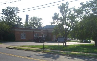
Photographed by Kevin W., September 15, 2007
2. Fredericksburg Campaign Marker
More about this marker. This marker is no longer standing and has not been replaced.
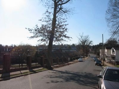
Photographed by Craig Swain, December 13, 2008
3. Start of Federal Advance
Looking from near Federal Hill, on Hanover Street, toward the west in the direction of Marye's Heights. The right flank of the Federal advanced passed between this road and William Street. At the base of this hill was the mill race or canal which caused much difficulty with the Union advance.
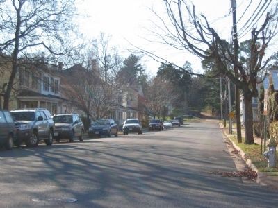
Photographed by Craig Swain, December 13, 2008
4. Advance to the Sunken Road
Looking up Mercer Street, with the white sides of the Innis House just visible through the trees in the distant center. Federal forces were stopped in these last 200 yards before reaching the Confederate positions in the Sunken Road.
Credits. This page was last revised on February 2, 2023. It was originally submitted on September 15, 2007, by Kevin W. of Stafford, Virginia. This page has been viewed 1,997 times since then and 25 times this year. Last updated on November 23, 2017, by Shane Oliver of Richmond, Virginia. Photos: 1, 2. submitted on September 15, 2007, by Kevin W. of Stafford, Virginia. 3, 4. submitted on December 14, 2008, by Craig Swain of Leesburg, Virginia. • Bill Pfingsten was the editor who published this page.
