Near Natural Bridge in Rockbridge County, Virginia — The American South (Mid-Atlantic)
George Washington
Photographed by M. L., June 19, 1999
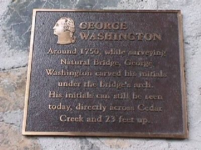
1. George Washington Marker
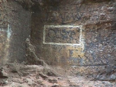
Around 1750, while surveying Natural Bridge, George Washington carved his initials under the bridge's arch. His initials can still be seen today, directly across Cedar Creek and 23 feet up.
Topics and series. This historical marker is listed in these topic lists: Bridges & Viaducts • Colonial Era • Environment • Exploration. In addition, it is included in the Former U.S. Presidents: #01 George Washington series list. A significant historical year for this entry is 1750.
Location. 37° 37.884′ N, 79° 32.677′ W. Marker is near Natural Bridge, Virginia, in Rockbridge County. It can be reached from the intersection of Lee Highway (U.S. 11) and Wert Faulkner Highway (Virginia Highway 130). Touch for map. Marker is in this post office area: Natural Bridge VA 24578, United States of America. Touch for directions.

Regionally, this marker is in the Mountain Region. It is also in the American South, specifically in the Upper South, in Appalachia, and specifically in Southern Appalachia. Globally, it is in North America, the Western Hemisphere, the Western World, and the Anglosphere. Historically,
this page online
Other nearby markers. At least 8 other markers are within walking distance of this marker: Natural Bridge (approx. 0.2 miles away); a different marker also named Natural Bridge (approx. 0.2 miles away); Once Enslaved, He Became Natural Bridge's First Caretaker (approx. 0.2 miles away); A Cave that Armed American Soldiers (approx. ¼ mile away); “The Most Sublime of Nature’s Works” (approx. ¼ mile away); Natural Bridge Patent (approx. ¼ mile away); “Vires-Acquirit-Eundo” Ancient Arbor Vitae (approx. ¼ mile away); The Time-Traveling Tree of Life (approx. ¼ mile away). Touch for a list and map of all markers in Natural Bridge.
Other markers no longer nearby. Monacan Village (was approx. 0.2 miles away but has been permanently removed); a different marker also named Natural Bridge (was approx. 0.2 miles away but has been permanently removed); Saltpetre Cave (was approx. ¼ mile away but has been permanently removed).
Also see . . .
1. Natural Bridge State Park.
Photographed by M. L., June 19, 1999
2. George Washington initials
2. The Natural Bridge Zoological Park. Zoo website homepage:
Home to the largest, most complete collection of animals and birds in the state of Virginia and breeding center for rare and endangered species. (Submitted on September 6, 2008, by M. L. 'Mitch' Gambrell of Taylors, South Carolina.)
Photographed by M. L., June 19, 1999
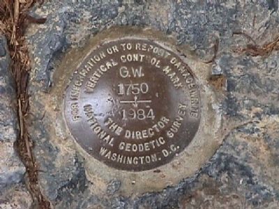
3. Datum point located near marker
Photographed by M. L., June 19, 1999
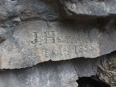
4. More initials carved in rock.
Photographed by M. L., June 19, 1999
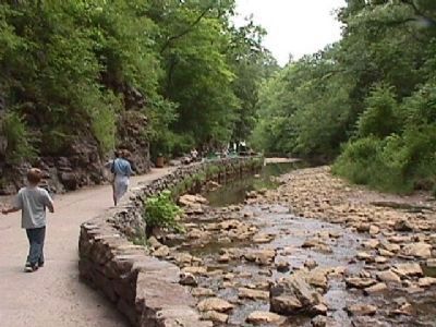
5. Nature trail beside Cedar Creek
Photographed by M. L., June 19, 1999
6. Saltpeter cave
Credits. This page was last revised on May 22, 2025. It was originally submitted on September 5, 2008, by M. L. 'Mitch' Gambrell of Taylors, South Carolina. This page has been viewed 11,852 times since then and 632 times this year. Photos: 1, 2, 3, 4, 5, 6. submitted on September 5, 2008, by M. L. 'Mitch' Gambrell of Taylors, South Carolina. • Kevin W. was the editor who published this page.
