Vicksburg National Military Park in Warren County, Mississippi — The American South (East South Central)
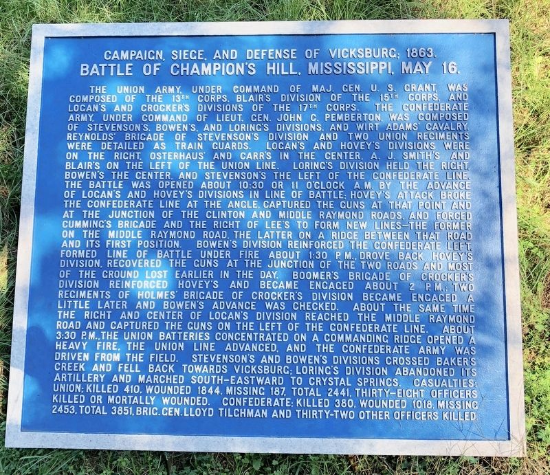
Battle of Champion's Hill, Mississippi, May 16.
Campaign, Siege, and Defense of Vicksburg; 1863.
Inscription.
The Union Army, under command of Maj. Gen. U. S. Grant, was composed of the 13th Corps, Blair’s division of the 15th Corps, and Logan’s and Crocker’s Divisions of the 17th Corps. The Confederate Army, under command of Lieut. Gen. John C. Pemberton, was composed of Stevenson’s, Bowen’s, and Loring’s Divisions, and Wirt Adams Cavalry, Reynolds' Brigade of Stevenson’s Division and two Union regiments were detailed as train guards. Logan's and Hovey’s Divisions were on the right, Osterhaus and Carr's in the center, A. J. Smith's and Blair’s on the left of the Union line. Loring's Division held the right, Bowen’s the center, and Stevenson’s the left of the Confederate line. The battle was opened about 10:30 or 11 o'clock a.m. by the advance of Logan’s and Hovey’s Divisions in line of battle: Hovey’s attack broke the Confederate line at the angle, captured the guns at that point and at the junction of the Clinton and Middle Raymond Roads, and forced Cumming’s Brigade and the right of Lee's to form new lines the former on the Middle Raymond Road, the latter on a ridge between that road and its first position. Bowen's Division reinforced the Confederate left formed line of battle under fire about 1:30 p m. drove back Hovey’s Division, recovered the guns at the junction of the two roads of the ground lost earlier in the day. Boomers Brigade of
Crocker’s Division reinforced Hovey’s and became engaged about 2 p.m.;
regiments of Holmes Brigade of Crocker’s Division became engaged a little later and Bowen’s advance was checked. About the same time
the right and center of Logan's Division reached the Middle Raymond Road and captured the guns on the left of the Confederate line. About 3:30 p m. the Union batteries concentrated on a commanding ridge opened a heavy fire, the Union line advanced, and the Confederate Army was driven from the field. Stevenson's and Bowen’s Divisions crossed Bakers Creek and fell back towards Vicksburg: Loring's Division abandoned its artillery and marched south-eastward to Crystal Springs. Casualties: Union: killed 410, wounded 1844, missing 187, total 2441, thirty-eight officers killed or mortally wounded. Confederate: killed 380, wounded 1018, missing 2453, total 3851, Brig. Gen. Lloyd Tilghman and thirty-two other officers killed.
Erected by National Park Service, Department of the Interior.
Topics. This historical marker is listed in this topic list: War, US Civil. A significant historical year for this entry is 1844.
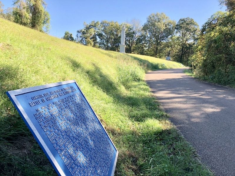
Location. 32° 22.623′ N, 90° 50.051′ W. Marker is in Vicksburg National Military Park, Mississippi, in Warren County. Marker is on Grant Circle west of Grant Avenue, on the left when traveling east. Touch for map. Marker is at or near this postal address: Grant Circle, Vicksburg MS 39183, United States of America. Touch for directions.
Other nearby markers. At least 8 other markers are within walking distance of this marker. Engagement at Jackson, Mississippi, May 14. (a few steps from this marker); Ulysses S. Grant (within shouting distance of this marker); Engagement at Raymond, Mississippi, May 12. (within shouting distance of this marker); Assault on the Confederate Line of Defense, May 19. (within shouting distance of this marker); Battle of Port Gibson, Mississippi, May 1. (within shouting distance of this marker); Assault on the Confederate Line of Defense, May 22. (within shouting distance of this marker); U.S. Detached for Service on Gunboats; (within shouting distance of this marker); U S Headquarters 16th Corps (Detachment) (within shouting distance of this marker). Touch for a list and map of all markers in Vicksburg National Military Park.
Also see . . . Wikipedia article on the Battle of Champion Hill. (Submitted on November 17, 2017, by Mark Hilton of Montgomery, Alabama.)
Credits. This page was last revised on December 1, 2017. It was originally submitted on November 17, 2017, by Mark Hilton of Montgomery, Alabama. This page has been viewed 288 times since then and 17 times this year. Last updated on November 30, 2017, by T. Patton of Jefferson, Georgia. Photos: 1, 2. submitted on November 17, 2017, by Mark Hilton of Montgomery, Alabama. • Bill Pfingsten was the editor who published this page.

