Augusta in Kennebec County, Maine — The American Northeast (New England)
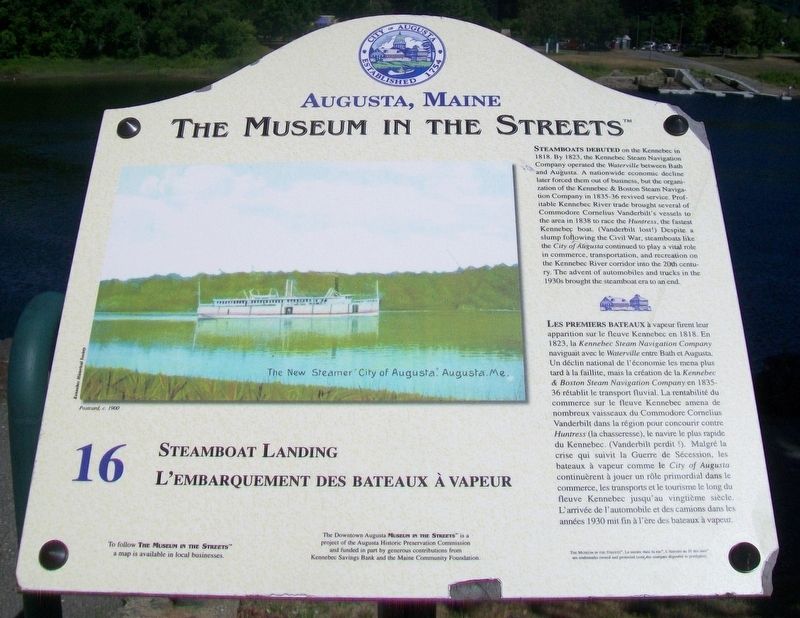
Steamboat Landing / L'embarquement des bateaux à vapeur
Augusta, Maine
— The Museum in the Streets® —
Inscription.
Steamboats debuted on the Kennebec in 1818. By 1823, the Kennebec Steam Navigation Company operated the Waterville between Bath and Augusta. A nationwide economic decline later forced them out of business, but the organization of the Kennebec & Boston Steam Navigation Company in 1835-36 revived service. Profitable Kennebec River trade brought several of Commodore Cornelius Vanderbilt's vessels to the area in 1838 to race the Huntress, the fastest Kennebec boat. (Vanderbilt lost!) Despite a slump following the Civil War, steamboats like the City of Augusta continued to play a vital role in commerce, transportation, and recreation on the Kennebec River corridor into the 20th century. The advent of automobiles and trucks in the 1930s brought the steamboat era to an end.
Erected by The Museum in the Streets®. (Marker Number 16.)
Topics and series. This historical marker is listed in these topic lists: Industry & Commerce • Parks & Recreational Areas • Waterways & Vessels. In addition, it is included in the The Museum in the Streets®: Augusta, Maine series list. A significant historical year for this entry is 1818.
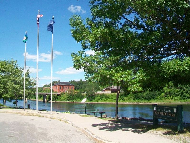
Location. 44° 18.874′ N, 69° 46.416′ W. Marker is in Augusta, Maine, in Kennebec County. Marker is at the intersection of Front Street and Winthrop Street, on the right when traveling north on Front Street. Touch for map. Marker is at or near this postal address: Waterfront Park, next to the flagpoles, Augusta ME 04330, United States of America. Touch for directions.
Other nearby markers.
At least 8 other markers are within walking distance of this marker. Shipbuilding Days / L'époque des chantiers navals (within shouting distance of this marker); Market Square / La place du Marché (within shouting distance of this marker); Granite Block / Un Bâtiment en granit (within shouting distance of this marker); Augusta's Publishing Empire / L'empire de l'édition à Augusta (within shouting distance of this marker); Flag Protest ~ War of 1812 / Drapeau en berne - Guerre de 1812 (within shouting distance of this marker); United States Post Office / La Poste des Etats-Unis (about 300 feet away, measured in a direct line); Cornerstone Day / La pose des premières pierres (about 300 feet away); The Great Fire / Le Grand incendie (about 300 feet away). Touch for a list and map of all markers in Augusta.
Also see . . . The Museum in the Streets Tour Map, Augusta, Maine. (Submitted on December 7, 2017, by William Fischer, Jr. of Scranton, Pennsylvania.)
Credits. This page was last revised on November 17, 2021. It was originally submitted on December 7, 2017, by William Fischer, Jr. of Scranton, Pennsylvania. This page has been viewed 209 times since then and 16 times this year. Photos: 1, 2. submitted on December 7, 2017, by William Fischer, Jr. of Scranton, Pennsylvania.

