Kerrville in Kerr County, Texas — The American South (West South Central)
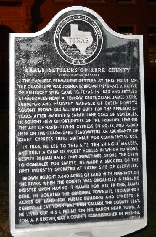
Early Settlers of Kerr County
(The Shingle Makers)
The earliest permanent settler at this point on the Guadalupe was Joshua D. Brown (1816-74), a native of Kentucky who came to Texas in 1830 and settled at Gonzales near a fellow Kentuckian, James Kerr, surveyor and resident manager of Green DeWitt's Colony. Brown did military duty for the Republic of Texas. After marrying Sarah Jane Goss of Gonzales, he sought new opportunities on the frontier, learned the art of hand-riving cypress shingles, and found here on the Guadalupe's headwaters an abundance of giant cypress trees suitable for commercial use.
In 1846, he led to this site ten shingle makers, and built a camp of picket houses in which to work. Despite Indian raids that sometimes drove the crew to Gonzales for safety, he made a success of the first industry operated at later site of Kerrville.
Brown bought 2,640 acres of land with frontage on the river. When the county was organized in 1856, he insisted upon having it named for his friend, James Kerr. He donated the original townsite, including 4 acres of land for public buildings and streets in Kerrsville (as town was then called), the county seat. He lived out his lifetime on his ranch near town. A son, A.P. Brown, was county commissioner in 1935-36.
Erected 1971 by State Historical Survey Committee . (Marker Number 1352.)
Topics. This historical marker is listed in these topic lists: Industry & Commerce • Man-Made Features • Settlements & Settlers.
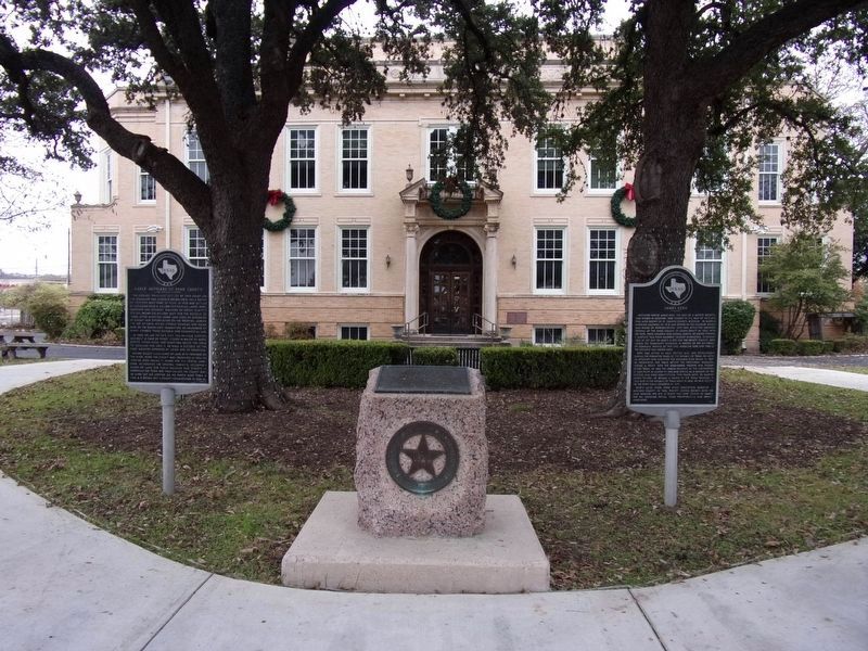
Location. 30° 2.839′ N, 99° 8.379′ W. Marker is in Kerrville, Texas, in Kerr County. Marker is on Main Street (State Highway 27) north of Earl Garrett Street, on the right when traveling north. Marker is located in plaza in front of the Kerr County Courthouse, between the parking lot and the main entrance. Touch for map. Marker is at or near this postal address: 700 Main Street, Kerrville TX 78028, United States of America. Touch for directions.
Other nearby markers. At least 8 other markers are within walking distance of this marker. Kerr County (here, next to this marker); James Kerr (here, next to this marker); Bocock Civil War Cannon (within shouting distance of this marker); Kerr County War Memorial (within shouting distance of this marker); Joshua D. Brown (about 300 feet away, measured in a direct line); Charles A. Schreiner (about 300 feet away); Kerrville (about 300 feet away); Guthrie Building (about 300 feet away). Touch for a list and map of all markers in Kerrville.
Also see . . .
1. Kerr County Settlement.
The first attempt at Anglo settlement in the area of the present Kerr County occurred in 1846 when Joshua D. Brown led a group of ten men to the Guadalupe River and established a shingle-making camp at
the site of present Kerrville. They were soon driven off by Indians, only to return to the site, which they named Brownsborough, in 1848. A number of settlers moved into the area in the early 1850s, erecting sawmills on the various streams and establishing farms. Indian raids became increasingly troublesome in the early 1850s, and in response the United States Army established a post at Camp Verde in southern Kerr County on July 8, 1855. This post became the headquarters for the famed experiment with camels as transport, and promoted development in the area as well as providing protection. Settlers faced the dangers of Indian attack for the next twenty years, and the final raid took place in 1878. (Submitted on December 9, 2017, by Cosmos Mariner of Cape Canaveral, Florida.)
2. A Brief History of Kerr County.
In 1857, A German master miller named Christian Dietert and millwright Bathasar Lich started a large grist and saw mill on a bluff next to the Guadalupe River. Because the mill's location was protected from floods had a permanent source of power (the river), it became the most etensive operation of its kind west of New Braunfels and San Antonio. (Submitted on December 9, 2017, by Cosmos Mariner of Cape Canaveral, Florida.)
Credits. This page was last revised on December 1, 2019. It was originally submitted on December 9, 2017, by Cosmos Mariner of Cape Canaveral, Florida. This page has been viewed 291 times since then and 22 times this year. Photos: 1. submitted on December 9, 2017, by Cosmos Mariner of Cape Canaveral, Florida. 2. submitted on November 30, 2019, by Kayla Harper of Dallas, Texas. • Bernard Fisher was the editor who published this page.

