Golden in Jefferson County, Colorado — The American Mountains (Southwest)
Triceratops Trail
Photographed by Alan M. Perrie, November 26, 2017
1. Welcome to Triceratops Trail Marker
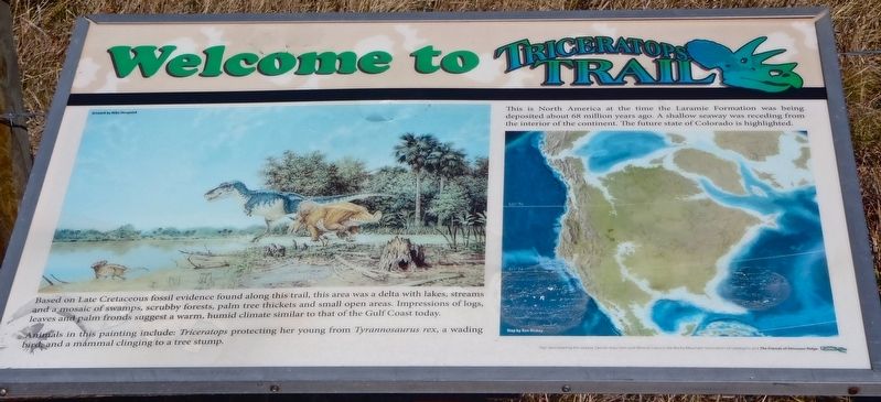
Based on Late Cretaceous fossil evidence found along this trail, this area was a delta with lakes, streams and a mosaic of swamps, scrubby forests, palm tree thickets and small open areas. Impressions of logs, leaves and palm fronds suggest a warm, humid climate similar to that of the Gulf Coast today.
Animals in this painting include: Triceratops protecting her young from Tyrannosaurus rex, a wading bird, and a mammal clinging to a tree stump.
This is North America at the time the Laramie Formation was being deposited about 68 million years ago. A shallow seaway was receding from the interior of the continent. The future state of Colorado is highlighted.
Erected by The Greater Denver Area Gem and Mineral Council, the Rocky Mountain Association of Geologists, and the Friends of Dinosaur Ridge.
Topics. This historical marker is listed in these topic lists: Animals • Environment • Paleontology.
Location. 39° 44.591′ N, 105° 13.276′ W. Marker is in Golden, Colorado, in Jefferson County. It is on 6th Avenue (U.S. 6) half a mile south of 19th Street, on the
this page online

Regionally, this marker is in the Front Range. It is also in the American Mountain West. Globally, it is in North America, the Rocky Mountains, the Western Hemisphere, the Western World, and the Anglosphere. Historically, it finds itself in what was once the Louisiana Purchase.
Other nearby markers. At least 8 other markers are within walking distance of this marker: Clay Mining (about 300 feet away, measured in a direct line); Bird Track (about 500 feet away); Triceratops Tracks (about 500 feet away); Palm Fronds (about 500 feet away); Stop 7: Laramie Formation (68 mya) Clay Pits Fault, Fire Clay Mining, Reclamation (approx. 0.7 miles away); White Ash Mine Disaster (approx. 0.7 miles away); Stop 7a: White Ash Mine (approx. 0.7 miles away); Colorado School Of Mines (approx. ¾ mile away). Touch for a list and map of all markers in Golden.
Also see . . .
1. Triceratops. (Submitted on December 13, 2017, by Alan M. Perrie of Unionville, Connecticut.)
2. Cretaceous Period.
Photographed by Leslie Eudy, November 1, 2025
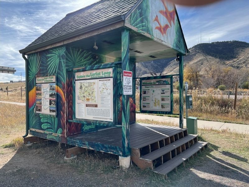
2. Triceratops Trail Marker Wide View
Credits. This page was last revised on November 18, 2025. It was originally submitted on December 13, 2017, by Alan M. Perrie of Unionville, Connecticut. This page has been viewed 466 times since then and 23 times this year. Photos: 1. submitted on December 13, 2017, by Alan M. Perrie of Unionville, Connecticut. 2. submitted on November 2, 2025, by Leslie Eudy of Golden, Colorado. • Andrew Ruppenstein was the editor who published this page.
