Capitol Hill in Southeast Washington in Washington, District of Columbia — The American Northeast (Mid-Atlantic)
War Gardens Over the Top
World War I Era Garden
| — | The Library of Congress Commemorates World War I | — |
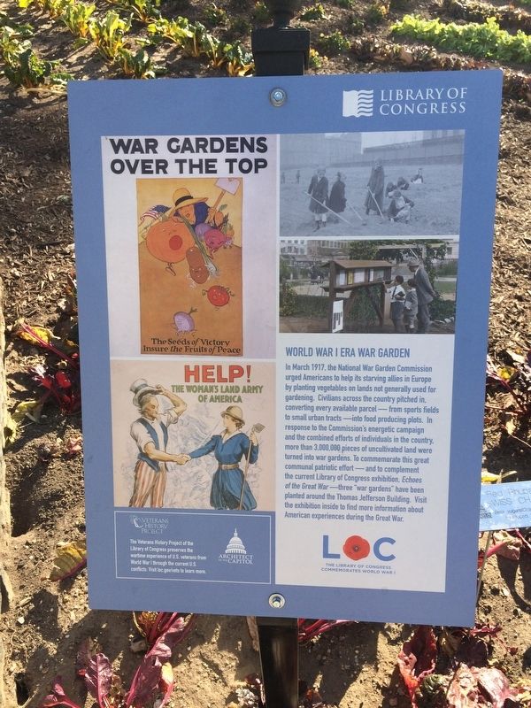
Erected by Architect of the Capitol.
Topics. This historical marker is listed in these topic lists: Agriculture • Horticulture & Forestry • Patriots & Patriotism • War, World I. A significant historical month for this entry is March 1917.
Location. Marker has been permanently removed. It was located near 38° 53.28′ N, 77° 0.323′ W.
this page online
We have been informed that this marker is no longer there and will not be replaced. This page is an archival view of what was.
Regionally, this marker was in the Washington Metropolitan Area. It was also in the American Northeast, in the Upper South, in the Mid-Atlantic, in the Tidewater, and in the Chesapeake Bay Region. Globally, it was in North America, the Western Hemisphere, the Western World, and the Anglosphere.

Other nearby markers. At least 8 other markers are within walking distance of this location: Jefferson (within shouting distance of this marker); Madison (within shouting distance of this marker); a different marker also named Madison (about 300 feet away, measured in a direct line); a different marker also named Jefferson
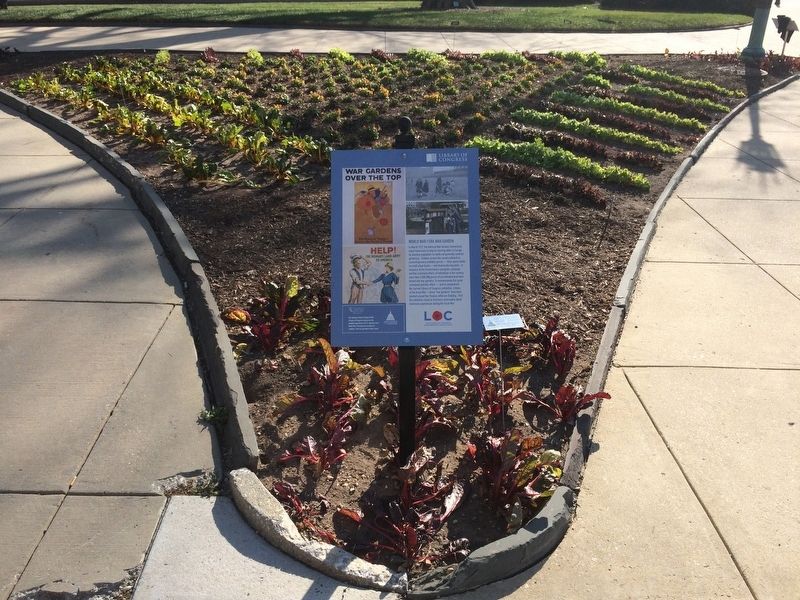
Other markers no longer nearby. War Garden (was here, next to this marker but has been permanently removed); a different marker also named War Garden (was here, next to this marker but has been permanently removed); Victory Garden (was about 400 feet away but has been permanently removed); a different marker also named Victory Garden (was about 400 feet away but has been permanently removed).
More about this marker.
[Captions:]
Ensure the Fruits of Peace
Help!
The woman's land army
of America
Veterans History Project
The Veterans History Project of the Library of Congress preserves the wartime experience of U.S. veterans from World War I through the current U.S. conflicts. Visit loc.gov/vets to learn more.
Credits. This page was last revised on January 30, 2023. It was originally submitted on December 13, 2017, by Devry Becker Jones of Washington, District of Columbia. This page has been viewed 500 times since then and 12 times this year. Photos: 1, 2. submitted on December 13, 2017, by Devry Becker Jones of Washington, District of Columbia. • Bill Pfingsten was the editor who published this page.
