
Yorktown in York County, Virginia — The American South (Mid-Atlantic)
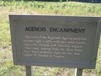
Agenois Encampment
Photographed by Bill Coughlin, August 12, 2008
1. Agenois Encampment Marker
Erected by Colonial National Historical Park, National Park Service.
Topics. This historical marker is listed in these topic lists: Notable Places • War, US Revolutionary. A significant historical year for this entry is 1781.
Location. 37° 13.864′ N, 76° 32.593′ W. Marker is in Yorktown, Virginia, in York County. It is on Historical Tour Drive, on the left when traveling east. Marker is located on the Yorktown Battlefield in Colonial National Historical Park, on the Allied Encampment Tour. Touch for map. Marker is in this post office area: Yorktown VA 23690, United States of America. Touch for directions.

Regionally, this marker is on Virginia’s Peninsula, in Coastal Virginia, and in the Hampton Roads Metropolitan Area. It is also in the American South, specifically in the Upper South, in the Tidewater, and on the Eastern Seaboard. Globally, it is in the
this page online
Other nearby markers. At least 8 other markers are within 2 miles of this marker, measured as the crow flies: St. Simon’s Headquarters (approx. 0.3 miles away); Soissonois Regiment (approx. 0.4 miles away); Saintonge Regiment (approx. 0.4 miles away); Regiment Royal Deux-Ponts (Zweibrücken) (approx. half a mile away); Bourbonnois Brigade Encampment (approx. 0.6 miles away); Washington-Rochambeau Route (approx. 1.3 miles away); A Changed Scene (approx. 1.4 miles away); French Trench (approx. 1.4 miles away). Touch for a list and map of all markers in Yorktown.
Also see . . .
1. Yorktown Battlefield. National Park Service. (Submitted on September 6, 2008, by Bill Coughlin of Woodland Park, New Jersey.)
2. The Battle of Yorktown. The Patriot Resource website. (Submitted on September 6, 2008, by Bill Coughlin of Woodland Park, New Jersey.)
3. The Battle of Yorktown 1781.
Photographed by Bill Coughlin, August 12, 2008
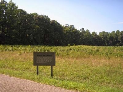
2. Marker on the Yorktown Battlefield
On these fields, French troops of Agenois's Regiment encamped during the 1781 Siege of Yorktown.
Photographed by Bernard Fisher, November 25, 2015
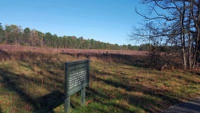
3. Agenois Encampment Marker
Credits. This page was last revised on June 16, 2016. It was originally submitted on September 6, 2008, by Bill Coughlin of Woodland Park, New Jersey. This page has been viewed 1,221 times since then and 33 times this year. Photos: 1, 2. submitted on September 6, 2008, by Bill Coughlin of Woodland Park, New Jersey. 3. submitted on November 26, 2015, by Bernard Fisher of Richmond, Virginia.
