The National Mall in Northwest Washington in Washington, District of Columbia — The American Northeast (Mid-Atlantic)
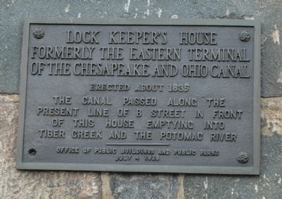
Lock Keeper’s House
Formerly the Eastern Terminal of the Chesapeake and Ohio Canal
| — | Erected about 1835 | — |

Photographed by J. Makali Bruton, November 21, 2024
1. Lock Keeper’s House Marker
The canal passed along the present line of B Street in front of this house emptying into Tiber Creek and the Potomac River.
Erected 1928 by Office of Public Buildings and Public Parks.
Topics and series. This historical marker is listed in these topic lists: Notable Buildings • Waterways & Vessels. In addition, it is included in the Chesapeake and Ohio (C&O) Canal series list. A significant historical year for this entry is 1835.
Location. 38° 53.512′ N, 77° 2.393′ W. Marker is in Northwest Washington in Washington, District of Columbia. It is in The National Mall. It is at the intersection of Constitution Avenue Northwest (U.S. 50) and 17th Street Northwest, on the right when traveling east on Constitution Avenue Northwest. The marker is affixed to the Lockkeeper's House, facing Constitution Avenue Northwest. Touch for map. Marker is in this post office area: Washington DC 20006, United States of America. Touch for directions.

Regionally, this marker is in the Washington Metropolitan Area. It is also in the American Northeast, in the Upper South, in the Mid-Atlantic, in the Tidewater, and in the Chesapeake
this page online
Other nearby markers. At least 8 other markers are within walking distance of this marker: The Washington City Canal (here, next to this marker); Silent Witness (here, next to this marker); Shifting Foundations (a few steps from this marker); Let's Ride (a few steps from this marker); Working Waterfront (within shouting distance of this marker); Disappearing Act (within shouting distance of this marker); White House on the Waterfront (within shouting distance of this marker); Inuksuk (within shouting distance of this marker). Touch for a list and map of all markers in Northwest Washington.
Another marker is no longer nearby. The Canal Connection (was a few steps from this marker but has been replaced with another marker now near it).
Regarding Lock Keeper’s House. Constitution Avenue is today's name for B Street mentioned on the marker. Tiber Creek has been filled and its source diverted into the city's drainage system. The C&O Canal now empties into Rock Creek about a mile northwest of here.
Photographed by Tom Fuchs, March 25, 2006
2. Lock Keeper's House Marker

Photographed by J. Makali Bruton, November 21, 2024
3. Lock Keeper’s House and Marker
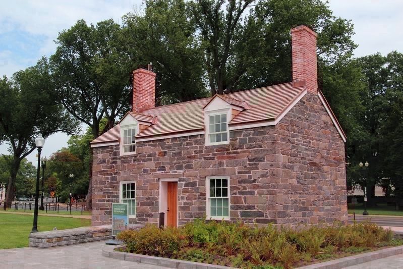
Photographed by Yuhan Zhang, August 18, 2018
4. South side of Lock Keeper’s House facing the Mall after relocation and restoration
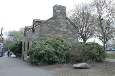
Photographed by Tom Fuchs, March 25, 2006
5. Lock Keeper's House
Photographer is standing on the sidewalk on Constitution Avenue. This marker can be seen to the left of the door. The Washington City Canal Marker can be seen in its previous location on the stone in the foreground.
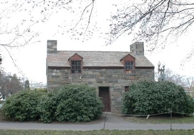
Photographed by Tom Fuchs, March 25, 2006
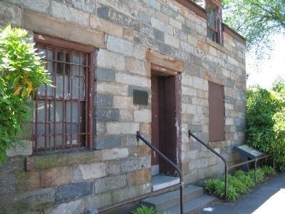
6. Lock Keeper's House
This is the south side of the house, facing the Mall.
Photographed by Craig Swain, May 23, 2008
7. Lock Keeper’s House and Canal Connection Markers
At the north side of the Lock Keeper's House.
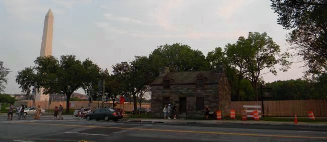
Photographed by Richard E. Miller, September 4, 2011
8. Lock Keeper’s House - viewed from across Constitution Avenue

Photographed by J. Makali Bruton, November 21, 2024
9. Outline of the previous Lock Keeper’s House
Credits. This page was last revised on February 3, 2026. It was originally submitted on March 28, 2006, by Tom Fuchs of Greenbelt, Maryland. This page has been viewed 12,165 times since then and 69 times this year. Last updated on December 15, 2017, by Devry Becker Jones of Washington, District of Columbia. Photos: 1. submitted on December 7, 2024, by J. Makali Bruton of Washington, District of Columbia. 2. submitted on March 28, 2006, by Tom Fuchs of Greenbelt, Maryland. 3. submitted on December 7, 2024, by J. Makali Bruton of Washington, District of Columbia. 4. submitted on December 17, 2018, by Bernard H. Berne of Arlington, Virginia. 5, 6. submitted on March 28, 2006, by Tom Fuchs of Greenbelt, Maryland. 7. submitted on August 12, 2008, by Craig Swain of Leesburg, Virginia. 8. submitted on September 8, 2011, by Richard E. Miller of Oxon Hill, Maryland. 9. submitted on December 7, 2024, by J. Makali Bruton of Washington, District of Columbia. • Bill Pfingsten was the editor who published this page.
