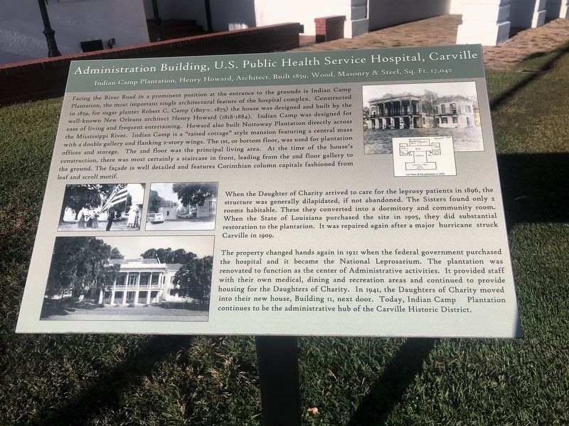
Administration Building, U.S. Public Health Service Hospital, Carville
Indian Camp Plantation, Henry Howard, Architect, Built 1859, Wood, Masonry & Steel, Sq.Ft. 17,042
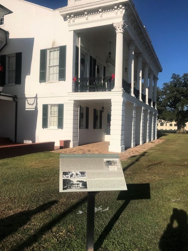
Facing River Road in a prominent position at the entrance to the grounds is Indian Camp Plantation, the most important single architectural feature of the hospital complex. Constructed in 1859, for sugar planter Robert C. Camp (1805-c. 1875) the house was designed and built by the well-known New Orleans architect Henry Howard (1818-1884). Indian Camp was designed for ease of living and frequent entertaining. Howard also built Nottoway Plantation directly across the Mississippi River. Indian Camp is a "raised cottage" style mansion featuring a central mass with a double gallery and flanking 2-story wings. The 1st, or bottom floor, was used for plantation offices and storage. The second floor was the principal living area. At the time of the house's construction, there was most certainly a staircase in front, leading from the 2nd floor gallery to the ground. The facade is well detailed and features Corinthian column capitals fashioned from leaf and scroll motif.
When the Daughters of Charity arrived to care for the leprosy patients in 1896, the structure was generally dilapidated, if not abandoned. The Sisters found only 2 rooms habitable. These were converted into a dormitory and community room. When the State of Louisiana
purchased the site in 1905, they did substantial restoration to the plantation. It was repaired again after a major hurricane struck Carville in 1909. The property changed hands again in 1921 when the federal government purchased the hospital and it became the National Leprosarium. The plantation was renovated to function as the center of Administrative activities. It provided staff with their own medical, dining and recreation areas and continued to provide housing for the Daughters of Charity. In 1941, the Daughters of Charity moved into their new house, Building II, next door. Today, Indian Camp Plantation continues to be the administrative hub of the Carville Historic District.
Topics. This historical marker is listed in these topic lists: Architecture • Charity & Public Work • Science & Medicine • Women.
Location. 30° 11.742′ N, 91° 7.553′ W. Marker is in Carville, Louisiana, in Iberville Parish. Marker can be reached from Point Clair Road (State Highway 141) one mile north of Martin Luther King Parkway (State Highway 75), on the right when traveling north. Touch for map. Marker is at or near this postal address: 5445 Point Clair Road, Carville LA 70721, United States of America. Touch for directions.
Other nearby markers. At least 8 other markers are within 3 miles of this marker, measured as the crow flies. Indian Camp Plantation (a few steps from this marker); Cage Door of Harry T. Chimpanzee
More about this marker. Marker is located inside the National Guard Site, but is part of the Museum's self driving tour. No photography is permitted except markers and site cemetery. This is currently an active Military base so check before visiting, and for other regulations which may apply.
Credits. This page was last revised on July 16, 2023. It was originally submitted on December 16, 2017, by Cajun Scrambler of Assumption, Louisiana. This page has been viewed 226 times since then and 9 times this year. Photos: 1, 2. submitted on December 16, 2017.

