Buchanan in Haralson County, Georgia — The American South (South Atlantic)
Haralson County
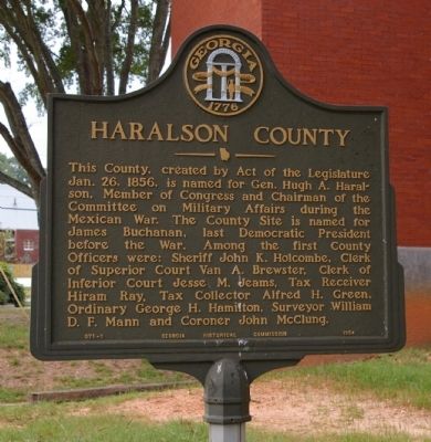
Photographed by David Seibert, September 6, 2008
1. Haralson County Marker
Erected 1954 by Georgia Historical Commission. (Marker Number 071-1.)
Topics and series. This historical marker is listed in these topic lists: Government & Politics • Law Enforcement • War, Mexican-American. In addition, it is included in the Former U.S. Presidents: #15 James Buchanan, and the Georgia Historical Society series lists. A significant historical date for this entry is January 26, 1856.
Location. 33° 48.104′ N, 85° 11.39′ W. Marker is in Buchanan, Georgia, in Haralson County. It is at the intersection of Business U.S. 27 and Weatherly Street, on the left when
this page online

Regionally, this marker is in Georgia’s Piedmont. It is also in the American South and specifically in the Deep South. Globally, it is in North America, the Western Hemisphere, the Western World, and the Anglosphere. Historically, it finds itself in what was once the territory of the Mississippian Culture, one of the original Thirteen Colonies, one of the Confederate States of America, and the Antebellum South.
Other nearby markers. At least 8 other markers are within 16 miles of this marker, measured as the crow flies: Hungarian Colony (approx. 6.2 miles away); Sandtown Trail (approx. 6.8 miles away); Seven Chestnuts (approx. 6.8 miles away); Historic Tallapoosa (approx. 6.8 miles away); Sacred Harp Singing (approx. 8½ miles away); Hernando de Soto in Alabama (approx. 13.9 miles away in Alabama); Cedar Valley Academy (approx. 14.4 miles away); Old Van Wert Polk County (approx. 15.6 miles away).
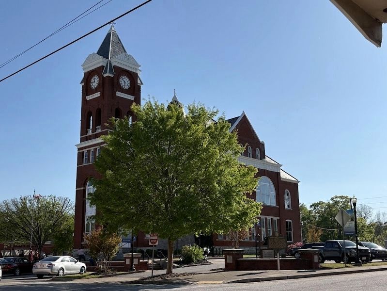
Photographed by Darren Jefferson Clay, April 12, 2025
2. Haralson County Marker
Credits. This page was last revised on April 25, 2025. It was originally submitted on September 7, 2008, by David Seibert of Sandy Springs, Georgia. This page has been viewed 1,854 times since then and 44 times this year. Photos: 1. submitted on September 7, 2008, by David Seibert of Sandy Springs, Georgia. 2. submitted on April 18, 2025, by Darren Jefferson Clay of Duluth, Georgia. • Kevin W. was the editor who published this page.
