Rock Creek Park in Northwest Washington in Washington, District of Columbia — The American Northeast (Mid-Atlantic)
Klingle Valley Trail
Rock Creek Park
| — | National Park Service, U.S. Department of the Interior | — |
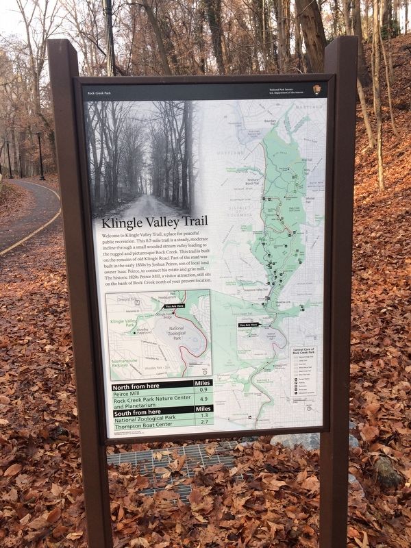
Erected 2017 by National Park Service, U.S. Department of the Interior.
Topics. This historical marker is listed in these topic lists: Charity & Public Work • Industry & Commerce • Roads & Vehicles. A significant historical year for this entry is 1820.
Location. 38° 55.999′ N, 77° 3.187′ W. Marker is in Northwest Washington in Washington, District of Columbia. It is in Rock Creek Park. It is on Klingle Road Northwest west of Porter Street Northwest. Touch for map. Marker is at or near this postal address: 2601 Klingle Road Northwest, Washington DC 20008, United States of America. Touch for directions.

Regionally,
this page online
Other nearby markers. At least 8 other markers are within walking distance of this marker: Ostrich (about 500 feet away, measured in a direct line); From Collecting to Breeding (about 600 feet away); The Scoop on Poop (about 600 feet away); Meet Our Bison (about 600 feet away); Are They Bison or Buffalo? (about 600 feet away); Bison and the Land (about 600 feet away); And Then There Were (Almost) None (about 700 feet away); Last Chance (about 700 feet away). Touch for a list and map of all markers in Northwest Washington.
Another marker is no longer nearby. Meet Our Bison (was about 600 feet away but has been replaced with another marker now near it).
Credits. This page was last revised on January 30, 2023. It was originally submitted on December 24, 2017, by Devry Becker Jones of Washington, District of Columbia. This page has been viewed 422 times since then and 32 times this year. Photos: 1, 2. submitted on December 24, 2017, by Devry Becker Jones of Washington, District of Columbia. • Bill Pfingsten was the editor who published this page.
