Pendleton in Umatilla County, Oregon — The American West (Northwest)
Umatilla County
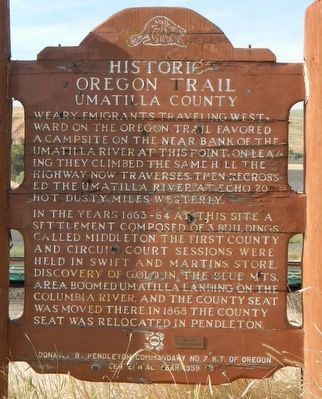
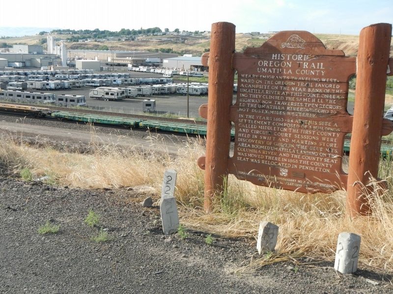
Historic Oregon Trail.
In the years 1863-64 at this site a settlement composed of 3 buildings called Middleton, the first county and circuit court sessions were held in Swift and Martins store. Discovery of gold in the Blue Mts. area boomed Umatilla Landing on the Columbia River, and the county seat was moved there. In 1868 the county seat was relocated in Pendleton.
Erected by Oregon Department of Transportation.
Topics and series. This historical marker is listed in these topic lists: Government & Politics • Roads & Vehicles • Settlements & Settlers. In addition, it is included in the Oregon Beaver Boards, and the Oregon Trail series lists.
Location. 45° 40.454′ N, 118° 49.674′ W. Marker is in Pendleton, Oregon, in Umatilla County. Marker is on Westgate (Northwest Pendleton Highway) (U.S. 30) near County Route 1302, on the left when traveling west. Touch for map. Marker is at or near this postal address: 3800 Westgate, Pendleton OR 97801, United States of America. Touch for directions.
Other nearby markers. At least 8 other markers are within 2 miles of this marker, measured as the crow flies. Pendleton City Hall (approx. 1.8 miles away); First Christian Church (approx. 1.9 miles away); Carnegie Building (approx. 1.9 miles away); Brown Building (approx. 1.9 miles away); Milarkey-Murphy Bldg (approx. 1.9 miles away); Bowman Studio (approx. 1.9 miles away); Donald C. Requa (approx. 1.9 miles away); U.S. Post Office & Courthouse (approx. 1.9 miles away). Touch for a list and map of all markers in Pendleton.
Also see . . . Oregon Travel Experience - Umatilla County. (Submitted on January 12, 2018, by Douglass Halvorsen of Klamath Falls, Oregon.)
Credits. This page was last revised on January 29, 2018. It was originally submitted on December 26, 2017, by Barry Swackhamer of Brentwood, California. This page has been viewed 232 times since then and 7 times this year. Photos: 1, 2. submitted on December 26, 2017, by Barry Swackhamer of Brentwood, California.

