Echo in Umatilla County, Oregon — The American West (Northwest)
The Lower Crossing
Photographed by Barry Swackhamer, July 1, 2017
1. The Lower Crossing Marker
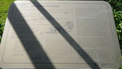
This morning after going one mile, we left the river, five mile over the ridge we crossed the river and encamped for the day in order to recruit our cattle as they were much fatigued by crossing the Blue Mountains. -- William J. Watson, August 25, 1849
this days brot us the the (sic) Indian agency on the west bank of the Umatila River here we got some provisions flour at 60 per bacon 75 beef 25 shugar 75 coffee 75 per pound and hard to get at that this is a beautiful valley well calculated for farming. -- John Newton Lewis, October 3, 1852
Passed over a ridge of high land, then down the bottom to the crossing of the umatilla, the river has a large channel here but the water all sinks, and we passed on a bed of gravel and pebble stones, for which the stream is famous all along. On the west bank is United States Agency, a very neat looking frame house painted white, it looked cheering, as we had not seen a frame house since we left fort Laramie. -- John or David Dinwiddie, September 2, 1853
Destruction of the Whitman Mission in 1847 drastically altered the emigrant route. The wagon trains then began following
this page online
This was an important campsite. These fertile Umatilla River bottom lands afforded immense growths of rye grass, waving almost six feet above the rich loam. The meadows and marshes near the river were thick with wild hay grass and tules. There was abundant feed for livestock, wood for campfires, and water for humans and animals. On the west bank, the white-frame Indian Agency offered scarce provisions for sale. The camp served as a point of repairs, preparations and respite.
This junction also offered an option: turn north to follow the Columbia and its rapids, or continue west over the dusty, windy and often scorching-hot trek across the Columbia Plateau. Most headed due west toward Well Spring.
Look up-river toward the groves of cottonwood and alders along the quiet river banks. The pastoral scene is little changed from what the emigrants saw along the Umatilla River from 1843 to 1859.
Erected by City of Echo.
Topics and series. This historical marker is listed
Photographed by Barry Swackhamer, July 1, 2017
2. The Lower Crossing Marker
Location. 45° 44.5′ N, 119° 11.898′ W. Marker is in Echo, Oregon, in Umatilla County. It can be reached from West Main Street near Water Street, on the left when traveling west. Touch for map. Marker is at or near this postal address: 10 West Main Street, Echo OR 97826, United States of America. Touch for directions.

Regionally, this marker is in Eastern Oregon. It is also in the American Mountain West and in the Lewis & Clark Corridor. Globally, it is in North America, on the Pacific Rim, in the Western Hemisphere, in the Western World, and in the Anglosphere.
Other nearby markers. At least 8 other markers are within walking distance of this marker: The Blockhouse (a few steps from this marker); Umatilla County Jail (within shouting distance of this marker); Covered Wagon Museum (within shouting distance of this marker); Jack Dempsey (within shouting distance of this marker); Umatilla Masonic Lodge #40 (about 500 feet away, measured in a direct line); Echo Mercantile Building/Post Offices (about 500 feet away); Arlington Hotel (about 600 feet away); Echo Methodist-Episcopal Church (approx. 0.2 miles away). Touch for a list and map of all markers in Echo.
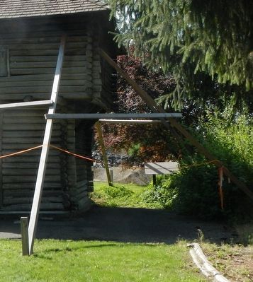
More about this marker. This marker is located in Fort Henrietta Park.
Credits. This page was last revised on July 29, 2021. It was originally submitted on December 26, 2017, by Barry Swackhamer of Brentwood, California. This page has been viewed 772 times since then and 32 times this year. Photos: 1, 2. submitted on December 26, 2017, by Barry Swackhamer of Brentwood, California.
