Near Ione in Morrow County, Oregon — The American West (Northwest)
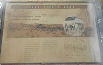
Rocks, Sand & Wind
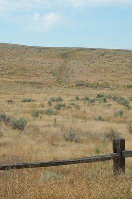
On the hillside ahead, see if you can spot the many smaller ruts next to the main ditch-like route. The smaller ruts often tell the story of a pioneer's search for resources or an attempt to avoid the dust, deep ruts and congestion of the main trail.
We are told that we must make fourteen miles before reaching water ... so over rocks, gravel and sand we plod along all day. Nothing indicates life except an occasional juniper tree. Where it gets soil or moisture was to us a question. ... after a hard day's work we of course were hungry but to cook with fire made of green sage brush with the sand driving into your eyes, ears and mouth, being mixed in our dough, eat and coffee was a task that we seldom want repeated. We finally abandoned the fire part and crouch into our wagons and nibble hard tack. -- Harriet A. Loughary, August 20, 1864
Went eleven miles to Willow Creek here there was Plenty of water and had been Plenty of grass But it had been eaten off After leaving Willow Creek we went nine miles and Camped in Cedar hollow In the evening one of the wagons upset with three persons in the wagon no person badly injured Somewhat frightened Mrs. Wolford lost one tooth in a Fall One young lady concluded She was killed But after walking About for a While She concluded She was mistaken It was All a Fright Appearance of the country high and rolling -- George N. Taylor, September 20, 1853
This morning we collected enough greasewood to get breakfast with, and left Well springs as soon as we could get off. Our road led over hills and ridges for twelve miles, to Willow creek. Here we found water in pools, but were not very dry, for it had rained on us all day. but to our great relief, when found plenty of dry juniper for fire wood, and it quit raining so that we could stand around large fires and get dry. This is a rich, grassy valley, about one-half mile wide. (The following day) we traveled thirteen miles. First up a long, steep winding hill to the top of the ridge, whenever hills and hollows all the way to where we found a dry valley with a pack of juniper. Here we stopped for the night. -- P.V. Crawford, August 30, 1851
Erected by Bureau of Land Management.
Topics and series. This historical marker is listed in these topic lists: Roads & Vehicles • Settlements & Settlers
. In addition, it is included in the Oregon Trail series list.
Location. 45° 37.326′ N, 120° 2.634′ W. Marker is near Ione, Oregon, in Morrow County. Marker is on Fourmile Canyon Road. Touch for map. Marker is in this post office area: Ione OR 97843, United States of America. Touch for directions.
Other nearby markers. At least 4 other markers are within 11 miles of this marker, measured as the crow flies. Fourmile Canyon (a few steps from this marker); Willow Creek Campground (approx. 4˝ miles away); This Marks the Crossing of the Old Oregon Trail (approx. 5.9 miles away); Arlington Oregon Trail Kiosk (approx. 10.3 miles away).
More about this marker. The Fourmile
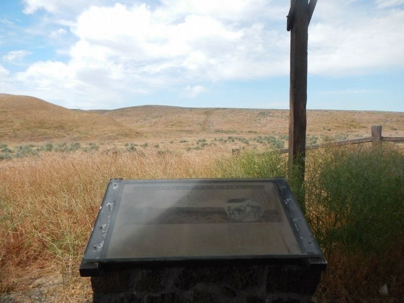
Fourmile Canyon Kiosk and Marker image. Click for full size.
Correct or Update By Barry Swackhamer, July 1, 2017
2. Fourmile Canyon Kiosk and Marker
Canyon kiosk is in the middle of nowhere; though maps name the road Fourmile Canyon Road, there are no road signs to identify it.
Credits. This page was last revised on December 27, 2017. It was originally submitted on December 27, 2017, by Barry Swackhamer of Brentwood, California. This page has been viewed 227 times since then and 8 times this year. Photos: 1, 2, 3. submitted on December 27, 2017, by Barry Swackhamer of Brentwood, California.


