
Mobridge in Walworth County, South Dakota — The American Midwest (Upper Plains)
Lewis and Clark/Mobridge
Photographed by Ruth VanSteenwyk, April 30, 2017
1. Lewis and Clark/Mobridge Marker
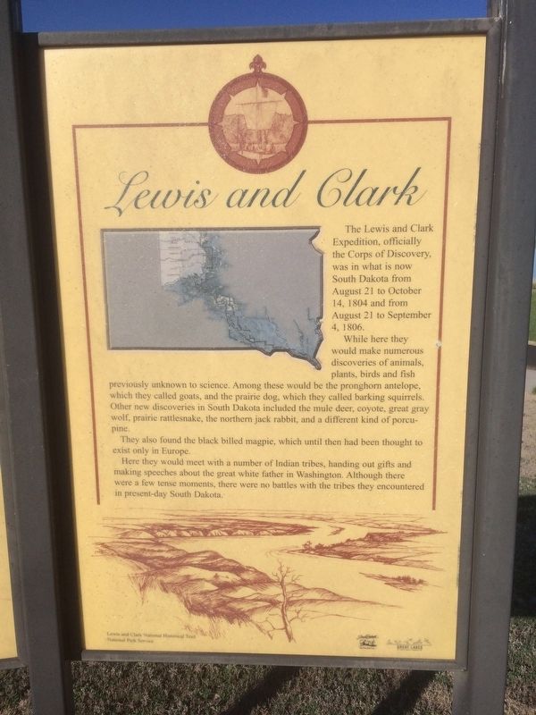
Lewis and Clark
The Lewis a nd Clark Expedition, officially the Corps of Discovery, was in what is now South Dakota from August 21 to October 14, 1804 and from August 21 to September 4, 1806.
While here they would make numerous discoveries of animals, plants, birds and fish previously unknown to science. Among these would be the prong horn antelope, which they called goats, and the prairie dog, which they called barking squirrels. Other new discoveries in South Dakota included the mule deer, coyote, great gray wolf, prairie rattlesnake, the northern jack rabbit, and a different kind of porcupine.
They also found the black billed magpie, which until then had been thought to exist only in Europe.
Here they would meet with a number of Indian tribes, handing out gifts and making speeches about the great white father in Washington. Although there were a few tense moments, there were no battles with the tribes they encountered in present-day South Dakota.
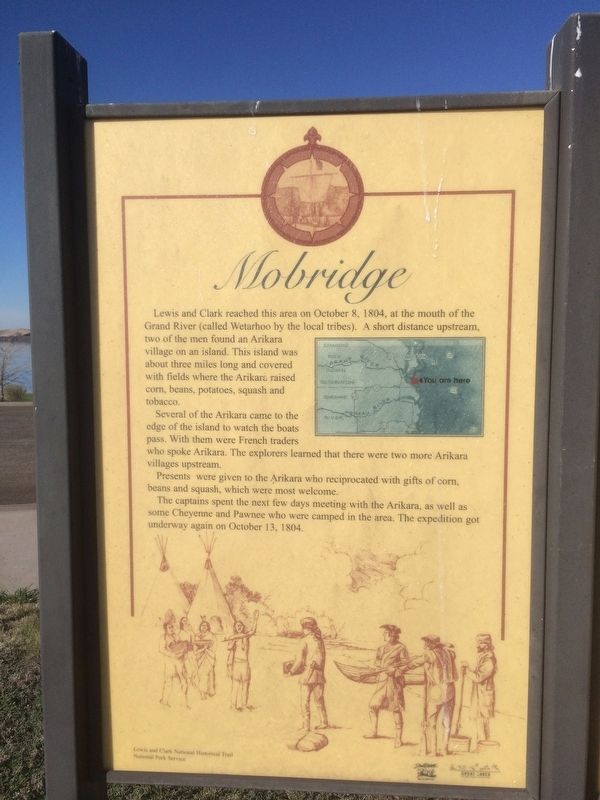
Mobridge
Lewis and Clark reached this area on October 8, 1804, at the mouth of the Grand River (called Wetarhoo by the local tribes). A short distance
this page online
Several of the Arikara came to the edge of the island to watch the boats pass. With them were French traders who spoke Arikara. The explorers learned that there were two more Arikara villages upstream.
Presents were given to the Arikara who reciprocated with gifts of corn, beans and squash, which were most welcome.
The captains spent the next few days meeting with the Arikara, as well as some Cheyenne and Pawnee who were camped in the area. The expedition got underway again on October 13, 1804.
Erected by Lewis and Clark National Historical Trail and National Park Service.
Topics and series. This historical marker is listed in these topic lists: Exploration • Indigenous Peoples and Communities. In addition, it is included in the Lewis & Clark Expedition series list.
Location. 45° 31.835′ N, 100° 26.058′ W. Marker is in Mobridge, South Dakota, in Walworth County. It is on
Photographed by Ruth VanSteenwyk, April 30, 2017
2. Lewis and Clark/Mobridge Marker

Regionally, this marker is on the Cheyenne River Reservation and in East River. It is also in the American Lewis & Clark Corridor, on the prairies, and on the Northern Plains. Globally, it is in North America, the Western Hemisphere, the Western World, and the Anglosphere. Historically, it finds itself in what was once Rupert’s Land and also the Louisiana Purchase.
Other nearby markers. At least 8 other markers are within 2 miles of this marker, measured as the crow flies: A Valuable Member of the Team (within shouting distance of this marker); "the track of the white bear" (within shouting distance of this marker); "they just did a man's job" (approx. half a mile away); "Sakakawea and Lewis & Clark" (approx. half a mile away); Lewis and Clark Expedition (approx. ¾ mile away); Honored Leaders (approx. 0.9 miles away); A Final Resting Place (approx. 0.9 miles away); Lewis & Clark meet the Arikaras (approx. 1.4 miles away). Touch for a list and map
Photographed by Ruth VanSteenwyk, April 30, 2017
3. Lewis and Clark/Mobridge Marker
Credits. This page was last revised on January 2, 2018. It was originally submitted on January 1, 2018, by Ruth VanSteenwyk of Aberdeen, South Dakota. This page has been viewed 612 times since then and 61 times this year. Photos: 1, 2, 3. submitted on January 1, 2018, by Ruth VanSteenwyk of Aberdeen, South Dakota. • Bill Pfingsten was the editor who published this page.
