Columbus in Polk County, North Carolina — The American South (South Atlantic)
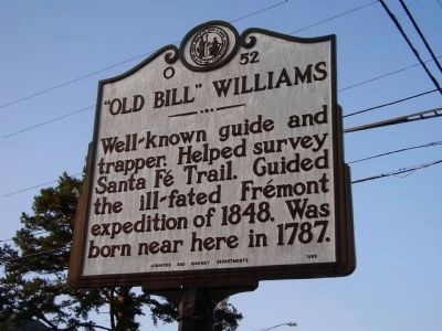
"Old Bill" Williams
Erected 1959 by Archives and Highway Departments. (Marker Number O-52.)
Topics and series. This historical marker is listed in these topic lists: Animals • Exploration • Roads & Vehicles. In addition, it is included in the North Carolina Division of Archives and History series list. A significant historical year for this entry is 1848.
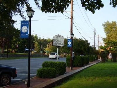
Location. 35° 15.107′ N, 82° 11.924′ W. Marker is in Columbus, North Carolina, in Polk County. Marker is on W. Mills Street (State Highway 108) near Hampton Court. Touch for map. Marker is in this post office area: Columbus NC 28722, United States of America. Touch for directions.
Other nearby markers. At least 8 other markers are within 3 miles of this marker, measured as the crow flies. Preserve our Freedom (within shouting distance of this marker); Polk County Courthouse (within shouting distance of this marker); Polk County World War Memorial (within shouting distance of this marker); Battle of Round Mountain (within shouting distance of this marker); Polk County Bicentennial Memorial (within shouting distance of this marker); Dr. Columbus Mills (within shouting distance of this marker); The Brave Devoted Patriots (about 700 feet away, measured in a direct line); Tryon Mountain (approx. 2.3 miles away). Touch for a list and map of all markers in Columbus.
Regarding "Old Bill" Williams. Old Bill Williams was a mountain man. The wiry redhead - William Sherley Williams, if you want to be formal - was born in North Carolina in 1787 and was killed by Utes in the Rocky Mountains in 1849. His life reads like something out of a 19th-century dime novel.
Old Bill was well educated and, as a young man, served as an itinerant preacher and missionary to the Indians. Rather than converting them, however, he married into the Osage Tribe in 1813 and had two daughters, Mary and Sarah. Over the years, he worked as a trapper, translator and guide, and developed a reputation as a crack shot with a powerful fondness for whiskey.
Between 1821 and 1880, the Santa Fe Trail was primarily a commercial highway connecting Missouri and Santa Fe, New Mexico. From 1821 until 1846, it was an international commercial highway used by Mexican and American traders. In 1846, the Mexican-American War began. The Army of the West followed the Santa Fe Trail to invade New Mexico. When the Treaty of Guadalupe Hidalgo ended the war in 1848, the Santa Fe Trail became a national road connecting the United States to the new southwest territories. Commercial freighting along the trail continued, including considerable military freight hauling to supply the southwestern forts.
The trail was also used by stagecoach lines, thousands of gold seekers heading to the California and Colorado gold fields, adventurers, fur trappers, and emigrants. In 1880 the railroad reached Santa Fe and the trail faded into history.
Credits. This page was last revised on July 1, 2021. It was originally submitted on September 7, 2008, by Stanley and Terrie Howard of Greer, South Carolina. This page has been viewed 1,595 times since then and 30 times this year. Photos: 1, 2. submitted on September 7, 2008, by Stanley and Terrie Howard of Greer, South Carolina. • Kevin W. was the editor who published this page.

