Riverton in Barkhamsted in Litchfield County, Connecticut — The American Northeast (New England)
Barkhamsted Lighthouse Village Charcoal Kilns
A Connecticut State Archaeological Preserve

Photographed By Alan M. Perrie, April 9, 2017
1. Barkhamsted Lighthouse Village Charcoal Kilns Marker
"“Outcasts” Build Their Own Village in 18th-Century Barkhamsted"
Connecticut History website entry
Click for more information.
Connecticut History website entry
Click for more information.
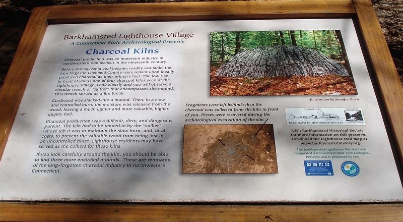
Charcoal production was an important industry in northwestern Connecticut in the nineteenth century.
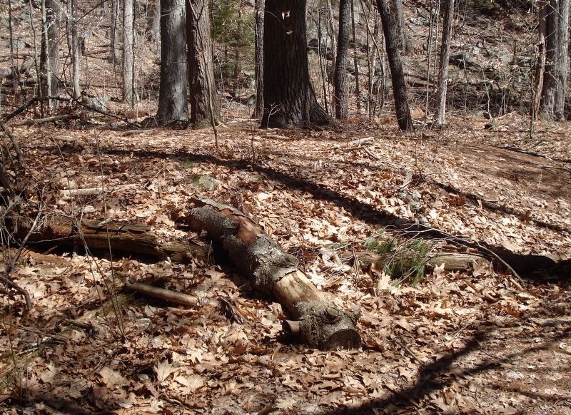
Before Pennsylvania coal became readily available, the iron forges in Litchfield County were reliant upon locally produced charcoal as their primary fuel. The low rise in front of you is one of the four charcoal kilns seen at the Lighthouse Village. Look closely and you will observe a circular trench or “gutter” that encompasses the mound. This trench serves as a fire break.
Cordwood was stacked into a mound. Then, in a slow and controlled burn, the moisture was released from the wood, leaving a much lighter and more valuable, higher quality fuel.
Charcoal production was a difficult, dirty, and dangerous pursuit. The kiln had to be tended to by the “collier” whose job it was to maintain the slow burn, and, at all costs, to prevent the valuable wood from being lost in an uncontrolled blaze. Lighthouse residents may have served as the colliers for these kilns.
If you look carefully around the kiln, you should be able to find three more encircled mounds. These are the remnants of the long-forgotten charcoal industry in northwestern Connecticut.
Erected by Barkhamsted Historical Society.
Topics and series. This historical marker is listed in these topic lists: Industry & Commerce • Native Americans. In addition, it is included in the Lighthouses series list.
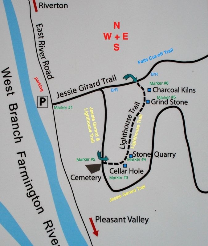
Location. 41° 56.589′ N, 73° 0.383′ W. Marker is in Barkhamsted, Connecticut, in Litchfield County. It is in Riverton. Marker can be reached from East River Road, 1.7 miles south of Connecticut Route 20. The marker is located on the Lighthouse Trail, 0.28 miles from the trail-head. The trail starts at the Barkhamsted Lighthouse Village Marker found 1.7 miles south from state route 20 on East River Road. Touch for map. Marker is in this post office area: Barkhamsted CT 06063, United States of America. Touch for directions.
Other nearby markers. At least 8 other markers are within walking distance of this marker. Barkhamsted Lighthouse Village Cemetery (within shouting distance of this marker); Barkhamsted Lighthouse Village Stone Quarry (within shouting distance of this marker); Barkhamsted Lighthouse Village Grind Stone (within shouting distance of this marker); Barkhamsted Lighthouse Village Cellar Holes (within shouting distance of this marker); Barkhamsted Lighthouse Village (about 300 feet away, measured in a direct line); Peoples State Forest
(about 300 feet away); Camp White (approx. 0.3 miles away); Henry Robinson Buck (approx. 0.3 miles away). Touch for a list and map of all markers in Barkhamsted.
Also see . . . Charcoal making. Cornwall Historical Society website entry (Submitted on January 3, 2018, by Alan M. Perrie of Unionville, Connecticut.)
Credits. This page was last revised on February 10, 2023. It was originally submitted on January 3, 2018, by Alan M. Perrie of Unionville, Connecticut. This page has been viewed 260 times since then and 46 times this year. Photos: 1, 2, 3. submitted on January 3, 2018, by Alan M. Perrie of Unionville, Connecticut. • Bill Pfingsten was the editor who published this page.

