Near Richmond Hill in Bryan County, Georgia — The American South (South Atlantic)
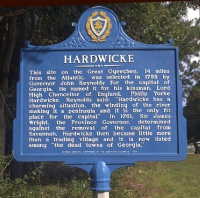
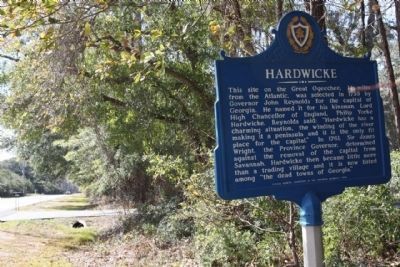
Hardwicke
Erected 1968 by Georgia Society, Daughters of the Amercan Colonists.
Topics and series. This historical marker is listed in these topic lists: Colonial Era • Settlements & Settlers. In addition, it is included in the Daughters of the American Colonists series list. A significant historical year for this entry is 1755.
Location. 31° 52.981′ N, 81° 13.807′ W. Marker is near Richmond Hill, Georgia, in Bryan County. Marker is on Fort McAllister Road (State Highway 144 Spur) 2.1 miles east of Bryan Neck Road (State Route 144), on the left when traveling east. Touch for map. Marker is in this post office area: Richmond Hill GA 31324, United States of America. Touch for directions.
Other nearby markers. At least 8 other markers are within 2 miles of this marker, measured as the crow flies. Richard James Arnold (approx. 1.3 miles away); Guale Village at Seven-Mile Bend (approx. 1.8 miles away); Machinery From The C.S.S. Nashville (approx. 1.8 miles away); Burnt Church Cemetery (approx. 1.9 miles away); Destruction of the C.S.S. Nashville (approx. 1.9 miles away); C.S.S. Nashville (approx. 1.9 miles away); Sinking of the CSS "Nashville (Rattlesnake)" (approx. 1.9 miles away); George W. McAllister (approx. 1.9 miles away). Touch for a list and map of all markers in Richmond Hill.
Credits. This page was last revised on June 16, 2016. It was originally submitted on September 8, 2008, by David Seibert of Sandy Springs, Georgia. This page has been viewed 1,701 times since then and 30 times this year. Photos: 1. submitted on September 8, 2008, by David Seibert of Sandy Springs, Georgia. 2, 3. submitted on February 13, 2009, by Mike Stroud of Bluffton, South Carolina. • Craig Swain was the editor who published this page.


