Weaverville in Trinity County, California — The American West (Pacific Coastal)
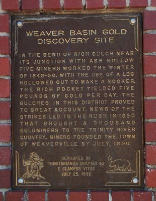
Weaverville Basin Gold Discovery Site
Erected 1992 by E Clampus Vitus, Trinitarianus Chapter 62.
Topics and series. This historical marker is listed in these topic lists: Natural Features • Settlements & Settlers. In addition, it is included in the E Clampus Vitus series list. A significant historical month for this entry is July 1850.
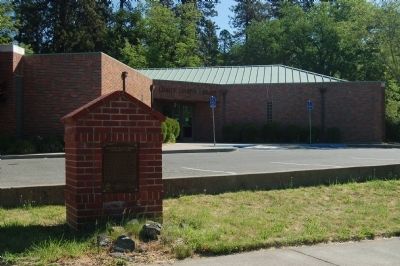
Location. 40° 44.115′ N, 122° 56.565′ W. Marker is in Weaverville, California, in Trinity County. Marker can be reached from the intersection of North Main Street (California Route 229) and Garden Gulch Street, on the right when traveling north. This marker is located at the front of the Weaverville Library. Touch for map. Marker is at or near this postal address: 211 North Main Street, Weaverville CA 96093, United States of America. Touch for directions.
Other nearby markers. At least 8 other markers are within walking distance of this marker. Site of First Cabin (about 600 feet away, measured in a direct line); Trinity County Courthouse (about 600 feet away); Weaverville Bandstand (about 700 feet away); I.O.O.F. Hall (about 700 feet away); Spanish Corral (about 700 feet away); Spiral Staircases (about 700 feet away); Clifford Hall (about 800 feet away); Weaverville Drug Store (approx. 0.2 miles away). Touch for a list and map of all markers in Weaverville.
Credits. This page was last revised on January 11, 2018. It was originally submitted on June 7, 2012, by Barry Swackhamer of Brentwood, California. This page has been viewed 671 times since then and 14 times this year. Last updated on January 10, 2018, by Douglass Halvorsen of Klamath Falls, Oregon. Photos: 1, 2. submitted on June 7, 2012, by Barry Swackhamer of Brentwood, California.

