Pelzer in Anderson County, South Carolina — The American South (South Atlantic)
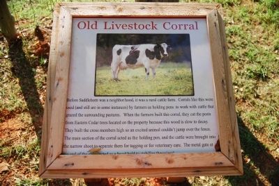
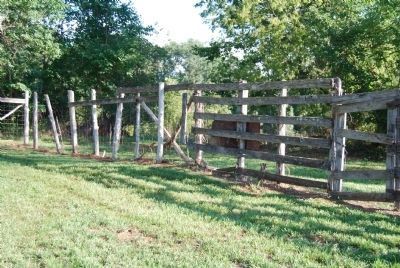
Old Livestock Corral
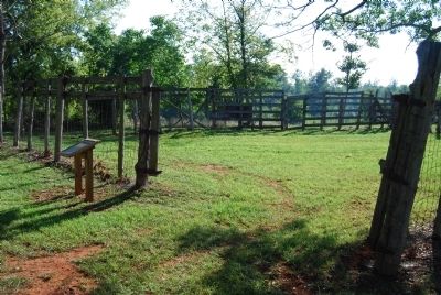
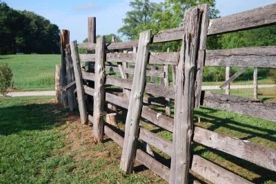
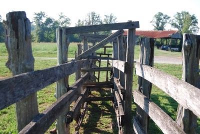
Before Saddlehorn was a neighborhood, it was a rural cattle farm. Corrals like this were used (and still are in some instances) by farmers as holding pens to work with cattle that grazed the surrounding pastures. When farmers built this corral, they cut the posts from Eastern Cedar trees located on the property because this wood is slow to decay. They built the cross members high so an excited animal couldn't jump over the fence. The main section of the corral acted as the holding pen, and the cattle were brought into the narrow shoot to separate them for tagging or for veterinary care. The metal gate at the end of the shoot acted as a head-hold to stabilize the animal.
Topics. This historical marker is listed in this topic list: Agriculture.
Location. 34° 39.53′ N, 82° 21.277′ W. Marker is in Pelzer, South Carolina, in Anderson County. Marker can be reached from Reedy Fork Road. Marker is located down a gravel road just past the entrance to the Saddlehorn subdivision on the right. Touch for map. Marker is in this post office area: Pelzer SC 29669, United States of America. Touch for directions.
Other nearby markers. At least 10 other markers are within 5 miles of this marker, measured as the crow flies. Reese Family Cemetery (about 300 feet away, measured in a direct line); Toney's Store / Militia Muster Ground (approx. 2.2 miles away); Hopkins Farm (approx. 2.2 miles away); Battle of Great Cane Brake (approx. 2.2 miles away); Fork Shoals Baptist Church (approx. 3.6 miles away); Fork Shoals School (approx. 3.6 miles away); Pepper School (approx. 3.8 miles away); Environment – Cedar Falls Park (approx. 4˝ miles away); History - Cedar Falls Park (approx. 4˝ miles away); History – Cedar Falls Park (approx. 4˝ miles away). Touch for a list and map of all markers in Pelzer.
Credits. This page was last revised on October 16, 2020. It was originally submitted on September 5, 2008, by Brian Scott of Anderson, South Carolina. This page has been viewed 1,938 times since then and 41 times this year. Last updated on September 8, 2008, by Mike Stroud of Bluffton, South Carolina. Photos: 1, 2, 3, 4, 5. submitted on September 5, 2008, by Brian Scott of Anderson, South Carolina. • Craig Swain was the editor who published this page.
