Honea Path in Anderson County, South Carolina — The American South (South Atlantic)
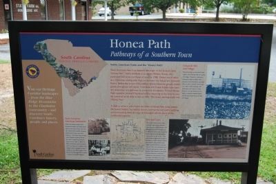
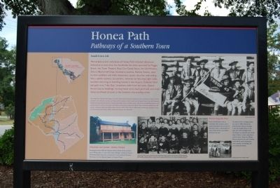
Honea Path
Pathways of a Southern Town
[Front]:
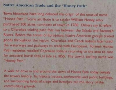
Native American Trade and the "Honey Path"
Town historians long debated the origin of the unusual name "Honea Path." Some attribute it to settler William Honey, who purchased 200 acres northeast of town in 1788. Others say it refers to a Cherokee trading path that ran between the Saluda and Savannah Rivers. Before the arrival of Europeans, Native American groups traded goods throughout the region. Cherokee and Creek Indians later used the waterways and pathways to trade with Europeans. Former Honea Path residents recalled Cherokee Indians returning to the area to care for ancestral burial sites as late as 1855. The town's earliest name was "Honey Path."
A walk or drive in and around the town of Honea Path today reveals the town's history. Its historic houses, commercial and public buildings, and surrounding fields of crops and livestock tell the story of the community's growth.
Chiquola Mill and Village
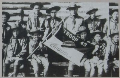
Most prominent on the town's landscape is the Chiquola Mill and nearby mill village. Chiquola is distinctive among the region's textile mills, because it has remained in operation since its doors opened, and because of a tragic conflict between mill employees and owners in 1934. Chiquola was also famous for its highly competitive baseball teams, who fiercely battled those of other mill villages.
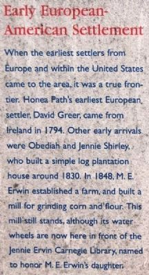
Early European-American Settlement
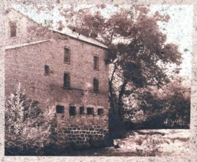
When the earliest settlers from Europe and within the United States came to the area, it was a true frontier. Honea Path's earliest European settler, David Greer, came from Ireland in 1794. Other early arrivals were Obediah and Jennie Shirley, who built a simple log plantation house around 1830. In 1848, M.E. Erwin established a farm, and built a mill for grinding corn and flour. This mill still stands, although its water wheels are now in front of the Jennie Ervin Carnegie Library, named to honor M.E. Erwin's daughter.
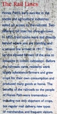
The Rail Lines
Honea Path's early success in the testile and agricultural industries relied on access to the railroad. Two different rail lines ran through town. In 1855, train tracks were laid directly behind where you are standing, and a second line arrived in 1911. train service allowed farmers of the area to specialize in cotton cultivation. Before the railroads came, residents were largely subsistence farmers and grew crops for their own consumption and produced many goods at home. The benefits of the railroad to the people of Honea Path were tremendous -- including not only shipment of crops, but regular mail delivery, new types of merchandise, and frequent visitors.
[Reverse]:
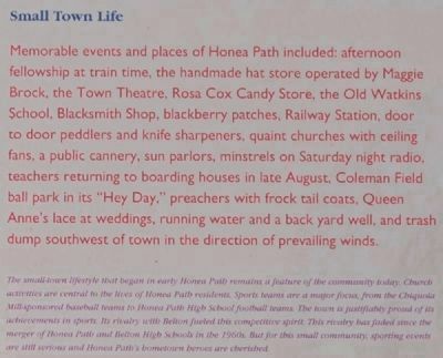
Small Town Life
Memorable events and
places of Honea Path included afternoon fellowship at train time, the handmade hat store operated by Maggie Brock, the Town Theatre, Rosa Cox Candy Store, the Old Watkins School, Blacksmith Shop, blackberry patches, Railway Station, Door to Door peddlers and knife sharpeners, quaint churches with ceiling fans, a public cannery, sun parlors, minstrels on Saturday night radio, teachers returning to boarding houses in late August, Coleman Field park in its "Hey Day," preachers with frock tail coats, Queen Anne's lace at weddings, running water and a back yard well, and trash dump southwest of town in the direction of prevailing winds.
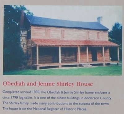
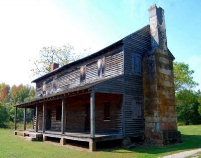
Obediah and Jennie Shirley House
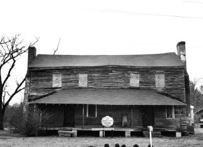
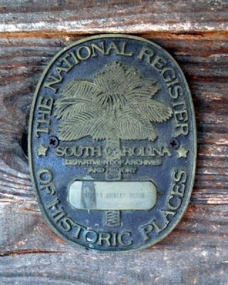
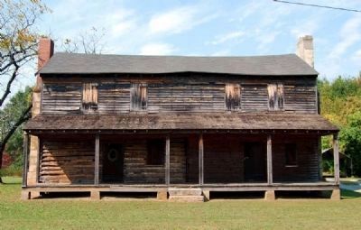
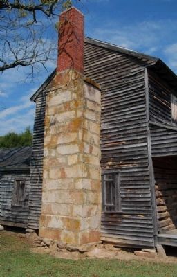
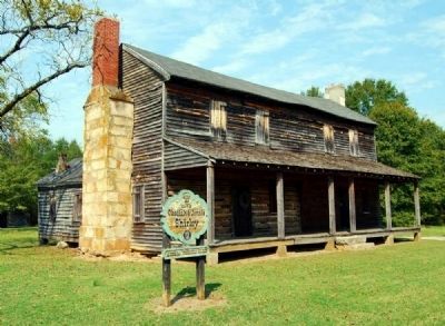
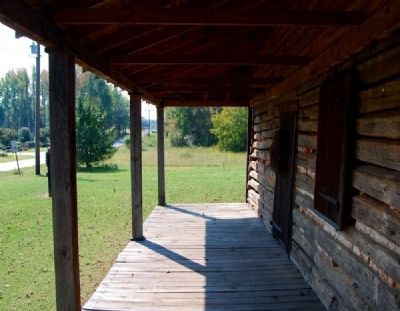
Completed around 1830, the Obediah & Jennie Shirley home encloses a circa 1790 log cabin. It is one of the oldest buildings in Anderson County. The Shirley family made many contributions to the success of the town. The house is on the National Register of Historic Places.
Preserving the Past
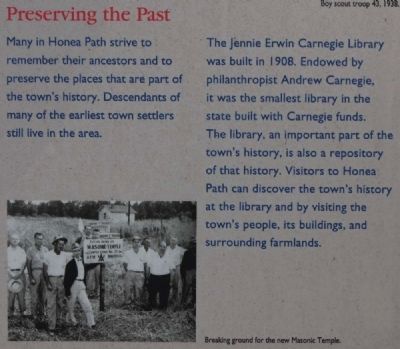
Many in Honea Path strive to remember their ancestors and to preserve the places that are part of the town's history. Descendants of many of the earliest town settlers still live in the area.
Carnegie Library
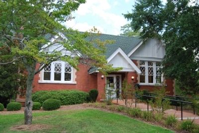
The Jennie Erwin Carnegie Library was built in 1908. Endowed by philanthropist Andrew Carnegie, it was the smallest library in the state built with Carnegie
funds. The library, an important part of the town's history, is also a repository of that history. Visitors to Honea Path can discover the town's history by visiting the town's people, its buildings, and surrounding farmlands.
Erected by South Carolina Heritage Corridor.
Topics and series. This historical marker is listed in these topic lists: Native Americans • Notable Places • Settlements & Settlers. In addition, it is included in the South Carolina Heritage Corridor series list. A significant historical year for this entry is 1788.
Location. 34° 26.847′ N, 82° 23.542′ W. Marker is in Honea Path, South Carolina, in Anderson County. Marker is on North Shirley Ave west of Chiquola Avenue, on the left when traveling east. Marker is located on the grounds of the Carnegie Library, next to its historical marker. Touch for map. Marker is in this post office area: Honea Path SC 29654, United States of America. Touch for directions.
Other nearby markers. At least 10 other markers are within 3 miles of this marker, measured as the crow flies. Carnegie Library (here, next to this marker); Honea Path Veterans Memorial (about 400 feet away, measured in a direct line); Panoramic Journey Through Honea Path (about 500 feet away); They Died for the Rights of the Working Man (approx. ¼ mile away); David Greer, Sr. (approx. ¼ mile away); Chiquola Baptist Church Bell
(approx. 0.3 miles away); The Story of the Bell (approx. 0.3 miles away); Chiquola Mill Monument (approx. 0.3 miles away); Southside Baptist Church (approx. 1½ miles away); James Kay House / Gentsville (approx. 2½ miles away). Touch for a list and map of all markers in Honea Path.
Also see . . .
1. Honea Path: The Little Town with the Big Heart. Honea Path is fast becoming one of the most sought after bedroom communities in South Carolina. (Submitted on August 26, 2008, by Brian Scott of Anderson, South Carolina.)
2. Honea Path. Honea Path is a town in Abbeville and Anderson counties in the U.S. state of South Carolina. (Submitted on August 26, 2008, by Brian Scott of Anderson, South Carolina.)
3. Chiquola Mill Massacre. Wikipedia entry (Submitted on June 7, 2023, by Larry Gertner of New York, New York.)
4. Labor Landmark Turns into an Eyesore. All that remains of the abandoned South Carolina textile mill that was the site of the nation’s deadliest violence during a labor strike 75 years ago are crumbling brick walls, creaky wood floors and whispers of the tragedy. (Submitted on October 17, 2010, by Brian Scott of Anderson, South Carolina.)
5. Obediah Shirley House
. The Obediah Shirley House sits on a one-acre site located outside Honea Path and is an excellent example of a simple plantation farmhouse, or I-House. (Submitted on September 29, 2010, by Brian Scott of Anderson, South Carolina.)
6. Obediah Shirley House Work Week. Includes photos of restoration completed in 1988. (Submitted on October 8, 2010, by Brian Scott of Anderson, South Carolina.)
7. John Shirley Descendants. (Submitted on October 8, 2010, by Brian Scott of Anderson, South Carolina.)
Additional commentary.
1. Honea Path
The curiously double name of Honea (Ind., path) Path, 67.6 m. (810 alt., 2,740 pop.), was adopted when as many whites as Indians frequented this section. Another version is that Honea was the name of a family who lived there. At Honea Path in the late summer of 1934 occurred a mill riot that grew out of a Nation-wide textile strike. All South Carolina mills did not close on the zero hour, and "flying squadrons" of strikers and union sympathizers paid quick visits to mills that continued to operate. As a rule the squadrons were orderly, engaging in demonstrations to persuade the mill hands to strike; but minor injuries to their opponents kept them before the public eye. When arbitration failed, Governor Ibra C. Blackwood called out the National Guard. About 700 guardsmen were stationed in the Greenville area, and 600 citizens were deputized in Anderson to assist in preserving order. On September 6 a flying squadron visited Honea Path, to be met by a group of deputies and excited townsmen. Arguments grew into fist fights and gunplay, in which six strikers were slain and a seventh mortally wounded. At the same time a man was killed by a deputy in the Greenville area, and from Greenville and Pickens Counties came requests for the application of martial law. The governor issued a proclamation against flying squadrons, and the Honea Path Mill, for whose closing seven pickets had died on Thursday, opened the next Monday, protected by soldiers with machine guns. After the National Guard had been on duty for about a month, most of the strikers throughout the region decided to go back to work. (Source: South Carolina: A Guide to the Palmetto State by Federal Writers Project pg 420.)
— Submitted October 8, 2010, by Brian Scott of Anderson, South Carolina.
2. Obediah Shirley House
Summary Paragraph
The Obediah Shirley House property sits on a one-acre site located just outside the western boundary of Honea Path, South Carolina, in Anderson County. It faces Bagwell Road (a county road) and is 0.5 miles north of Route 76. Austin Road, SR4203, lies 232
feet to the southeast. The house is a two-story, 4-bay gable roofed frame structure. There is a one-story front shed porch and kitchen ell in the rear, and two exterior and chimneys. The original core is a one-story log structure that was extended at least twice by the addition of two rooms to the north and a second story. The front porch was added in the latter half of the nineteenth century, with the kitchen ell also dating from that time. The exterior and interior are equally simple. The house is an excellent example of a plain plantation farmhouse that was modified over time but has had no significant modernizing features added. There are no other associated structures remaining.
Additional Descriptive Information
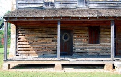
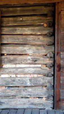
The Obediah Shirley House was built in several phases, to accommodate the changing needs of the households who occupied it until the late 1880s. The original core of the building, on the left (south) side of the house, was a one-story log structure built ca. 1826. The log framing has inverted re-notched corners, visible to the ceiling at the left corner of the house where the clapboards have pulled away. Log construction was also used in the house's first addition, a small room to the north of the core and now the middle room at the front of the house. (On the interior, the cut logs that formed the exterior all are visible in this middle room.) After 1850 another room was added on the right, extending the house width to three rooms. This northern room has an enclosed stairway to the second floor.
The last major addition was at the rear of the house on the south end. This one story ell was used as a kitchen. a porch on the north side of the ell, added after 1900, was removed in the late 1980s because of deterioration. The location of the porch is indicated on the 1988 property survey, which has an outline of the house.
The exterior end chimneys are of ashlar stone. The south chimney has a new brick stack. The north chimney has a stack of older brick, which has been stuccoed. The foundation is fieldstone piers with no infilling. The house has clapboard siding, attached to the framing with wire nails. On the southern end of the house the clapboards have square nail holes., although no nails are visible and wire nails have been used to hold the clapboards to the building. The second level shows a change in framing, to studs, and the nailing pattern for the siding also changes from the first level to the second.
The porch roof framing, of 2 x 4s, dates to the late 1980s when a stabilization effort was launched by the family foundation. The floor deck is of wideboard construction, when about half of the deck material being new. The porch roof is temporarily supported by 4 x 4s. Flushboard siding was used in the center portion of the porch. The porch extends beyond the flush board siding and covers the clapboards.
The asphalt roof replaced a deteriorated roof in 1988.
On the front facade, there are two entrance doors, symmetrically placed, leading to the rooms at each end of the house. The window between the two doors provides the only opening in the middle room. The doors were apparently used to provide easier access to the functions of the house, as it was never divided for two-family use. The room at the north end was used as a parlor, the middle room as a dining room, and the south room as a living room.
The stairwell to the second floor, which is enclosed, is to the left of the north entrance door. It leads to the northern of the two rooms on the second story. A doorway connects the two rooms. The ceiling joists, some of which are rough hewn logs with adze marks that are clearly visible, can be seen in both rooms. Framing members in the northwest corner of the north room are new.
Few modifications have been made on the interior, and the detailing is simple. The house has electricity and according to James Austin, a descendant of Obediah Shirley who inherited the property in 1956, running water was added in the kitchen ca. 1950 by Bessie Shirley Austin, who owned the property at that time. There is little evidence of as the walls in the ell have been stripped to the exterior material. Bathroom plumbing was never installed. Walls and ceiling are generally sheathed in flush boards throughout although some of the boards were removed during the period of tenant occupation. There is some evidence of paint and wallpaper, but much of the sheathing appears to have not been painted. Molding around doors is simple, and there is otherwise no decorative molding. Floors are of narrow-width planks on the first floor.
There are three fireplaces, two on the first floor. Each of the first-floor fireplaces has a wood mantel of simple design. At the time of the initial stabilization effort in 1988 and 1989, stoves were removed from the fireplaces. The fire place at the southern end is lined with brick; the fireplace on the northern end is not lined and the fieldstone is visible. The third fireplace, which has no mantel, is on the second floor in the north room. Constructed of fieldstone, it is of three parts; one large piece of fieldstone serves as a lintel, which is supported by two equally large stones at the sides.
The fieldstone used for the chimneys and foundation came from the quarry on the other side of Bagwell Road, part of the original property.
Statement of Significance
The Obediah Shirley House, in the Honea Path vicinity of Anderson County, S.C., is eligible for inclusion in the
National Register of Historic Places under Criterion C as an excellent example of a simple plantation farmhouse. It is associated with the Shirley family of Honea Path who occupied the house for approximately sixty years and farmed the property for more than 150 years.
Obediah Hugh Shirley was born in Abbeville, South Carolina, in 1802. He married Jane (Jennie) Armstrong in 1824. Shirley and his family settled on the property in 1826 and built the house shortly thereafter. Obediah Shirley became the owner of (possibly through his father-in-law James Armstrong) significant portions of the land that later became the developed portion of Honea Path as well as acreage in the surrounding area. He was a successful farmer and as part of his operations, hauled cotton to Hamburg (now North Augusta), South Carolina, the nearest market.
Over a 26-year period, ten children were born to Jane and Obediah Shirley. On those ten, eight survived to adulthood. Several of the five sons and three daughters built homes in the town of Honea Path. Obediah Shirley died in 1889, the year that marks the end of the latest period of family occupancy. The house and substantial acreage in the vicinity were left to the youngest son, William Marshall Shirley. At his death in 1926, the house and an undetermined amount of land were passed on to his daughter, Bessie Shirley Austin. Her husband,
Photographed By Brian Scott, August 23, 2008
12. Honea Path - Reverse
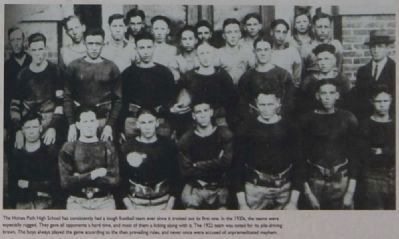
Honea Path High School Football Team
Honea Path High School Football Team
The Honea Path High School has consistently had a tough football team ever since it trotted out its first one. In the 1920s, the teams were especially rugged. They gave all opponents a hard time, and most of them a licking along with it. The 1922 team was noted for its pile-driving brawn. The boys played the game according to the prevailing rules, and never once were accused of unpremeditated mayhem.
After the end of the Shirley family occupancy in the 1880s, the house continued to be used as a residence under tenant occupancy until the early 1980s. The Shirley House Foundation intends to restore and interpret the property as a house museum. (Source: National Register nomination form.)
— Submitted October 8, 2010, by Brian Scott of Anderson, South Carolina.
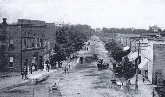
South Carolina Postcards, Vol. IX: Anderson County, by Howard Woody, circa 1900
15. Street Scene, Honea Path
This postcard view of Main Street, looking north, shows the small business district of this community in 1900. An 197 map of Honea Path indicates Main Street stores on the left were owned by W.A. and R.M. Shirley; J.W., L.A., and T.H. Brock; T.J. Clatworthy; and the Farmers Alliance. On the right were the town council offices, warehouses, and other retail stores.
South Carolina Postcards, Vol. IX: Anderson County, by Howard Woody, circa 1930
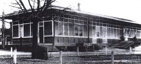
16. Southern Depot, Honea Path
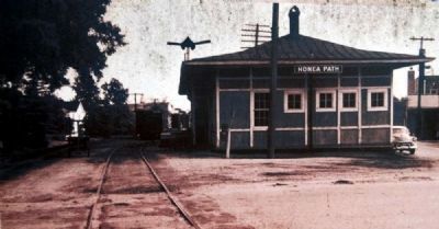
The Honea Path area obtained train service when the Greenville and Columbia Railroad established a depot in 1853. This line and other local railroads were obtained by the regional Southern Railway System in 1894. The second railroad line there was the Piedmont and Northern Railroad in 1911. The Southern's depot was torn down in 1970, while the latter depot stands and is used for other purposes in 2002.
Credits. This page was last revised on June 7, 2023. It was originally submitted on August 26, 2008, by Brian Scott of Anderson, South Carolina. This page has been viewed 5,741 times since then and 183 times this year. Last updated on September 8, 2008, by Mike Stroud of Bluffton, South Carolina. Photos: 1. submitted on August 26, 2008, by Brian Scott of Anderson, South Carolina. 2. submitted on September 29, 2010, by Brian Scott of Anderson, South Carolina. 3, 4, 5, 6, 7. submitted on November 3, 2010, by Brian Scott of Anderson, South Carolina. 8. submitted on August 26, 2008, by Brian Scott of Anderson, South Carolina. 9, 10, 11, 12, 13. submitted on September 29, 2010, by Brian Scott of Anderson, South Carolina. 14. submitted on August 26, 2008, by Brian Scott of Anderson, South Carolina. 15, 16, 17. submitted on October 8, 2010, by Brian Scott of Anderson, South Carolina. 18, 19, 20, 21, 22, 23, 24, 25. submitted on October 15, 2010, by Brian Scott of Anderson, South Carolina. • Craig Swain was the editor who published this page.
