Ashland in Jackson County, Oregon — The American West (Northwest)
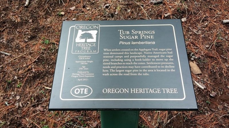
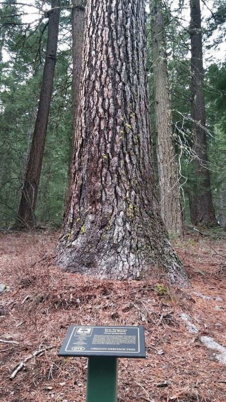
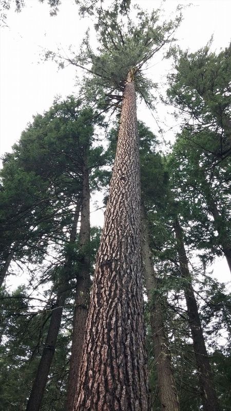
Tub Springs Sugar Pine
When settlers crossed on the Applegate Trail, sugar pine trees dominated this landscape. Native Americans had seasonal camps and purposefully managed the sugar pines, including using a hook-ladder to move up the tiered branches to reach the cones. Settlement pressures, needs and practices may have contributed to its decline here. The largest sugar pine in the area is located in the wash across the road from the tubs.
Circumference: 226.8 inches
Average Crown Spread:
Approximate Age: approx. 250 years
Oregon Heritage Tree
Erected 2012 by Oregon Travel Experience.
Topics and series. This historical marker is listed in these topic lists: Horticulture & Forestry • Native Americans. In addition, it is included in the Historic Trees series list.
Location. 42° 6.946′ N, 122° 26.542′ W. Marker is in Ashland, Oregon, in Jackson County. Marker is on Green Springs Highway (U.S. 66). Touch for map. Marker is in this post office area: Ashland OR 97520, United States of America. Touch for directions.
Other nearby markers. At least 8 other markers are within 8 miles of this marker, measured as the crow flies. The Applegate Trail (a few steps from this marker); Crossing the Siskiyous (a few steps from this marker); Historic Applegate Trail (within shouting distance of this marker); Greensprings (approx. 1.2 miles away); Historic Applegate Trail 1846 - 1869 (approx. 2 miles away); Keene Creek Wagon Slide (approx. 2 miles away); Route of Historic Applegate Trail (approx. 6.6 miles away); Siskiyou Mountain Wagon Road (approx. 8.1 miles away). Touch for a list and map of all markers in Ashland.
More about this marker. Marker and tree are located within Tub Springs State Park.
Regarding Tub Springs Sugar Pine. The Tub Springs Sugar Pine is the first Sugar pine to be elected to the Oregon Heritage Tree list. The species was “Discovered” by David Douglas in early 1800’s (Douglas-fir namesake); but known by indigenous people for millennia before him. The Sugar pine’s range is from Baja California in the south to Southern Washington Cascades in the north and Western Nevada in the east to Western California Coast Range and Oregon Siskiyou Mountains in the West, and at elevations from 1,000 to about 5,500 feet above sea level. Susceptibility to white pine blister rust, and has resulted in relative decline of occurrence in most of its range. It is a source of fine interior trim and window sash lumber and furniture stock, and was also used by early settlers for structural lumber, shake and shingle roofing and siding. It was and still is a source for several food and topical and internal medicines for humans, and is an important food source for certain wildlife. The Sugar pine is more resistant to frequent low-intensity fires than other species, and may produce and exude chemicals that can prevent other plant seeds from germinating near it.
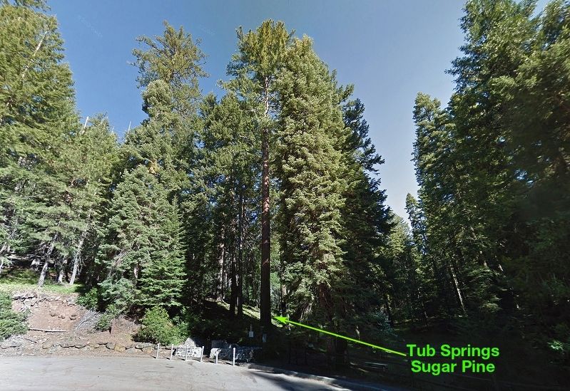
Fire suppression practices in its native range has allowed other less-resistant trees to compete (such as the situation was at Tub Springs through the 20th century). Large specimens of sugar pine dominated the landscape at and around Tub springs for travelers on the Applegate Trail. The Tub Springs property was acquired by State in 1930 and used as a rest-and-watering stop for motorists on the new state highway system. The Tub Springs Sugar Pine, the largest remaining specimen in Tub Springs is located across the highway about 200 feet from the wayside parking lot. Source: Oregon Travel Experience
Also see . . . Oregon Travel Experience - Tub Springs Sugar Pine. (Submitted on January 13, 2018, by Douglass Halvorsen of Klamath Falls, Oregon.)
Credits. This page was last revised on January 16, 2018. It was originally submitted on January 13, 2018, by Douglass Halvorsen of Klamath Falls, Oregon. This page has been viewed 263 times since then and 24 times this year. Photos: 1, 2, 3, 4. submitted on January 13, 2018, by Douglass Halvorsen of Klamath Falls, Oregon. • Bill Pfingsten was the editor who published this page.


