Rescue in El Dorado County, California — The American West (Pacific Coastal)
The Coloma Road
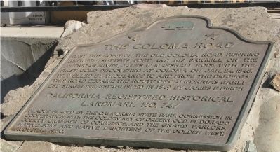
Photographed by Syd Whittle, September 8, 2008
1. The Coloma Road Marker
Erected 1960 by California State Park Commission in cooperation with the Golden Key of Greenwood, Eldorado County Chamber of Commerce,and the Grand Parlors, Native Sons and Native Daughters of the Golden West. (Marker Number 747.)
Topics and series. This historical marker is listed in these topic lists: Landmarks • Notable Places • Roads & Vehicles • Settlements & Settlers. In addition, it is included in the California Historical Landmarks, and the Native Sons/Daughters of the Golden West series lists. A significant historical month for this entry is January 1935.
Location. 38° 42.67′ N, 120° 57.12′ W. Marker is in Rescue, California, in El Dorado County. It is at the intersection of Green Valley Road and Deer Valley Road, on the right when traveling east on Green Valley Road.
this page online

Regionally, this marker is in Sacramento Metro. Globally, it is in North America, on the Ring of Fire, on the Pacific Rim, in the Western Hemisphere, in the Western World, and in the Anglosphere. Historically, it finds itself in what was once New Spain and also Mexico’s Alta California.
Other nearby markers. At least 8 other markers are within 6 miles of this marker, measured as the crow flies: Old Coloma Road (within shouting distance of this marker); James Skinner Winery & Distillery (approx. 2½ miles away); Camp Site of Boston-Newton Party (approx. 3½ miles away); Pleasant Grove House (approx. 3.8 miles away); Du Roc House (approx. 4.1 miles away); Wakamatsu Tea and Silk Farm Colony (approx. 5.4 miles away); El Dorado (Mud Springs) (approx. 5.9 miles away); El Dorado (approx. 5.9 miles away).
Related markers. Click here for a list of markers that are related to this marker. Other Coloma Road markers in El Dorado and Sacramento Counties.
Also see . . . El Dorado County History. (Submitted on September 8, 2008, by Syd Whittle of Mesa, Arizona.)
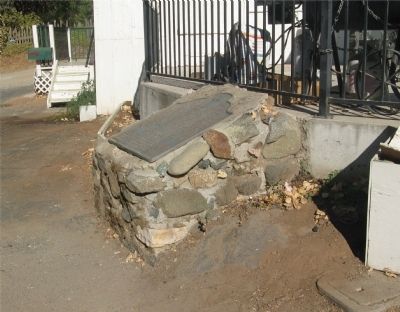
Photographed by Syd Whittle, September 8, 2008
2. The Coloma Road Marker
Credits. This page was last revised on June 4, 2018. It was originally submitted on September 8, 2008, by Syd Whittle of Mesa, Arizona. This page has been viewed 1,947 times since then and 36 times this year. Photos: 1, 2. submitted on September 8, 2008, by Syd Whittle of Mesa, Arizona. • Kevin W. was the editor who published this page.
