Jamestown in Stutsman County, North Dakota — The American Midwest (Upper Plains)
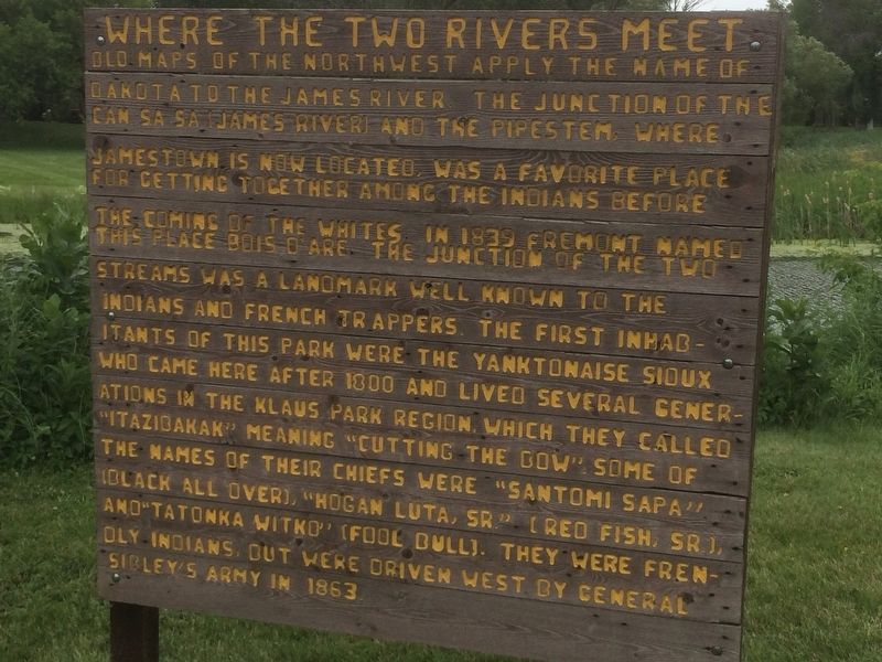
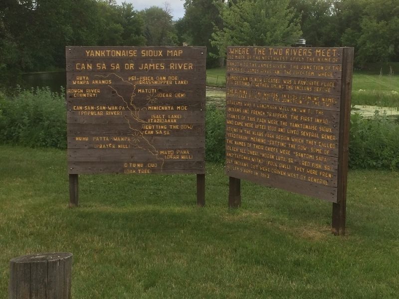
Where the Two Rivers Meet
Old maps of the Northwest apply the name of Dakota to the James River. The junction of the Can Sa Sa (James River) and the Pipestem, where Jamestown is now located, was a favorite place for getting together among the Indians before the coming of the whites.
In 1839 Fremont named this place Bois D' Are. The junction of the two streams was a landmark well known to the Indians and French trappers. The first inhabitants of this park were the Yanktonaise Sioux who came here after 1800 and lived several generations in the Klaus Park Region, which they called "Itazidakak" meaning "Cutting the Bow"
Some of the names of their chiefs were "Santomi Sapa " (Black All Over), "Hogan Luta, Sr." (Red Fish, Sr.), and "Tatonka Witko" (Fool Bull). They were friendly Indians, But were driven west by General Sibley's Army in 1863.
Topics. This historical marker is listed in these topic lists: Native Americans • Settlements & Settlers • Waterways & Vessels. A significant historical year for this entry is 1839.
Location. 46° 54.171′ N, 98° 42.954′ W. Marker is in Jamestown, North Dakota, in Stutsman County. Marker can be reached from Klaus Park Rd. This marker is located in Klaus Park near the river. Touch for map. Marker is in this post office area: Jamestown ND 58401, United States of America. Touch for directions.
Other nearby markers. At least 8 other markers are within 2 miles of this marker, measured as the crow flies. Alton Klaus (approx. 0.2 miles away); The Hansen Arts Park (approx. half a mile away); In Celebration of the Two Hundredth Year Birthday of the United States of America, 1976 (approx. 0.6 miles away); Fort Seward (approx. 0.7 miles away); Fort William H. Seward (approx. ¾ mile away); a different marker also named Fort Seward (approx. ¾ mile away); Model 1861 8" Siege Howitzer (approx. ¾ mile away); World's Largest Buffalo (approx. 1.2 miles away). Touch for a list and map of all markers in Jamestown.
Credits. This page was last revised on January 17, 2018. It was originally submitted on January 14, 2018, by Ruth VanSteenwyk of Aberdeen, South Dakota. This page has been viewed 472 times since then and 52 times this year. Photos: 1, 2. submitted on January 14, 2018, by Ruth VanSteenwyk of Aberdeen, South Dakota. • Bill Pfingsten was the editor who published this page.

