Mount Vernon near Alexandria in Fairfax County, Virginia — The American South (Mid-Atlantic)
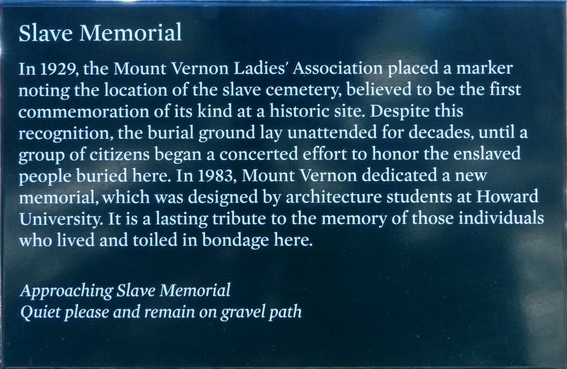
Slave Memorial
Photographed by Allen C. Browne, January 13, 2018
1. Slave Memorial Marker
Approaching Slave Memorial
Quiet please and remain on gravel path
Topics and series. This historical marker and memorial is listed in these topic lists: African Americans • Cemeteries & Burial Sites. In addition, it is included in the Historically Black Colleges and Universities series list. A significant historical year for this entry is 1929.
Location. 38° 42.383′ N, 77° 5.346′ W. Marker is near Alexandria, Virginia, in Fairfax County. It is in Mount Vernon. It can be reached from the intersection of Mount Vernon Memorial Highway (Virginia Route 235) and Mount Vernon Memorial
this page online

Regionally, this marker and memorial is in the Washington Metropolitan Area and in Northern Virginia. It is also in the American South, specifically in the Upper South, in the Mid-Atlantic, and on the Eastern Seaboard. Globally, it is in the North Atlantic Region, North America, the Western Hemisphere, the Western World, and the Anglosphere. Historically, it finds itself in what was once the territory of the Mississippian Culture, one of the original Thirteen Colonies, one of the Confederate States of America, and the Antebellum South.
Other nearby markers. At least 8 other markers are within walking distance of this marker: Archaeology of the African-American Burial Ground (here, next to this marker); African-American Burial Ground (a few steps from this marker); Who Lies Buried Here? (a few steps from this marker); In Memory of the Many Faithful Colored Servants of the Washington Family
Photographed by Allen C. Browne, January 13, 2018
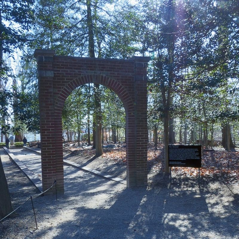
2. Slave Memorial Marker
Photographed by Allen C. Browne, November 5, 2011
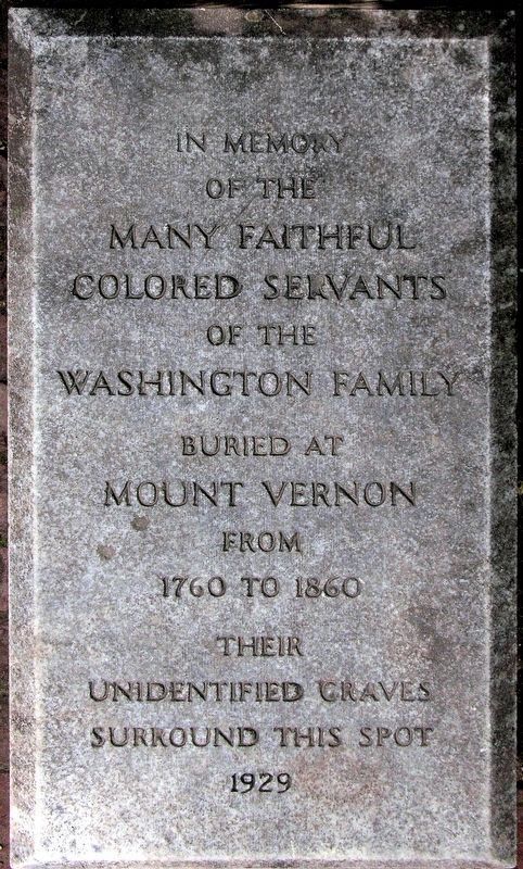
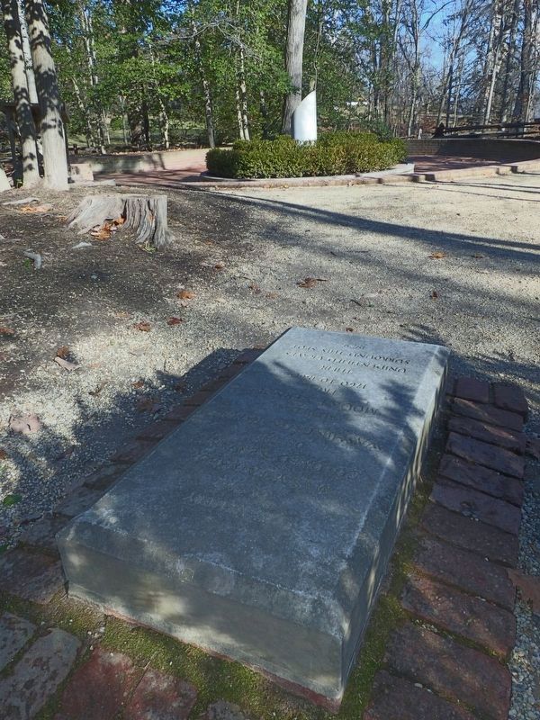
3. Colored Servants Memorial
1929
1929
of the
Many Faithful
Colored Servants
of the
Washington Family
Buried at
Mount Vernon
From
1760 to 1860
Their
Unidentified Graves
Surround This Spot
1929
Photographed by Allen C. Browne, January 13, 2018
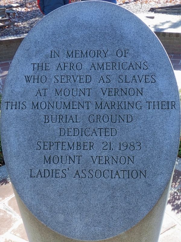
4. Enslaved Afro American Memorial
1983
1983
The Afro Americans
Who Served as Slaves
at Mount Vernon
This Monument marking their
Burial Ground
Dedicated
September 21, 1983
Mount Vernon
Ladies' Association
Photographed by Allen C. Browne, January 13, 2018
5. Two Memorials
Credits. This page was last revised on January 27, 2023. It was originally submitted on January 17, 2018, by Allen C. Browne of Silver Spring, Maryland. This page has been viewed 690 times since then and 34 times this year. Photos: 1, 2, 3, 4, 5. submitted on January 17, 2018, by Allen C. Browne of Silver Spring, Maryland. • Bernard Fisher was the editor who published this page.
