Chiloquin in Klamath County, Oregon — The American West (Northwest)
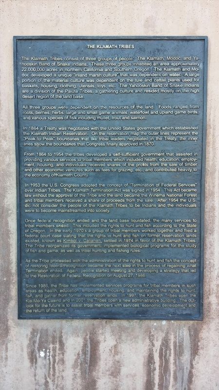
The Klamath Tribes
All three groups were dependent on the resources of the land. Foods ranged from roots, berries, herbs, large and small game animals, waterfowl and upland game birds, and various species of fish including mullet, trout and salmon.
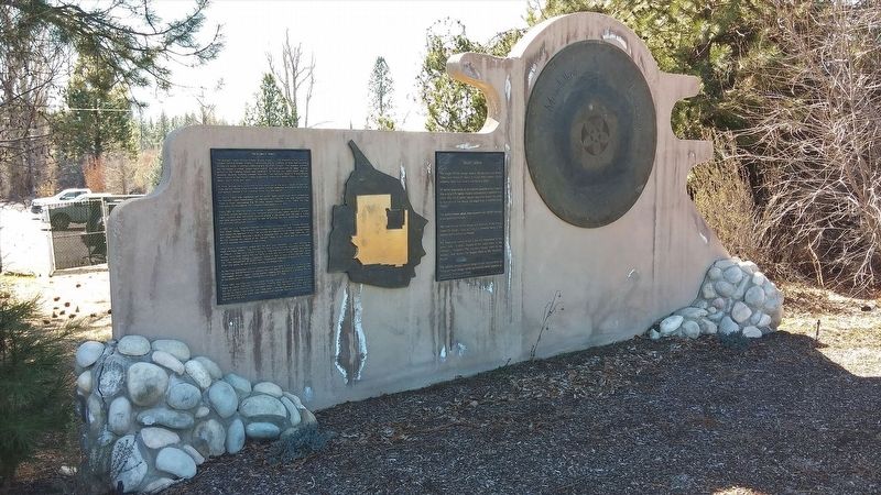
In 1864 a Treaty was negotiated with the United States government which established the Klamath Indian Reservation. On the reservation map the outer lines represented the "Peak to Peak" boundaries that the tribal leaders negotiated in the Treaty, the inner lines show the boundaries that Congress finally approved in 1870.
From 1864 to 1954 the tribes developed a self-sufficient government that assisted in providing various services to tribal members which included health, education, employment, housing, and individuals received shares of the profits from the sale of timber and other economic ventures such as fees for grazing, etc., and contributed heavily to the economy of Klamath County.
In 1953 the U.S. Congress adopted the concept of "Termination of Federal Services" over the Indian Tribes. The Klamath Termination Act was signed in 1954. This Act became law without the approval of the Tribe and the land became the Winema National Forest and tribal members received a share of the proceeds from the sale. After 1954 the U.S. did not consider the people of the Klamath Tribes to be Indians and the individuals were to become mainstreamed into society.
Once federal recognition ended and the land base liquidated, the many services to tribal members ended. This included the rights to hunt and fish according to the State of Oregon. In the early 1970's a group of tribal members worked together and filed a federal court case stating that the rights to hunt and fish on former reservation lands existed, known as Kimbol v. Callahan, settled in 1974 in favor of the Klamath Tribes. The Tribe reorganized its government, implemented biological programs for the study of fish and game, as well as tribal hunting and fishing rules.
As the Tribe proceeded with the administration of the rights to hunt and fish the concept of restoring federal recognition
Photographed By Douglass Halvorsen, February 21, 2015
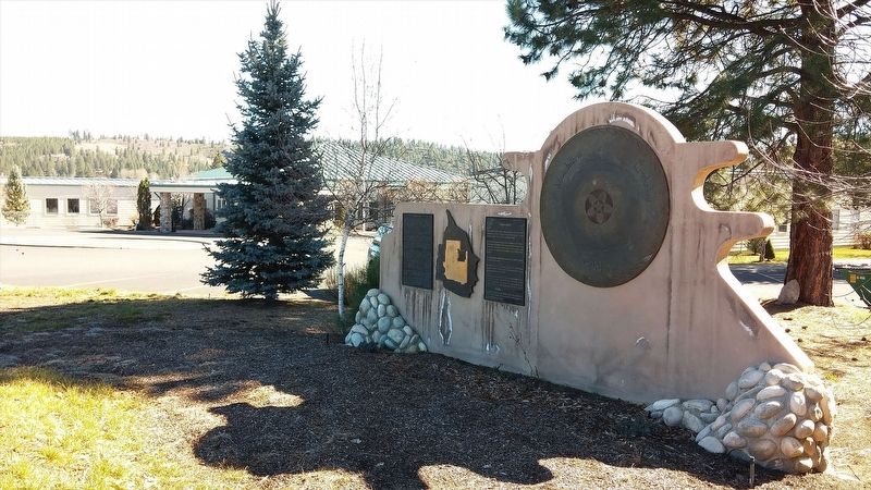
2. The Klamath Tribes Interpretive Display
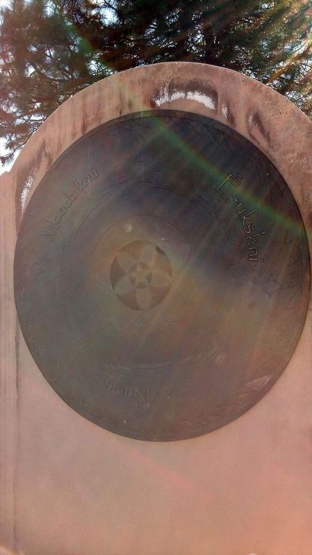
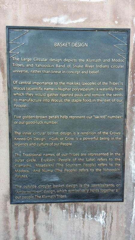
The large Circular design depicts the Klamath and Modoc Tribes, and Yahooskin Band of Snake River Indians circular universe, rather than linear in concept and belief.
Of central importance to the maklaks (people) of the Tribes is Wocus (scientific name--Nuphar polysepalum) a waterlilly from which they would gather ripened pods and remove the seeds, to manufacture into Wocus, the staple food in the diet of our People.
Five golden-brown petals help represent out "sacred" number, or our good-luck number.
The inner circular basket design is a rendition of the Crows'Kneed-On Design. nGak, or Crow, is a powerful being in the legends and culture of our People.
The Traditional names of our Tribes are represented in the outer circle. E-ukskni (People of the Lake) refers to the Klamaths, Moadalkni (The Southern People) refers to the Modocs. And Numu (The People) refers to the Yahooskin Paiutes.
The outside circular basket design is the sawalsaltantk, or "Arrowpoint-on" design, which symbolically holds together all our people, The Klamath Tribes.
Since 1986, the Tribe has implemented services programs for tribal members in such areas as health, education, employment, housing, and maintaining the rights to hunt, fish, and gather from former reservation lands. In 1997, the Klamath Tribes open the Kla-Mo-Ya Casino and in 2001 the Tribes open a new administrative building. The outlook for the future is to assist tribal members with services, economic development and the return of the land.
Topics. This historical marker is listed in this topic list: Native Americans. A significant historical date for this entry is August 27, 1986.
Location. 42° 34.465′ N, 121° 52.516′ W. Marker is in Chiloquin, Oregon, in Klamath County. Marker is on Chiloquin Boulevard (Oregon Route 22). Touch for map. Marker is in this post office area: Chiloquin OR 97624, United States of America. Touch for directions.
Other nearby markers. At least 8 other markers are within 10 miles of this marker, measured as the crow flies. UMC Indian Mission (approx. 4.6 miles away); Williamson River (approx. 4.7 miles away); Collier Memorial Logging Museum (approx. 4.7 miles away); Stout Abner (approx. 4.7 miles away); Klamath Fish Hatchery (approx. 6.4 miles away); The First Sawmill (approx. 9˝ miles away); Ft. Klamath Frontier Post (approx. 9˝ miles away); Site of Fort Klamath (approx. 9.6 miles away). Touch for a list and map of all markers in Chiloquin.
More about this marker. Marker is located at the entrance to the Klamath Tribes administration facility
Credits. This page was last revised on January 20, 2018. It was originally submitted on January 17, 2018, by Douglass Halvorsen of Klamath Falls, Oregon. This page has been viewed 348 times since then and 36 times this year. Photos: 1, 2, 3, 4, 5. submitted on January 17, 2018, by Douglass Halvorsen of Klamath Falls, Oregon. • Bill Pfingsten was the editor who published this page.
