North Queen Anne in Seattle in King County, Washington — The American West (Northwest)
Fremont Bridge
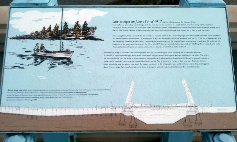
Before straightened into a channel, this site served as a seasonal home to the Duwamish people, who fished and hunted here on marshy banks and were supplanted by settlement. In photographs, as Lake Washington Ship Canal was being built (ca. 1911), the site is revealed as a mud flat, houses and shacks on its banks, weirs controlling the flow of water, and the neighborhoods on either side straggling up the banks and hills. Snapshots of the opening of the canal, on the 4th of July, 1917, show a more orderly landscape with crowds filling the streets and canal banks. This is still the place of nature and people, commerce and leisure, a crossroads of water and steel.
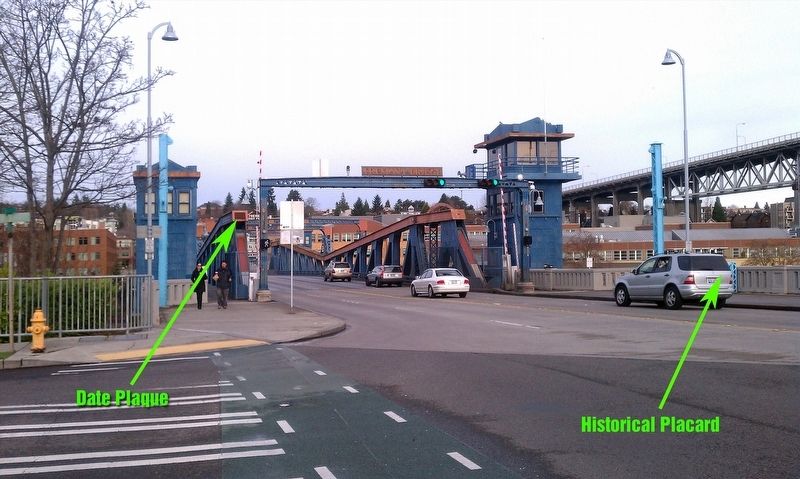
The Fremont Bridge is one of four bascule bridges that span the Lake Washington Ship Canal ('bascule' is French for balance). In addition to replacing the bridge's gears, recent renovations removed steel X bracing and replaced it with concrete pillars. The bridge has been retrofitted over the years to accommodate transportation and safety needs as times changed, although its essential character, presence and importance in connecting city neighborhoods and the flow of commerce remain as they ever were. From the trails on either side of the canal the viewer may watch the elegant movement of the bridge as it raises and then lowers, something that happens about 35 times a day. As it must have seemed in those first days, its action is majestic, entertaining and a celebratory event.
Erected 2009.
Topics. This historical marker is listed in these topic lists: Bridges & Viaducts • Native Americans. A significant historical date for this entry is June 15, 1917.
Location. 47° 38.823′ N, 122° 20.978′ W. Marker is in Seattle, Washington, in King County. It is in North Queen Anne. Marker is on 4th Avenue North, on the right when traveling north. Touch for map. Marker is in this post office area: Seattle WA 98109, United States of America. Touch for directions.
Other nearby markers. At least 8 other markers are within one mile of this marker, measured as the crow flies. Westlake and Dexter Historic Shelter (about 500 feet away, measured in a direct line); Sri Chinmoy (about 500 feet away); The J.P. Patches Show (approx. 0.2 miles away); Berlin Wall (approx. 0.2 miles away); The Fremont Troll (approx. 0.3 miles away); Lenin in Fremont (approx. 0.3 miles away); Tale of the Dinosaurs (approx. 0.3 miles away); Boeing's Lake Union Seaplane Hangar (approx. one mile away). Touch for a list and map of all markers in Seattle.
Also see . . . HistoryLink.org - Fremont Bridge. (Submitted on January 18, 2018, by Douglass Halvorsen of Klamath Falls, Oregon.)
Credits. This page was last revised on February 7, 2023. It was originally submitted on January 18, 2018, by Douglass Halvorsen of Klamath Falls, Oregon. This page has been viewed 223 times since then and 16 times this year. Photos: 1, 2. submitted on January 18, 2018, by Douglass Halvorsen of Klamath Falls, Oregon. • Bill Pfingsten was the editor who published this page.

