Near Ellensburg in Kittitas County, Washington — The American West (Northwest)
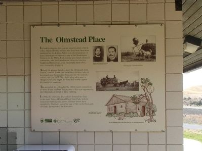
The Olmstead Place
Among the pioneer families were the Olmsteads from Illinois. Samuel, Sarah, and their three children rode on horseback over Snoqualmie Pass and into the sparsely settled valley in 1875. They built a log cabin next to Altapes Creek and began the farm that would support the family for a century.
The arrival of the railroad in 1880s meant connections to more distant markets. In response to this new opportunity, the Olmsteads switched to dairy farming.
In 1968, the Olmstead descendants donated the farm to the state. Today, Olmstead Place State Park, with its numerous buildings and pieces of horse-drawn farm, illustrates an earlier way of life on the thousands of family farms east of the Cascades.
Erected by Washington State Department of Transportation. (Marker Number 50.)
Topics. This historical marker is listed in these topic lists: Agriculture • Settlements & Settlers. A significant historical year for this entry is 1875.
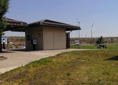
Location. 46° 56.831′ N, 120° 12.549′ W. Marker is near Ellensburg, Washington, in Kittitas County. Marker can be reached from Interstate 90 at milepost 126,, 10.8 miles west of Vantage Highway/Main Street when traveling west. The marker is located at Ryegrass Safety Rest Area Westbound, 10.3 miles west of Exit 136 on Interstate 90. Touch for map. Marker is in this post office area: Ellensburg WA 98926, United States of America. Touch for directions.
Other nearby markers. At least 1 other marker is within walking distance of this marker. Lava Flows (approx. half a mile away).
Also see . . . Olmstead Place State Park in pictures. Lori Jacobson built this Facebook tribute to Olmstead Place State Park. Still a work in progress, started when she volunteered at the park during the summer of 2011, she is still adding notes. It is a rich place, full of history and beauty. (Submitted on July 9, 2012, by Lori Jacobson of Crystal Falls, Michigan.)
Credits. This page was last revised on October 14, 2020. It was originally submitted on November 27, 2010, by PaulwC3 of Northern, Virginia. This page has been viewed 762 times since then and 15 times this year. Last updated on January 29, 2018, by Martin Schrattenholzer of Renton, Washington. Photos: 1, 2. submitted on November 27, 2010, by PaulwC3 of Northern, Virginia. • Bill Pfingsten was the editor who published this page.

