Cisco in Eastland County, Texas — The American South (West South Central)
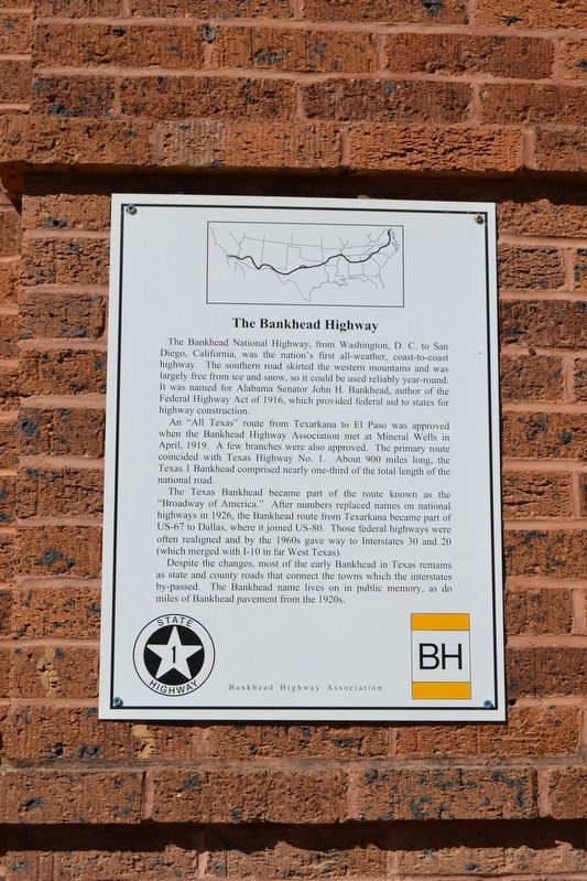
The Bankhead Highway
Photographed by Duane Hall, January 22, 2018
1. The Bankhead Highway Marker
An “All Texas” route from Texarkana to El Paso was approved when the Bankhead Highway Association met in Mineral Wells in April, 1919. A few branches were also approved. The primary route coincided with Texas Highway No. 1. About 900 miles long, the Texas 1 Bankhead comprised nearly one-third of the total length of the national road.
The Texas Bankhead became part of the route known as the “Broadway of America.” After numbers replaced names on national highways in 1926, the Bankhead route from Texarkana became part of US-67 to Dallas, where it joined US-80. Those federal highways were often realigned and by the 1960s gave way to Interstates 30 and 20 (which merged with I-10 in far West Texas).
Despite the changes, most of the early Bankhead in Texas remains as state and county roads that connect the towns which the interstates by-passed. The Bankhead name lives on in public memory, as do miles of Bankhead pavement from the 1920s.
Erected by Bankhead Highway Association.
Topics. This historical marker is listed in this topic list: Roads & Vehicles. A significant historical month for this entry is April 1919.
Location. 32° 23.326′ N, 98° 58.834′ W. Marker is in Cisco, Texas, in Eastland County. It can be reached from the intersection of W. 7th Street and Avenue E, on the right when traveling west. Touch for map. Marker is at or near this postal address:
this page online

Regionally, this marker is in Big Country. Globally, it is in North America, a Gulf of Mexico state, the Western Hemisphere, the Western World, and the Anglosphere. Historically, it finds itself in what was once New Spain, the Comanchería, the Republic of Texas, and one of the Confederate States of America.
Other nearby markers. At least 8 other markers are within 8 miles of this marker, measured as the crow flies: First National Bank (about 300 feet away, measured in a direct line); First Baptist Church of Cisco (about 700 feet away); Old Mobley Hotel (approx. 0.2 miles away); First United Methodist Church of Cisco (approx. ¼ mile away); First Presbyterian Church of Cisco (approx. ¼ mile away); Oakwood Cemetery (approx. 0.6 miles away); Cisco College (approx. 0.8 miles away); Dothan Cemetery (approx. 7.6 miles away). Touch for a list and map of all markers in Cisco.
Photographed by Duane Hall, January 22, 2018
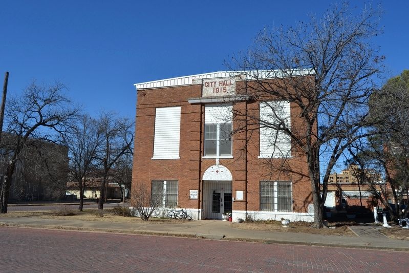
2. The Bankhead Highway Marker
Credits. This page was last revised on October 12, 2021. It was originally submitted on January 30, 2018, by Duane Hall of Abilene, Texas. This page has been viewed 476 times since then and 24 times this year. Photos: 1, 2. submitted on January 30, 2018, by Duane Hall of Abilene, Texas.
