Buena Vista in Southeast Washington in Washington, District of Columbia — The American Northeast (Mid-Atlantic)
A Navy Town
An East-of-the-River View
— Anacostia Heritage Trail —
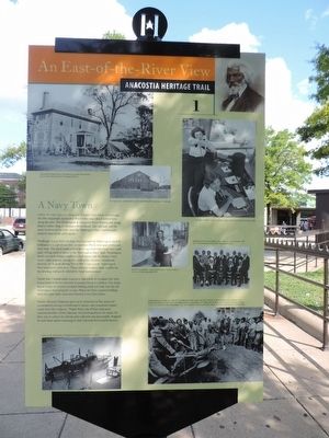
Long before Metro opened a Green Line station here in 1991, the B&O Railroad's Alexandria Branch line ran a block behind you, along the river. The Washington & Anacostia Street Railway ran along Martin Luther King Jr. Avenue a block ahead. The railroads and the area's location on the river near the Washington Navy Yard brought industry here in the early 1900s.
Pittsburgh-based Firth-Stirling Steel opened the Washington Steel & Ordnance Co. just down river at Giesboro Point, now part of the military base. The plant made armor-piercing projectiles from 1907 until 1928, selling most of them to the Washington Navy Yard. Washington Steel's 300-acre campus replaced small farms and the Buena Vista resort, once popular among the area's many German immigrant farmers. At its peak during World War I (1914-1918), Washington Steel employed 1,600 men. These workers made a ready market for the housing and goods offered by local businessmen.
World War I transformed Anacostia. Just north of the plant, the Navy Department built the riverside Anacostia Naval Air Station. The Army Signal Corps Air Service installed Bolling Field and took over the old Washington Steel property in 1935. When the Navy acquired Bolling Field five years later, Anacostia became a true Navy town.
Pauline Munson Chapman grew up in Anacostia in the 1940s and remembered waving to trainloads of sailors, who sometimes tossed candy from the windows. "Poplar Point was all Navy barracks," remembered Rev. Oliver Johnson, who lived nearby in the 1950s. On their way to school, he and his pals collected caps presumably dropped by inebriated sailors returning to their barracks from nearby taverns.
Erected 2015 by Cultural Tourism DC. (Marker Number 1.)
Topics and series. This memorial is listed in these topic lists: Air & Space • Military • Railroads & Streetcars • Waterways & Vessels. In addition, it is included in the Anacostia Heritage Trail series list.
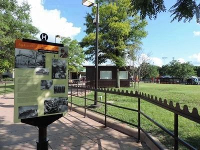
Location. 38° 51.725′ N, 76° 59.673′ W. Marker is in Southeast Washington in Washington, District of Columbia. It is in Buena Vista. Memorial is at the intersection of Howard Road Southeast and Shannon Place Southeast, on the right when traveling east on Howard Road Southeast. Touch for map. Marker is at or near this postal address: 1101 Howard Road Southeast, Washington DC 20020, United States of America. Touch for directions.
Other nearby markers. At least 8 other markers are within walking distance of this marker. Nichols Avenue Elementary School / Old Birney School Site (about 300 feet away, measured in a direct line); Faith and Action (about 300 feet away); Birney School (about 400 feet away); Bethlehem Baptist Church
(about 400 feet away); A Museum for the Community (about 600 feet away); Roads That Divide (about 800 feet away); Barry Farm Dwellings (approx. 0.2 miles away); Campbell African Methodist Episcopal Church (approx. 0.2 miles away). Touch for a list and map of all markers in Southeast Washington.
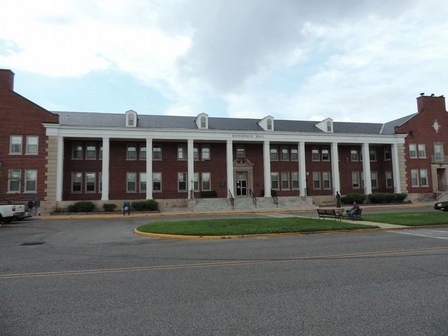
Additional keywords. Joint Base Anacostia-Bolling [JBAB]; HMX-1
![Marine Helicopter Squadron One [HMX1]. Click for full size. Marine Helicopter Squadron One [HMX1] image. Click for full size.](Photos3/329/Photo329550.jpg?923201595500AM)
Photographed By Richard E. Miller, July 15, 2015
4. Marine Helicopter Squadron One [HMX1]
- units in flight over JBAB from the Naval Support Facility heliport - the only such military aviation activity in Washington, DC - among other things, providing secure transportation for the President and other high level dignitaries.
Credits. This page was last revised on January 30, 2023. It was originally submitted on September 13, 2015, by Richard E. Miller of Oxon Hill, Maryland. This page has been viewed 573 times since then and 32 times this year. Last updated on February 2, 2018, by Devry Becker Jones of Washington, District of Columbia. Photos: 1. submitted on September 14, 2015, by Richard E. Miller of Oxon Hill, Maryland. 2. submitted on September 15, 2015, by Richard E. Miller of Oxon Hill, Maryland. 3, 4. submitted on September 19, 2015, by Richard E. Miller of Oxon Hill, Maryland. 5. submitted on September 26, 2015, by Richard E. Miller of Oxon Hill, Maryland. • Bill Pfingsten was the editor who published this page.
Editor’s want-list for this marker. A close-up photo of the reverse side of the marker. • Can you help?


!["Display Ship" <i>BARRY</i> [formerly, the Cold War-Vietnam Era destroyer "DD-733"]. Click for full size. "Display Ship" <i>BARRY</i> [formerly, the Cold War-Vietnam Era destroyer "DD-733"] image. Click for full size.](Photos3/330/Photo330962.jpg?262018112000AM)