San Mateo Almomoloa in Temascaltepec, Mexico State, Mexico — The Central Highlands (North America)
Piedra Herrada Monarch Butterfly Reserve
Inscription.
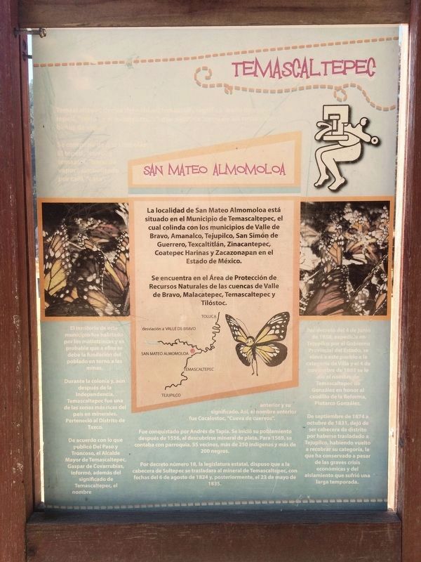
Temascaltepec
Temascaltepec deriva del náhuatl temazcalli, significa “baño de vapor”, y de tepetl, “cerro”, y el locativo de “c”, que significa “cerro de los temascales o baños de vapor”. Se compone de dos símbolos: El tepetl, “cerro” y temascal, “baño de vapor”, simbolizado por calli, “casa”.
San Mateo Almomoloa
La localidad de San Mateo Almomoloa está situado en el Municipio de Temascaltepec, el cual colinda con los municipios de Valle de Bravo, Amanalco, Tejupilco, San Simón de Guerrero, Texcaltitlán, Zinacantepec, Coatepec Harinas y Zacazonapan en el Estado de México.
Se encuentra en el Área de Protección de Recursos Naturales de las cuencas de Valle de Bravo, Malacatepec, Temascaltepec y Tilóstoc.
El territorio de este municipio fue habitado por los matlatzincas y es probable que a ellos se deba la fundación del poblado en torno a las minas. Durante la colonia y, aún después de la Independencia, Temascaltepec fue una de las zonas más ricas del país en minerales. Perteneció al distrito de Taxco. De acuerdo con lo que publicó Del Paso y Troncoso, el Alcalde Mayor de Temascaltepec, Gaspar de Covarrubias, informó además del significado de Temascaltepec, el nombre anterior y su significado. Así, el nombre anterior fue Cocalostoc, “Cueva de cuervos”. Fue conquistado por Andrés de Tapia. Se inició su poblamiento después de 1556, al descubrirse mineral de plata. Para 1569, se contaba con parroquia, 55 vecinos, más de 250 indígenas y más de 200 negros. Por decreto número 18, la legislatura estatal, dispuso que a la cabecera de Sutepec se trasladara al mineral de Temascaltepec, con fechas del 6 de agosto de 1824 y posteriormente, el 23 de mayo de 1835. Por decreto del 4 de junio de 1858, expedido en Tejupilco por el Gobierno Provincial del Estado, se elevó a este pueblo a la categoría de Villa y el 4 de noviembre de 1861 se le dio el nombre de Temascaltepec de González en honor al caudillo de la Reforma, Plutarco González. De septiembre de 1874 a octubre de 1831 (sic, 1881?), dejó de ser cabecera de distrito por haberse trasladado a Tejupilco, habiendo vuelto a recobrar su categoría, la que ha conservado a pesar de las graves crisis económicas y del aislamiento que sufrió una larga temporada.
De gran belleza y colorido, las mariposas monarcas son de vital importancia en el ciclo de la vida como agente polinizador y factor de equilibrio ecológico en los
bosques que habitan.
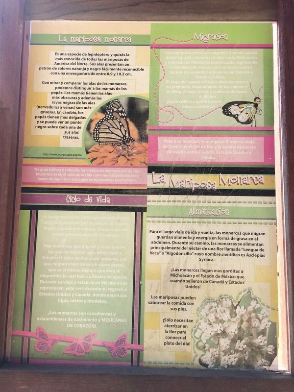
La mariposa monarca
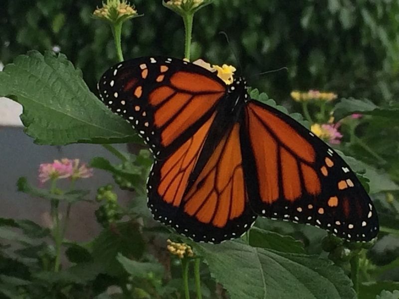
Es una especie de lepidóptero y quizás la más conocida de todas las mariposas de América del Norte. Sus alas presentan un patrón de colores naranja y negro fácilmente reconocible con una envergadura de entre 8.9 y 10.2 cm.
Con mirar y comparar las alas de las monarcas podemos distinguir a las mamás de los papás. Las mamás tienes las alas más obscuras y además las rayas negras de las alas (nervaduras a venas) son más gruesas. En cambio, los papás tienen mas delgadas y se puede ver un punto negro sobre cada una de sus alas traseras.
http://www.marisposa.org.mx/ (Sitio no activo a la fecha)
Migración
Las mariposas monarcas migran a fines de agosto desde Canadá y Estados Unidos hasta Michoacán y el Estado de México en nuestro país, regresando a mediados de marzo. Las monarcas migran porque no aguantan el invierno en Canadá y Estados Unidos.
El viaje de Canadá a México dura dos meses en promedio, dependiendo de los vientos y el clima. El viaje de ida y vuelta es de hasta 6,400 km. ¡Lo increíble es que lo hace la misma mariposa!
Pese a su levedad, la mariposa Monarca viaja de 2 mil a 4 mil km de ida y la misma distancia de vuelta entre Canadá, Estados Unidos y México.
Ciclo de Vida
A las monarcas les toma aproximadamente un mes para pasar por las etapas
de huevo, oruga, capullo y mariposa. Durante un año nacen generaciones de monarcas.
Hay monarcas que migran y otras que no, las que no migran viven en Canadá y Estados Unidos de dos a seis semanas. Las que migran viven de seis a nueve meses, que es el mismo tiempo que dura la migración, la cual inicia a finales de agosto. Durante su viaje y estancia en México no se reproducen, esto será durante su regreso a Estados Unidos y Canadá, donde nacen sus hijos, nietos y bisnietos.
¡Las monarcas son canadienses y estaunidenses (sic, estadounidenses) de nacimiento y mexicanas de corazón!
Alimentación
Para el largo viaja de ida y vuelta, las monarcas que migran guardan alimento y energia en forma de grasa en el abdomen. Durante su camino, las monarcas se alimentan principalmente del néctar de una flor lamada “Lengua de Vaca” o “Algodoncillo” cuyo nombre científico es Asclepias Syriaca.
¡Las monancas llegan mas gorditas a Michoacán y el Estado de México que cuando salieron de Canadá y Estados Unidos!
Las mariposes pueden saborear la comida con sus pies.
¡Sólo necesitan aterrizar en la flor para conocer el plato del dia!
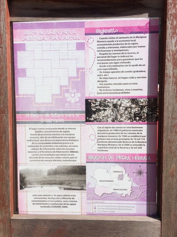
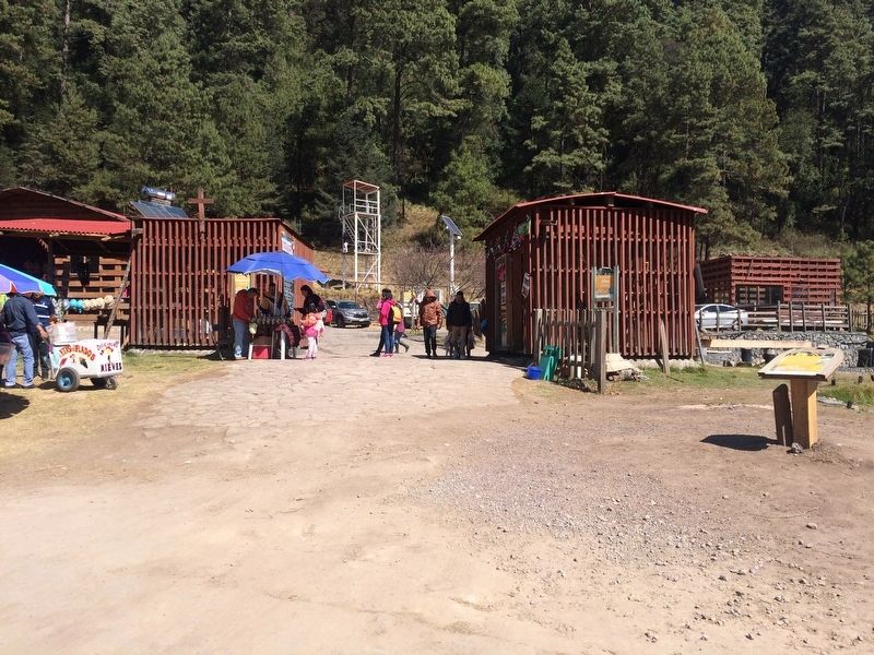
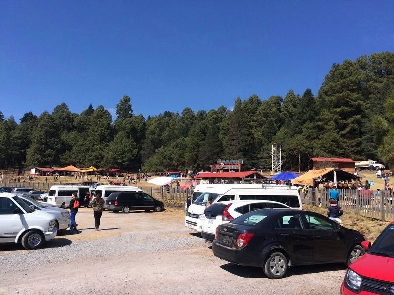
Centro de Cultura para la Conservación Piedra Herrada
El lugar cuenta restuarante donde se ofrecen platillos carácterísticos de región, tienda de artesanías alusivas a la mariposa
monarca, sala de sensibilización con equipo audiovisual, que destaca la importancia biológica de la conservación ambiental previo a la realización de recorridos a las colonias, así como cédulas de información sobre los recursos naturales y el fenómeno de hibernación. Además cuenta con tecnologías que hacen un uso eficiente de los recursos: celdas solares para el suministro de energía eléctrica, termotanque solar para abastecer de aqua caliente a los restuarantes, biodigestor y filtración de contaminantes en humedales, como sistema de tratamiento y reutilización de las aguas residuales (CONANP, 2008).
Con el objeto de conservar este fenómeno migratorio, en 1980 el gobierno mexicano decretó la protección de las colonias de la mariposa monarca. En 1986 se estableció por primera vez un área protegido de 16 mil 110 hectáreas denominada Reserva de la Biosfera Mariposa Monarca. En el 2000 se extendió la superficie total de la Reserva a 56 mil 259 hectáreas.
Reglamento
Reglamentos básico del parque
Ubicación de Piedra Herrada
Mapa de los áreas protegidos cerca de Piedra Herrada
Temascaltepec
The name Temascaltepec derives from náhuatl: from temazcalli, meaning "steam bath", tepetl, meaning "hill", and the locative "c", together meaning "hill of the temascales
or steam baths". Its symbol glyph is made up of two symbols: the tepetl, or "hill" and temascal, or "steam bath", symbolized by calli, or "house".
San Mateo Almomoloa
The town of San Mateo Almomoloa is located in the municipality of Temascaltepec, which borders the municipalities of Valle de Bravo, Amanalco, Tejupilco, San Simón de Guerrero, Texcaltitlán, Zinacantepec, Coatepec Harinas and Zacazonapan in the State of Mexico.
It is located in the Natural Resources Protected Area of Valle de Bravo, Malacatepec, Temascaltepec and Tilóstoc basins.
The territory of this municipality was inhabited by the Matlatzincas and it is probable that they founded the town around the mines. During the colonial period and after Independence, Temascaltepec was one of the richest areas of the country in minerals. It belonged to the district of Taxco. According to Del Paso and Troncoso, the Mayor of Temascaltepec, Gaspar de Covarrubias, also left information about the previous name of Temascaltepec and its meaning. The previous name was Cocalostoc, "Cueva de Cuervos" (The Blackbird Cave). It was conquered by Andrés de Tapia. Its settlement began after 1556, when silver ore was discovered. By 1569, there was a parish church, 55 residents, more than 250 Indians and more than 200 blacks. By Decree Number 18 the State Legislature ordered that the municipal
seat of Sutepec be moved to Temascaltepec on August 6, 1824 and again on May 23, 1835. By a June 4, 1858 decree, issued in Tejupilco by the Provincial Government of the State, the town was elevated to the category of Villa. On November 4, 1861 it was given the name of Temascaltepec de González in honor of a leader of the Reform, Plutarco González. From September 1874 to October 1881 the municipal seat was moved to Tejupilco. After regaining the municipal seat, it has conserved it, in spite of serious economic crises and its general isolation for many years.
Of great beauty and color, monarch butterflies are of vital importance in the life cycle as a pollinating agent and a factor in the ecological balance in the forests they inhabit.
The Monarch Butterfly
It is a species of the Lepidoptera order and perhaps the best known of all the butterflies of North America. Its wings have an easily recognizable orange and black pattern with a wingspan of between 8.9 and 10.2 cm.
When observing and comparing the wings of monarchs we can distinguish the females from the males. The females have darker wings and also the black stripes of the wings (from the ribs to the veins) are thicker. On the other hand, males are thinner and you can see a black dot on each of their hind wings.
http://www.marisposa.org.mx/ (Site not active to date)
Migration
Monarch butterflies migrate in late August from Canada and the United States to Michoacán and the State of Mexico in our country, returning in mid-March. The monarchs migrate because they can not stand the winter in Canada and the United States.
The trip from Canada to Mexico lasts two months on average, depending on the winds and the weather. The round trip is up to 6,400 km. The amazing thing is that the same butterfly does the whole trip!
Despite its light weight, the monarch butterfly travels from 2,000 to 4,000 km one way and the same distance back between Canada, the United States and Mexico.
Life Cycle
Monarchs take about a month to pass through the stages of egg, caterpillar, cocoon and butterfly. For a year, generations of monarchs are born.
There are monarchs that migrate and others that do not, those that do not migrate live in Canada and the United States for two to six weeks. Those who migrate live from six to nine months, which is the same time as the migration lasts, which begins at the end of August. During their trip and stay in Mexico they do not reproduce. They will reproduce during their return to the United States and Canada, where their children, grandchildren and great-grandchildren are born.
Monarchs are Canadians and Americans by birth and Mexicans in their heart!
Food
For the long journey back and forth, the monarchs that migrate store food and energy in the form of fat in their abdomen. During their journey, the monarchs feed mainly on the nectar of a flower called "Lengua de Vaca" or "Algodoncillo" (Cow’s tongue or Little cotton) whose scientific name is Asclepias syriaca.
The monarchs arrive fatter to Michoacán and the State of Mexico than when they left Canada and the United States!
Butterflies can taste their food with their feet.
They only need to land on a flower in order to know what will be their ‘meal of the day’!
Cultural Center for the Conservation of Piedra Herrada
The center is equipped with a restaurant where characteristic dishes of region are offered. There is also a gift shop with items related to the monarch butterfly and an “awareness room” with audiovisual equipment, which highlights the biological importance of environmental conservation prior to conducting tours to the colonies of butterflies, as well as information on the natural resources and the phenomenon of hibernation. It also has technologies that make efficient use of resources: solar cells for the supply of electricity, solar hot water tanks to supply hot water to the restaurants, a biodigester and filtration of pollutants before the site’s wetlands, a water treatment system and a water reuse system are also included in the site (CONANP, 2008).
In order to conserve this migratory phenomenon, in 1980 the Mexican government passed the first laws protecting the colonies of the monarch butterfly. In 1986, a protected area of 16,110 hectares called the Monarch Butterfly Biosphere Reserve was established for the first time. In 2000 the total area of the Reserve was extended to 56,259 hectares.
Regulations
Basic park regulations
Piedra Herrada’s location
Map of protected areas near Piedra Herrada
Erected 2008.
Topics. This historical marker is listed in these topic lists: Environment • Parks & Recreational Areas • Settlements & Settlers. A significant historical date for this entry is May 23, 1835.
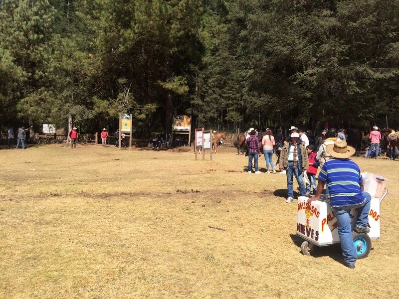
Location. 19° 10.5′ N, 99° 57.518′ W. Marker is in San Mateo Almomoloa, Estado de Mexico (Mexico State), in Temascaltepec. Marker can be reached from Carretera Toluca-Valle de Bravo, on the right when traveling west. The marker is near the walking trail up to the butterfly colonies at the Piedra Herrada Monarch Butterfly Reserve. Touch for map. Marker is in this post office area: San Mateo Almomoloa MEX 51320, Mexico. Touch for directions.
Other nearby markers. At least 8 other markers are within 19 kilometers of this marker, measured as the crow flies. José Castillo y Piña (approx. 18.2 kilometers away); Juan de Jesús Herrera y Piña (approx. 18.2 kilometers away); Pedro Velázquez H. (approx. 18.3 kilometers away); Joaquín Arcadio Pagaza (approx. 18.3 kilometers away); Nicolás Bravo (approx. 18.3 kilometers away); The Mexican Constitution of 1857 (approx. 18.3 kilometers away); The Name of Valle de Bravo (approx. 18.3 kilometers away); Valle de Bravo in the Mexican-American War (approx. 18.3 kilometers away).
Credits. This page was last revised on February 7, 2018. It was originally submitted on February 5, 2018, by J. Makali Bruton of Accra, Ghana. This page has been viewed 268 times since then and 20 times this year. Photos: 1, 2, 3, 4, 5, 6, 7. submitted on February 5, 2018, by J. Makali Bruton of Accra, Ghana. 8. submitted on February 7, 2018, by J. Makali Bruton of Accra, Ghana.
