Marker Logo
THE HISTORICAL
MARKER DATABASE
“Bite-Size Bits of Local, National, and Global History”
Somers in Capitol Region, Connecticut — The American Northeast (New England)
 

Somers
 
 
Somers Marker image. Click for full size.
Photographed by Michael Herrick, February 5, 2018
1. Somers Marker
Inscription.
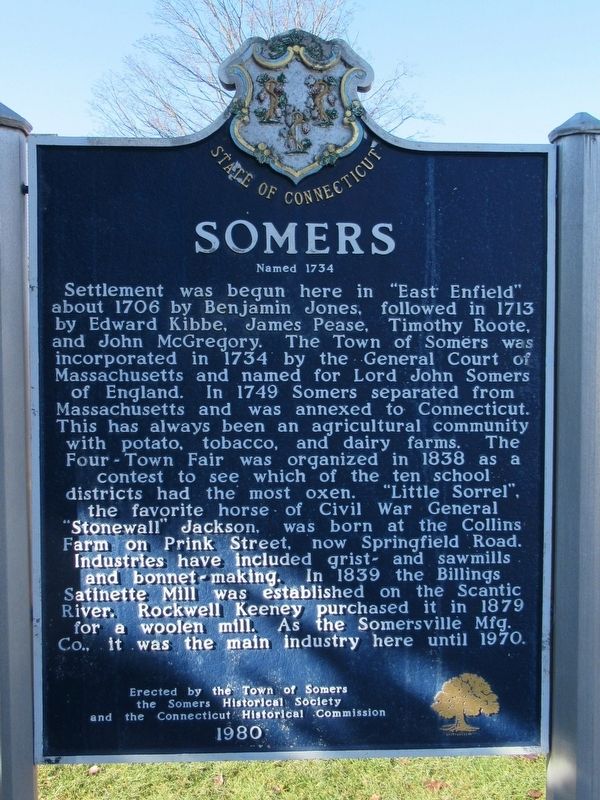
Somers
Named 1734
Settlement was begun here in "East Enfield" about 1706 by Benjamin Jones, followed in 1713 by Edward Kibbe, James Pease, Timothy Roote, and John McGregory. The Town of Somers was incorporated in 1734 by the General Court of Massachusetts and named for Lord John Somers of England. In 1749 Somers separated from Massachusetts and was annexed to Connecticut. This has always been an agricultural community with potato, tobacco, and dairy farms. The Four - Town Fair was organized in 1838 as a contest to see which of the ten school districts had the most oxen. “Little Sorrel", the favorite horse of Civil War General “Stonewall" Jackson, was born at the Collins Farm on Prink Street, now Springfield Road. Industries have included grist and sawmills and bonnet-making. In 1839 the Billings Satinette Mill was established on the Scantic River. Rockwell Keeney purchased it in 1879 for a woolen mill. As the Somersvillė Mfg. Co. it was the main industry here until 1970.
Erected by the Town of Somers
the Somers Historical Society
and the Connecticut Historical Commission
1980

 
Erected 1980 by Town
Paid Advertisement
Click or scan to see
this page online
of Somers, Somers Historical Society, Connecticut Historical Commission.
 
Topics. This historical marker is listed in these topic lists: Colonial EraSettlements & Settlers.
 
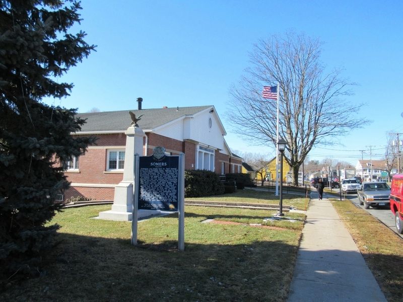
Location. 41° 59.13′ N, 72° 26.732′ W. Marker is in Somers in Capitol Region, Connecticut. It is at the intersection of Main Street and Battle Street (Connecticut Route 190), on the left when traveling west on Main Street. Located next to Somers Town Hall. Touch for map. Marker is at or near this postal address: 600 Main Street, Somers CT 06071, United States of America. Touch for directions.

Regionally, this marker is in the American Northeast and in New England. Globally, it is in North America, the Western Hemisphere, the Western World, and the Anglosphere. Historically, it finds itself in what was once Tolland County and also one of the original Thirteen Colonies.

Other nearby markers. At least 8 other markers are within 6 miles of this marker, measured as the crow flies: Somers Veterans Memorial (here, next to this marker); Descendant of the Original Charter Oak (about 600 feet away, measured
Somers Marker image. Click for full size.
Photographed by Michael Herrick, February 5, 2018
2. Somers Marker
in a direct line); Somers Memorial Honor Roll (about 600 feet away); Somers and Somersville Veterans Memorial (approx. 2 miles away); Scitico Roll of Honor (approx. 3½ miles away); The Hazardville Institute (approx. 4.8 miles away); Hazardville Veterans Monument (approx. 5.1 miles away); SFC Lawrence A. Dufraine (approx. 5.1 miles away). Touch for a list and map of all markers in Somers.
 
Also see . . .
1. Town of Somers. (Submitted on February 7, 2018, by Michael Herrick of Southbury, Connecticut.)
2. Somers, Connecticut on Wikipedia. (Submitted on February 7, 2018, by Michael Herrick of Southbury, Connecticut.)
 
 
Credits. This page was last revised on May 19, 2026. It was originally submitted on February 7, 2018, by Michael Herrick of Southbury, Connecticut. This page has been viewed 877 times since then and 72 times this year. Photos:   1, 2. submitted on February 7, 2018, by Michael Herrick of Southbury, Connecticut.

m=113828

CeraNet Cloud Computing sponsors the Historical Marker Database.
This website earns income from purchases you make after using our links to Amazon.com. We appreciate your support.
Paid Advertisement
Jul. 16, 2026