Marysville in Yuba County, California — The American West (Pacific Coastal)
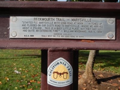
Beckwourth Trail – Marysville
⎯⎯⎯
Henness Pass Road – Marysville
| — | California Trail | — |
Photographed by Barry Swackhamer, November 18, 2012
1. Beckwourth Trail – Marysville Marker
Beckwourth Trail – Marysville. “Started for Marysville with good road at noon... hitched up and plodded on our dusty road to Marysville, where we arrived at 4 o’clock. This is a busy little place, but they had just had quite an extensive fire” – William Woodhams, August 5, 1854
Henness Pass Road – Marysville. “Sunday morning, left the Androse House. We are now in the Feather River and Sacramento Valley, passed the Farmer's House then to Briggs House, then ‘2 Miles House’ and in to Marysville – 12 miles.” —Loring Samuel Comstock, Sep 2, 1955
Erected 1996 by Trails West Inc. The Henness Pass Road marker on the other side was added in 2016. (Marker Number HP-22/B-50.)
Topics and series. This historical marker is listed in this topic list: Roads & Vehicles. In addition, it is included in the Beckwourth Trail, the California Trail, and the Trails West Inc. series lists. A significant historical year for this entry is 1854.
Location. 39° 8.299′ N, 121° 35.336′ W. Marker is in Marysville, California, in Yuba County. It is at the intersection of D Street and 3rd Street, on the right when traveling south on D Street. This
this page online

Regionally, this marker is in California’s Sacramento Metro, in the Sacramento Valley, and specifically in the Central Valley. Globally, it is in North America, on the Ring of Fire, on the Pacific Rim, in the Western Hemisphere, in the Western World, and in the Anglosphere. Historically, it finds itself in what was once New Spain and also Mexico’s Alta California.
Other nearby markers. At least 8 other markers are within walking distance of this marker: Historical Monument of Macy’s (approx. 0.2 miles away); New Mecklenberg (approx. 0.2 miles away); Lord Sholto Douglas (approx. 0.2 miles away); Mission Building (approx. 0.2 miles away); José Manuel Ramírez Rosales (approx. 0.2 miles away); Davis Hotel (approx. 0.2 miles away); Bok Kai Temple (approx. 0.2 miles away); Chinese Rock Wall (approx. 0.2 miles away). Touch for a list and map of all markers in Marysville.
Also see . . . Trails West Inc. Photo Tour. Follow the historic

Photographed by Cory Waters, October 6, 2025
2. Henness Pass Road – Marysville side of marker
Photographed by Barry Swackhamer, November 18, 2012
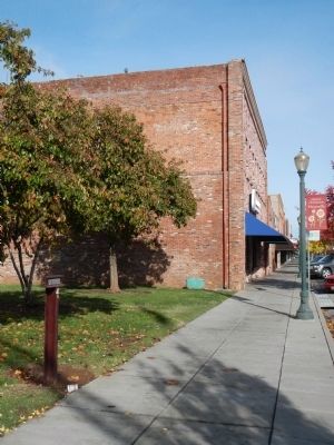
3. Beckwourth Trail – Marysville side of marker faces the sidewalk

Photographed by Cory Waters, October 6, 2025
4. Henness Pass Road – Marysville side of marker faces the grassy area
Photographed by Barry Swackhamer, November 18, 2012
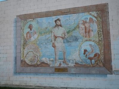
5. James Beckwourth Mural
Opposite the Beckwourth Trail - Marysville marker.
Credits. This page was last revised on October 13, 2025. It was originally submitted on November 29, 2012, by Barry Swackhamer of Brentwood, California. This page has been viewed 913 times since then and 45 times this year. Last updated on February 9, 2018, by Douglass Halvorsen of Klamath Falls, Oregon. Photos: 1. submitted on November 29, 2012, by Barry Swackhamer of Brentwood, California. 2. submitted on October 8, 2025, by Cory Waters of Bangor, California. 3. submitted on November 29, 2012, by Barry Swackhamer of Brentwood, California. 4. submitted on October 8, 2025, by Cory Waters of Bangor, California. 5. submitted on November 29, 2012, by Barry Swackhamer of Brentwood, California.
