
Wheaton in Silver Spring in Montgomery County, Maryland — The American Northeast (Mid-Atlantic)
One Tree's Life
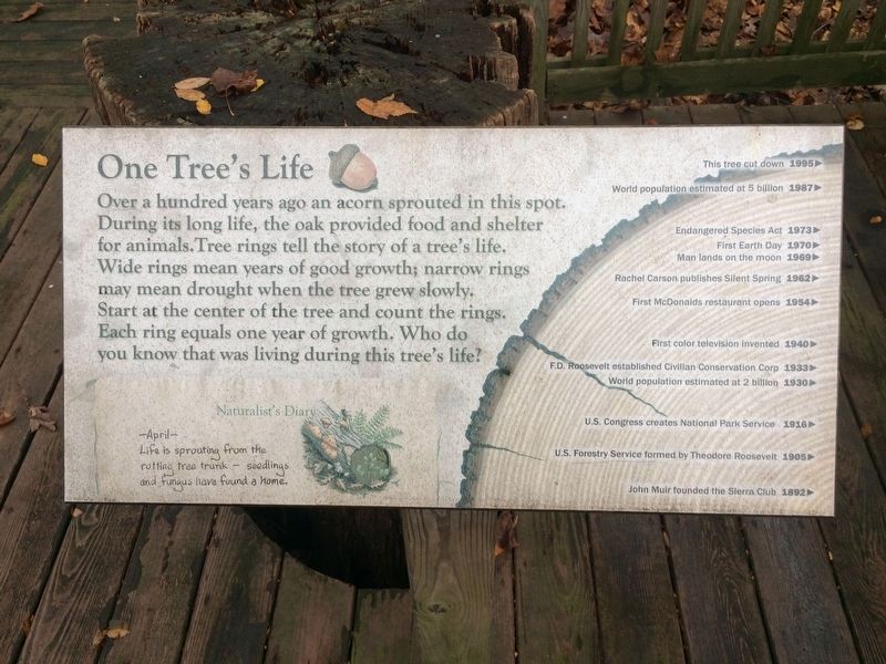
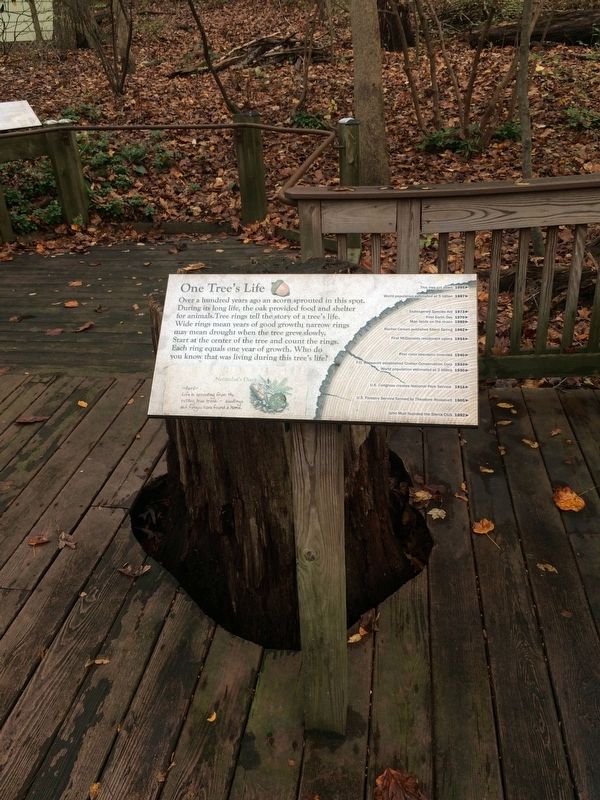
Over a hundred years ago an acorn sprouted in this spot. During its long life, the oak provided food and shelter for animals. Tree rings tell the story of a tree's life. Wide rings mean years of good growth; narrow rings may mean drought when the tree grew slowly. Start at the center of the tree and count the rings. Each ring equals one year of growth. Who do you know that was living during this tree's life?
Naturalist's Diary
-April-
Life is sprouting from the rotting tree trunk - seedlings and fungus have found a home.
[Timeline:]
1892 - John Muir founded the Sierra Club
1905 - U.S. Forestry Service formed by Theodore Roosevelt
1916 - U.S. Congress creates the National Park Service
1930 - World population estimated at 2 billion
1933 - F.D. Roosevelt established Civilian Conservation Corps
1940 - First color television invented
1954 - First McDonalds restaurant opens
1962 - Rachel Carson publishes Silent Spring
1969 - Man lands on the moon
1970 - First Earth Day
1973 - Endangered Species Act
1987 - World population estimated at 5 billion
1995 - This tree cut down
Erected by Montgomery Parks.
this page online
Topics and series. This historical marker is listed in these topic lists: Charity & Public Work • Environment • Horticulture & Forestry. In addition, it is included in the Civilian Conservation Corps (CCC), the Former U.S. Presidents: #26 Theodore Roosevelt, the Former U.S. Presidents: #32 Franklin D. Roosevelt, and the Maryland, Montgomery Parks series lists. A significant historical year for this entry is 1892.
Location. 39° 3.531′ N, 77° 1.981′ W. Marker is in Silver Spring, Maryland, in Montgomery County. It is in Wheaton. It can be reached from Glenallan Avenue east of Heurich Road, on the right when traveling east. On the grounds of Brookside Nature Center. Touch for map. Marker is at or near this postal address: 1400 Glenallan Ave, Silver Spring MD 20902, United States of America. Touch for directions.

Regionally, this marker is in the Washington Metropolitan Area. It is also in the American Mid-Atlantic. Globally, it is in North America, the Western Hemisphere, the Western World, and the Anglosphere. Historically, it finds itself in what was once one of the original Thirteen Colonies and also the Antebellum
Other nearby markers. At least 8 other markers are within walking distance of this marker: What Happened Here? (about 300 feet away, measured in a direct line); The Harper Family Homestead (about 300 feet away); Conservatory (about 400 feet away); Formal Gardens (about 500 feet away); Trial Garden (about 600 feet away); The Tree Trust (about 600 feet away); Composting (about 700 feet away); Azalea Garden (approx. 0.2 miles away). Touch for a list and map of all markers in Silver Spring.
Also see . . . Brookside Nature Center. (Submitted on November 9, 2017, by Devry Becker Jones of Washington, District of Columbia.)
Credits. This page was last revised on April 1, 2024. It was originally submitted on November 9, 2017, by Devry Becker Jones of Washington, District of Columbia. This page has been viewed 547 times since then and 23 times this year. Last updated on February 10, 2018, by Devry Becker Jones of Washington, District of Columbia. Photos: 1, 2. submitted on November 9, 2017, by Devry Becker Jones of Washington, District of Columbia. 3. submitted on November 26, 2017, by Devry Becker Jones of Washington, District of Columbia. • Bill Pfingsten was the editor who published this page.
