Lakota Hills in Golden in Jefferson County, Colorado — The American Mountains (Southwest)
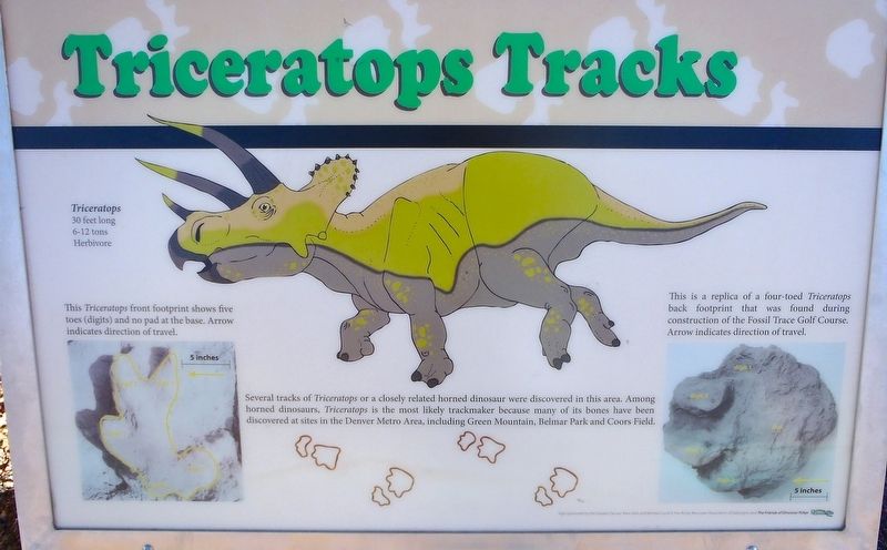
Triceratops Tracks
Photographed by Sherry L. Perrie, January 11, 2018
1. Triceratops Tracks Marker
This Triceratops front footprint shows five toes (digits) and no pad at the base. Arrow indicates direction of travel.
This is a replica of a four-toed Triceratops back footprint that was found during construction of the Fossil Trace Golf Course. Arrow indicates direction of travel.
Erected by Erected by The Greater Denver Area Gem and Mineral Council, the Rocky Mountain Association of Geologists, and the Friends of Dinosaur Ridge.
Topics. This historical marker is listed in these topic lists: Animals • Environment • Paleontology.
Location. 39° 44.595′ N, 105° 13.167′ W. Marker is in Golden, Colorado, in Jefferson County. It is in Lakota Hills. It can be reached from Triceratops Trail half a mile 19th
this page online

Regionally, this marker is in the Front Range. It is also in the American Mountain West. Globally, it is in North America, the Rocky Mountains, the Western Hemisphere, the Western World, and the Anglosphere. Historically, it finds itself in what was once the Louisiana Purchase.
Other nearby markers. At least 8 other markers are within walking distance of this marker: Palm Fronds (here, next to this marker); Bird Track (a few steps from this marker); Clay Mining (within shouting distance of this marker); Triceratops Trail (about 500 feet away, measured in a direct line); Colorado School Of Mines (approx. 0.7 miles away); Stop 7: Laramie Formation (68 mya) Clay Pits Fault, Fire Clay Mining, Reclamation (approx. ¾ mile away); Stop 7a: White Ash Mine (approx. ¾ mile away); White Ash Mine Disaster
Photographed by Sherry L. Perrie, January 11, 2018
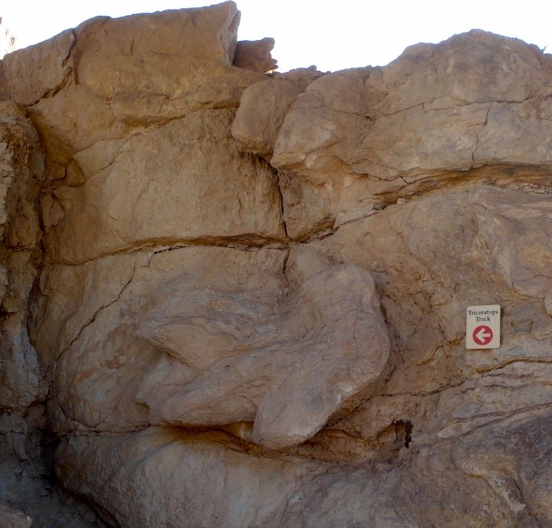
2. A Triceratops Track
Also see . . .
1. Triceratops Trail. Golden, Colorado website entry (Submitted on February 13, 2018, by Alan M. Perrie of Unionville, Connecticut.)
2. Triceratops Trail. Go Hike Colorado website entry (Submitted on February 13, 2018, by Alan M. Perrie of Unionville, Connecticut.)
3. Triceratops. Wikipedia entry (Submitted on February 13, 2018, by Alan M. Perrie of Unionville, Connecticut.)
Credits. This page was last revised on June 18, 2026. It was originally submitted on February 13, 2018, by Alan M. Perrie of Unionville, Connecticut. This page has been viewed 1,204 times since then and 100 times this year. Photos: 1, 2. submitted on February 13, 2018, by Alan M. Perrie of Unionville, Connecticut. • Andrew Ruppenstein was the editor who published this page.
