Atchafalaya River
Atchafalaya Welcome Center
| — | Atchafalaya Water Heritage Trail | — |
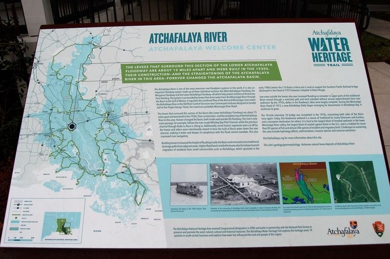
The levee that surround this section of the lower Atchafalaya Floodway are about 15 miles apart and were built in the 1930s. Their construction- and the straightening of the Atchafalaya River in this area- forever changed the Atchafalaya Basin.
The Atchafalaya Basin is one of the most extensive river-floodplain systems in the world. It is also an important floodway system made up of three individual sections—the West Atchafalaya Floodway, the Morganza Floodway and the Lower Atchafalaya Floodway—all which help protect millions of Americans from flooding. The system is surrounded by levees that direct water from the Mississippi River through the Basin to the Gulf of Mexico. It regulates the combined flow of the Red and Mississippi rivers down the Atchafalaya River at the Old River Control Structure near Simmesport and was designed to handle half of the Project Design Flood, the maximum probable Mississippi River flood.
The levees that surround this section of the Basin (the Lower Atchafalaya Floodway) are about 15 miles apart and were built in the 1930s. Their construction—and the straightening of the
this page online
Building levees increased the height of flooding inside the Basin and removed some traditional drainage paths from adjacent areas. Higher flood levels inside the levees also forced permanent migration of residents from small communities such as Atchafalaya, which sprouted in the early 1900s (where the I-10 Butte La Rose exit is now) to support the Southern Pacific Railroad bridge (destroyed in the Flood of 1927) between Lafayette to Baton Rouge.
Low areas outside the levees also saw increased flooding as rainwater in upper parts of the traditional Basin moved through a restricted path and land subsided without annual
The 18-mile Interstate 10 bridge was completed in the 1970s, connecting both sides of the Basin once again. Today, this biodiverse wetland is a source of livelihood for many fishermen and hunters, and a recreation destination for others. It is host to the largest block of forested wetlands in the lower Mississippi River valley, the largest block of coastal cypress forest in the U.S., and is a habitat for more than 85 species of fish and almost 300 species of resident and migratory birds. Challenges to sustaining this area include hydrology effects, sedimentation, invasive species and resource extraction.
Visit Atchafalaya.org for more information about this site.
This site’s geology/geomorphology: Holocene natural levee deposits of Atchafalaya River
Erected by State of Louisiana and National Park Service.
Topics and series. This historical marker is listed in these topic lists: Environment
Location. 30° 20.498′ N, 91° 43.373′ W. Marker is in Atchafalaya, Louisiana, in St. Martin Parish. It can be reached from the intersection of Atchafalaya River Highway (State Highway 3177) and Interstate 10. Touch for map. Marker is at or near this postal address: 1908 Atchafalaya River Highway, Breaux Bridge LA 70517, United States of America. Touch for directions.

Regionally, this marker is in Louisiana’s Acadiana — Cajun Country and specifically in Bayou Country. It is also in the American South, specifically in the Deep South, and on the Gulf Coast. Globally, it is in North America, a Gulf of Mexico state, the Western Hemisphere, the Western World, and the Anglosphere. Historically, it finds itself in what was once New Spain, Acadia, the territory of the Mississippian Culture, the Louisiana Purchase, one of the Confederate States of America, and the Antebellum South.
Other nearby markers. At least 8 other markers are within 10 miles of this marker, measured as the crow flies: Louisiana Airborne Memorial Bridge (within shouting distance of this marker); Atchafalaya Floodway (approx. 4.2 miles away); a different marker also named Atchafalaya Floodway (approx. 4.6 miles away); a different marker also named Atchafalaya River (approx. 4.8 miles away); Bottomland Hardwoods (approx. 6½ miles away); Big Alabama Bayou (approx. 6½ miles away); Louis Hebert (approx. 7.8 miles away); Stephanie-Martin Duralde House (approx. 9.3 miles away).
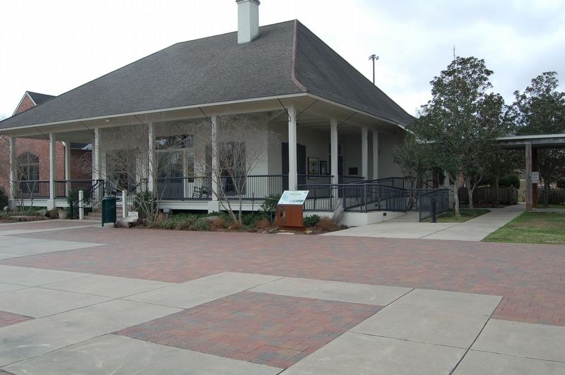
More about this marker. Located on the grounds of the Louisiana/Atchafalaya Welcome Center, Interstate 10 Louisiana Exit 121.
Also see . . . Pousser Des bêtes, Lost History of the Atchafalaya. (Submitted on April 15, 2019, by Kenneth Ramagost of Louisiana, USA.)
Credits. This page was last revised on June 2, 2023. It was originally submitted on February 18, 2018, by Cajun Scrambler of Assumption, Louisiana. This page has been viewed 589 times since then and 42 times this year. Photos: 1, 2. submitted on February 18, 2018.
