St. Landry Catholic Cemetery
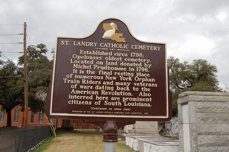
Side 1
Established circa 1798; Opelousas oldest cemetery. Located on land donated by Michel Prudhomme in 1796. It is the final resting place of numerous New York Orphan Train Riders and many veterans of wars dating back to the American Revolution. Also interred here are prominent citizens of South Louisiana
(continued on other side)
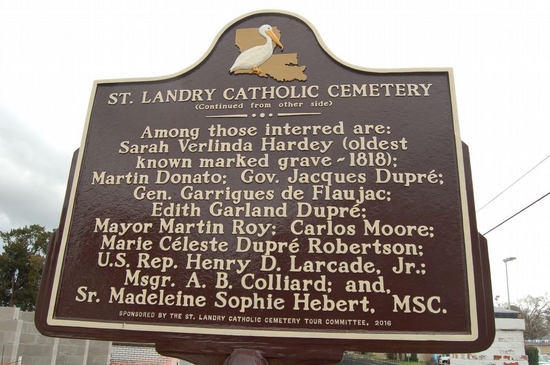
(continued from other side)
Side 2
Among those interred are: Sarah Verlinda Hardey (oldest known marker grave - 1818); Jacques Dupré; Gen. Garrigues de Flaujac; Edith Garland Dupré; Mayor Martin Roy; Carlos Moore; Marie Céleste Dupré Robertson; U.S. Rep. Henry D. Larcade, Jr.; Msgr. A.B. Colliard; and, Sr. Madeleine Sophie Hebert, MSC.
Erected 2016 by St. Landry Catholic Cemetery Tour Commission.
Topics. This historical marker is listed in these topic lists: Cemeteries & Burial Sites • Religion & Religious Structures.
Location. 30° 32.556′ N, 92° 4.752′ W. Marker is in Opelousas, Louisiana, in St. Landry Parish. It is at the intersection of North Union Street and Church Street, on the right when traveling north on North Union Street.
this page online

Regionally, this marker is in Louisiana’s Acadiana — Cajun Country. It is also in the American South and specifically in the Deep South. Globally, it is in North America, a Gulf of Mexico state, the Western Hemisphere, the Western World, and the Anglosphere. Historically, it finds itself in what was once New Spain, Acadia, the territory of the Mississippian Culture, the Louisiana Purchase, one of the Confederate States of America, and the Antebellum South.
Other nearby markers. At least 8 other markers are within walking distance of this marker: St. Landry Catholic Church (within shouting distance of this marker); a different marker also named St. Landry Catholic Church (about 300 feet away, measured in a direct line); Lt. Fr. Joseph "Verbis" Lafleur (about 400 feet away); Opelousas Catholic School (approx. 0.2 miles away); Black Academy At Mt. Olive Baptist Church (approx. ¼ mile away); Bloch Corner (approx. 0.6 miles away); City Hall (approx. 0.6 miles away); Louisiana Memorial Methodist Church
Credits. This page was last revised on June 17, 2022. It was originally submitted on February 19, 2018, by Cajun Scrambler of Assumption, Louisiana. This page has been viewed 1,170 times since then and 104 times this year. Photos: 1. submitted on February 19, 2018, by Cajun Scrambler of Assumption, Louisiana. 2, 3, 4. submitted on February 19, 2018.
