Dayton in Yamhill County, Oregon — The American West (Northwest)
Courthouse Square Park
Fort Yamhill Blockhouse
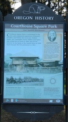
Photographed by Barry Swackhamer, September 26, 2017
1. Courthouse Square Park Marker
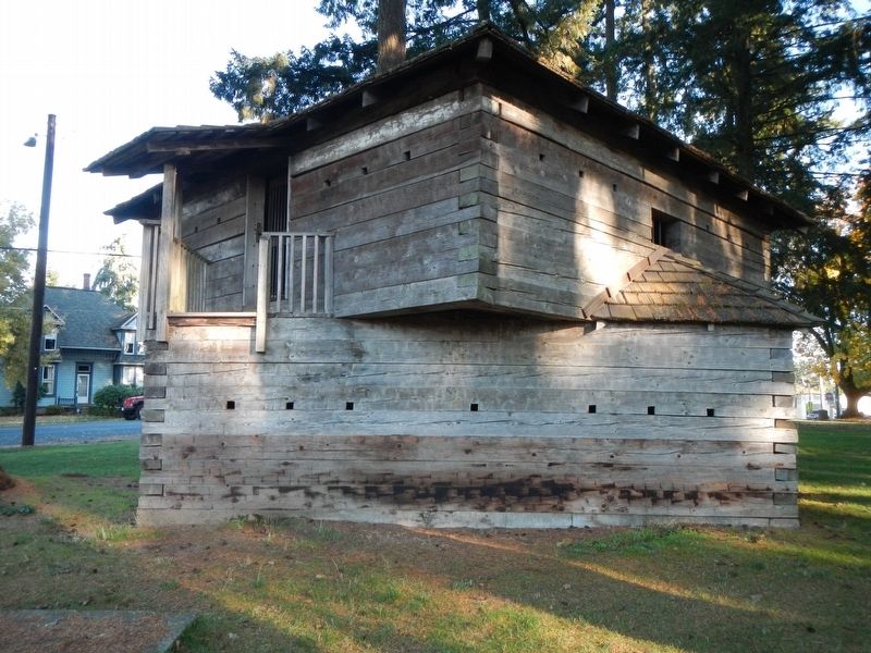
Captions: (details of the blockhouse, center left) Six rifle loopholes on each of eight sides allow protected gunfire; The structure consists of square hewn logs.; This two-story 20' x 20' wooden blockhouse originally stood at the entrance to the Grand Ronde Valley at Fort Yamhill from 1856 to 1866.; Moving the blockhouse to Dayton, 1911.
Courthouse Square Park is a monument to the civic and commercial aspirations of Dayton’s founders, Joel Palmer, his son-in-law Andrew Smith and Christopher Taylor. Palmer and Taylor, who settled here to farm in 1848, laid out the town site on the banks of the Yamhill River in 1850. Taylor became the first postmaster in 1851.
An Anticipating Town Square
The founders hoped that Dayton would become the county seat of Yamhill County, and planned that a courthouse would rise on this block. When the courthouse did not come, the block became the town square, with a bandstand, fountain, war memorial, and a historic blockhouse.
Many Years of Service
The blockhouse served from 1856 to 1866 at Fort Yamhill, a US Army post about thirty miles west of Dayton. The fort was a buffer at the western edge of the Grand Ronde Indian Reservation, where many Western Oregon natives were forcibly relocated after the wars of 1851-1856. When the fort was abandoned, the blockhouse was moved to Old Grand Ronde and used as a jail and storage building by the Bureau of Indian Affairs.
“Its form is different from the usual blockhouse, which had upper walls parallel to those below…here the upper block is the same size of the lower, but turned on a true diagonal.”
This design allowed for rifles to be fired form all eight sides every 45 degrees instead of four sides every 90 degrees. -- Jamieson Parker, Historic American Building Survey
(side-bar, upper right:)
Palmer came to Oregon from Indiana in 1845, and helped forge the Barlow Road around Mount Hood. He was Superintendent of Indian Affairs in Oregon from 1853 to 1856. Known as “General” Joel Palmer, he established the western Oregon reservations and led the way for removal of the tribes; which kept tribes
this page online
The blockhouse was neglected until John G. Lewis of Dayton arranged in 1911 to acquire it from the US government. It was moved to Dayton’s Courthouse Square Park as a memorial to Joel Palmer.
Erected by Oregon Heritage Commission, The City of Dayton & Downtown Dayton.
Topics and series. This historical marker is listed in these topic lists: Forts and Castles • Indigenous Peoples and Communities. In addition, it is included in the Oregon Beaver Boards series list.
Location. 45° 13.275′ N, 123° 4.575′ W. Marker is in Dayton, Oregon, in Yamhill County. It is on SouthEast Dayton-Salem Highway (aka 3rd Street) (Oregon Route 221) near Main Street, on the right when traveling south. Touch for map. Marker is at or near this postal address: 400 3rd Street, Dayton OR 97114, United States of America. Touch for directions.

Regionally, this marker is in Oregon Wine Country, in the Willamette Valley, and in Greater Portland Area. It is also on the
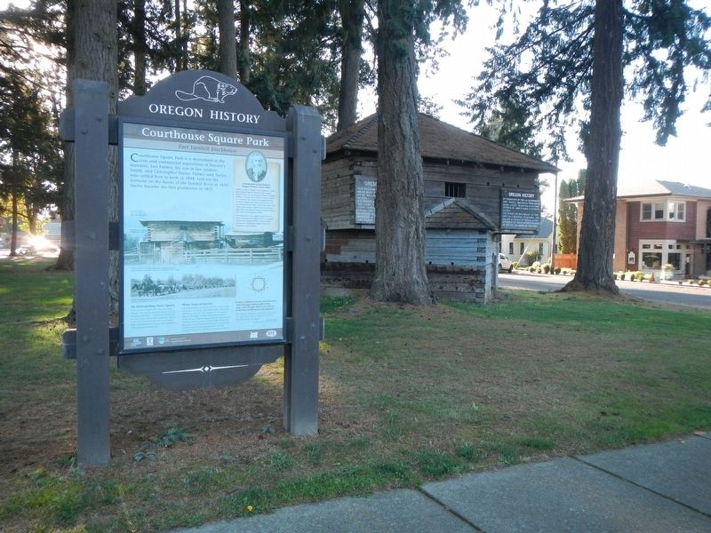
Photographed by Barry Swackhamer, September 26, 2017
2. Courthouse Square Park Marker
Yamhill Blockhouse in the background.
Other nearby markers. At least 8 other markers are within 10 miles of this marker, measured as the crow flies: Yamhill Blockhouse (a few steps from this marker); Pioneer Park and Blockhouse (a few steps from this marker); St. Paul Roman Catholic Church (approx. 4.8 miles away); The Most Reverend F. N. Blanchet (approx. 5 miles away); Hoover - Minthorn House (approx. 7½ miles away); Champoeg (approx. 8.7 miles away); The Wheatland Ferry (approx. 9.1 miles away); Madame Marie Dorion (approx. 9.4 miles away). Touch for a list and map of all markers in Dayton.
Another marker is no longer nearby. Willamette Post (was approx. 7.1 miles away but has been confirmed missing).
More about this marker. This marker is located in Courthouse Square Park.
Also see . . . Oregon Travel Experience - Dayton Courthouse Square Park and Blockhouse. The official 'Beaver Board' website for Oregon State Historical Markers
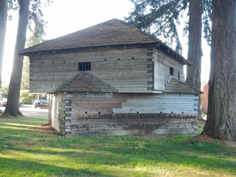
Photographed by Barry Swackhamer, September 26, 2017
3. Yamhill Blockhouse
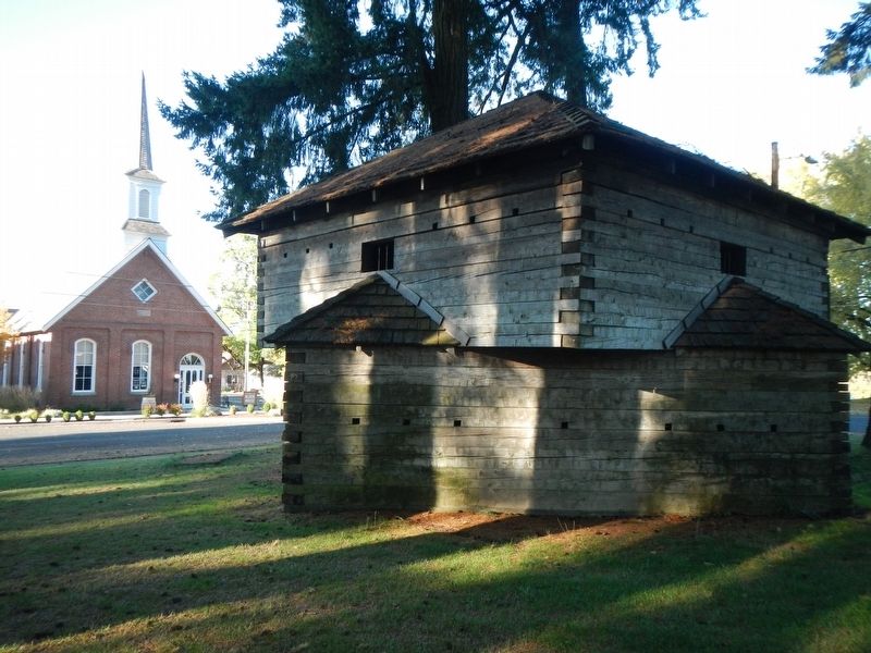
Photographed by Barry Swackhamer, September 26, 2017
4. Yamhill Blockhouse
Photographed by Barry Swackhamer, September 26, 2017
5. Yamhill Blockhouse
Credits. This page was last revised on October 25, 2024. It was originally submitted on February 23, 2018, by Barry Swackhamer of Brentwood, California. This page has been viewed 516 times since then and 47 times this year. Photos: 1, 2, 3, 4, 5. submitted on February 23, 2018, by Barry Swackhamer of Brentwood, California.
