
Santiago de Querétaro in Querétaro, Mexico — The Central Highlands (North America)
Fountain of the Verdolagas
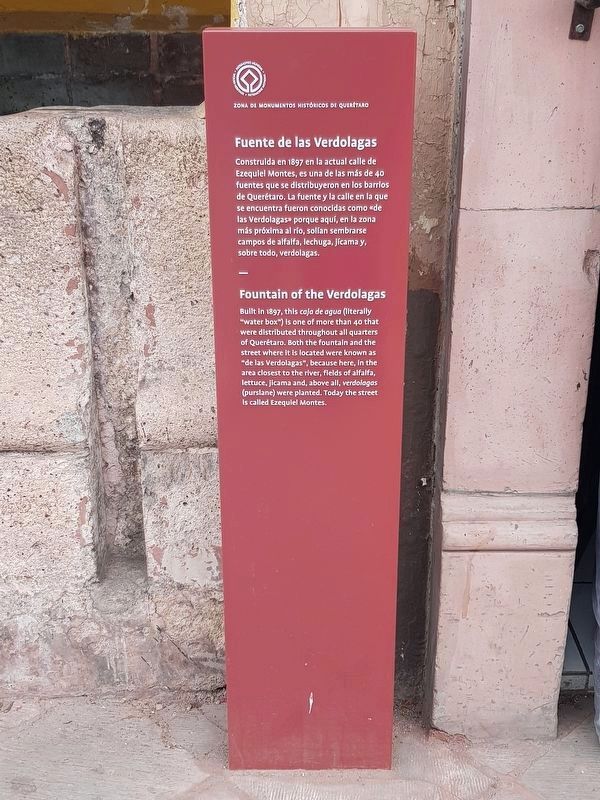
Photographed by J. Makali Bruton, July 26, 2018
1. Fountain of the Verdolagas Marker
This marker with updated text replaced an older marker in 2018.

Fuente de las Verdolagas
Construida en 1897 en la actual calle de Ezequiel Montes, es una de las más de 40 fuentes que se distribuyeron en los barrios de Querétaro. La fuente y la calle en la que se encuentra fueron conocidas como “de las Verdolagas” porque aquí, en la zona más próxima al río, solían sembrarse campos de alfalfa, lechuga, jícama y sobre todo, verdolagas.
Fountain of the Verdolagas
Built in 1897, this caja de agua (literally "water box") is one of more than 40 that were distributed throughout all quarters of Querétaro. Both the fountain and the street where it is located were known as “de las Verdolagas”, because here, in the area closest to the river, fields of alfalfa, lettuce, jicama and, above all, verdolagas (purslane) were planted. Today the street is called Ezequiel Montes.
Erected 2018 by Municipalidad de Querétaro.
Topics. This historical marker is listed in these topic lists: Charity & Public Work • Industry & Commerce • Man-Made Features. A significant historical date for this entry is March 18, 1897.
Location. 20° 35.735′ N, 100° 23.955′ W. Marker is in
this page online

Regionally, this marker is in Central Mexico and in the Bajío. Globally, it is in North America, specifically in Mesoamerica, on the Ring of Fire, and in the Western Hemisphere. Historically, it finds itself in what was once New Spain, a Spanish colony, and the Aztec Empire.
Other nearby markers. At least 8 other markers are within walking distance of this marker: Temple and fountain of Santa Ana (approx. 0.2 kilometers away); Félix Nabor Osores de Sotomayor García (approx. 0.2 kilometers away); Vecindad del Agua Limpia (approx. 0.4 kilometers away); Benjamin N. Velasco Military Institute (approx. 0.4 kilometers away); Temple and former Convent of Capuchins (approx. 0.4 kilometers away); Chapel of the Sacred Family (approx. half a kilometer away); Manuel de la Peña y Peña (approx. half a kilometer away); Last Prison of Maximilian (approx. half
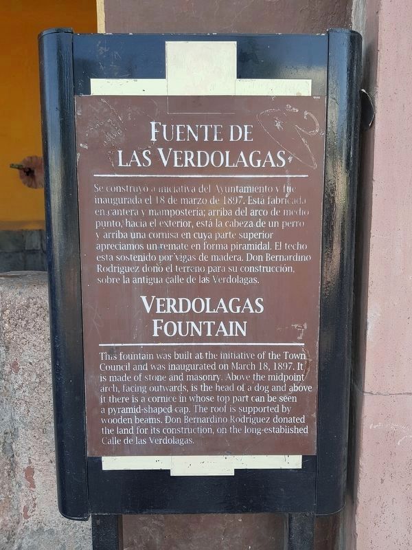
Photographed by J. Makali Bruton, February 23, 2018
2. The previous Verdolagas Fountain Marker
This marker was replaced soon after February 2018. It read:
Fuente de las Verdolagas Se construyó a iniciativa del Ayuntamiento y fue inaugurada el 18 de marzo de 1897. Está fabrícada en cantera y mampostería; arriba del arco de mediopunto, hacia el exterior, está la cabeza de un perro y arriba una cornisa en cuya parte superior
apreciamos un remate en forma piramidal. El techo esta sostenido por vigas de madera. Don Bernardino
Rodríguez donó el terreno para su construcción, sobre la antigua calle de las Verdolagas.
English:
Verdolagas Fountain This fountain was built at the initiative of the Town Council and was inaugurated on March 18, 1897. It is made of stone and masonry. Above the midpoint arch, facing outwards, is the head of a dog and above it there is a cornice in whose top part can be seen a pyramid-shaped cap. The roof is supported by wooden beams. Don Bernardino Rodriguez donated the land for its construction, on the long-established Calle de las Verdolagas.
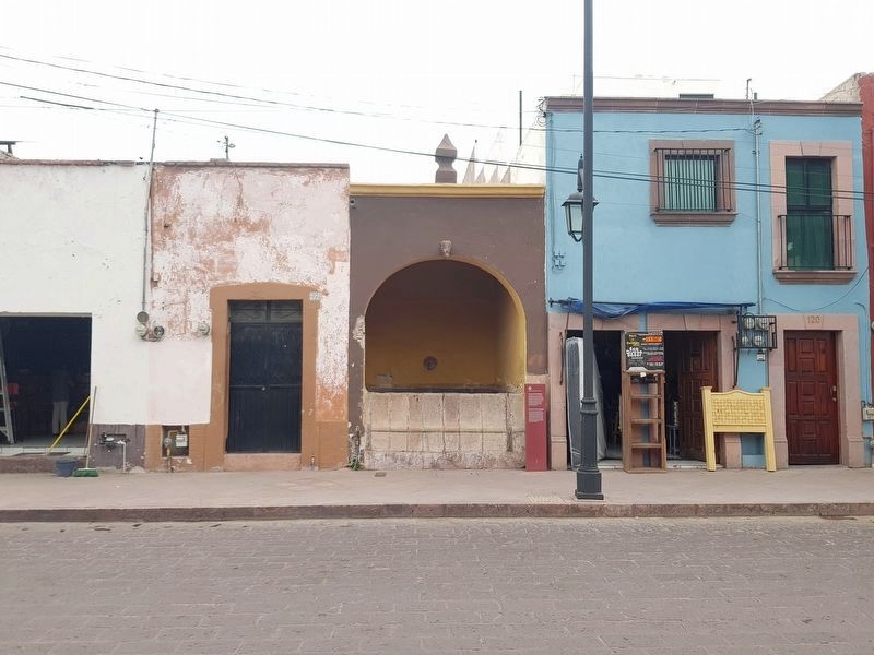
Photographed by J. Makali Bruton, July 26, 2018
3. Fountain of the Verdolagas and Marker
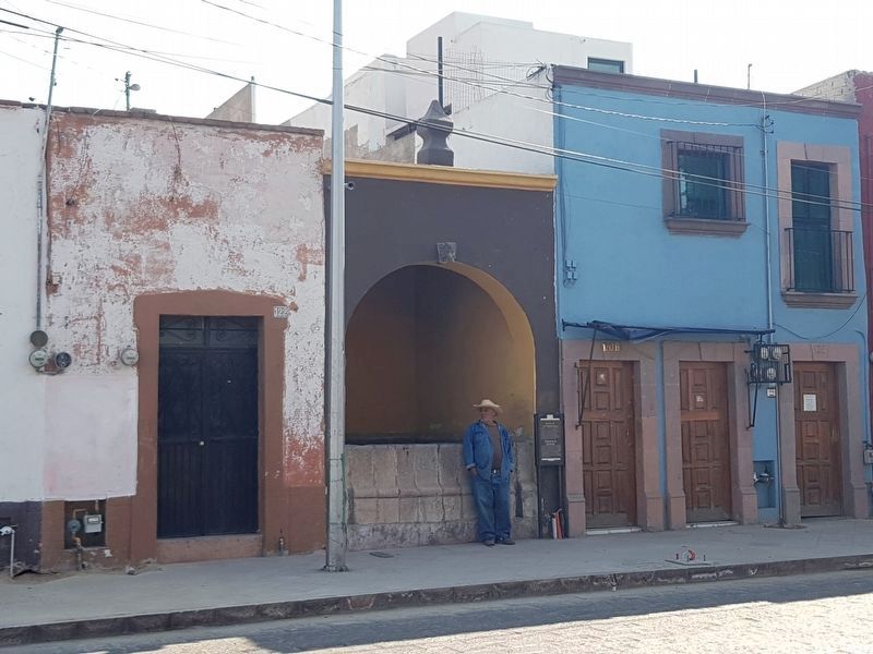
Photographed by J. Makali Bruton, February 23, 2018
4. Verdolagas Fountain and the previous marker
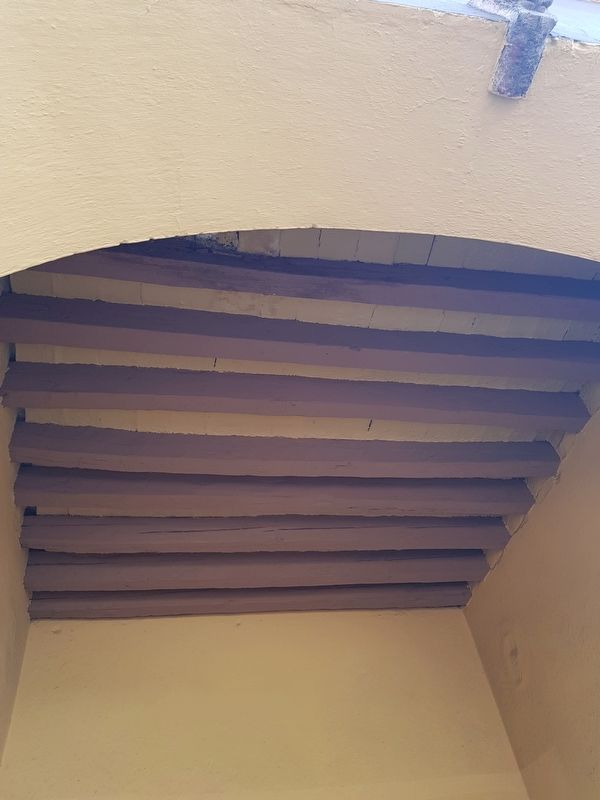
Photographed by J. Makali Bruton, February 23, 2018
5. Verdolagas Fountain wooden beams supporting the roof
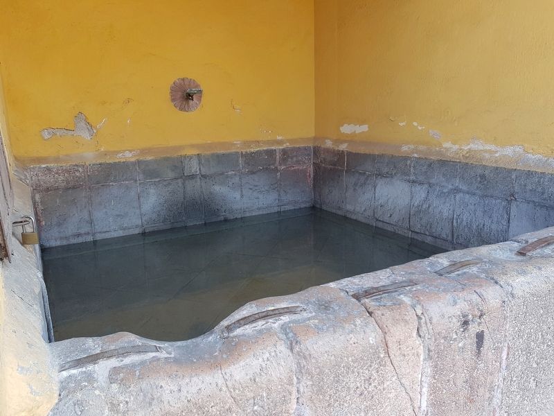
Photographed by J. Makali Bruton, February 23, 2018
6. Verdolagas Fountain detail
Note the wearing on the left-hand side from years of removing water from the fountain by buckets.
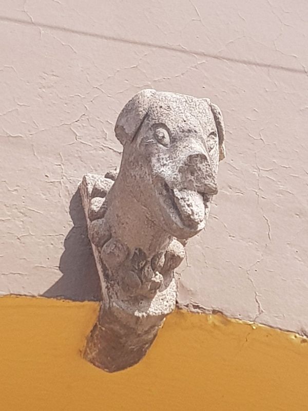
Photographed by J. Makali Bruton, February 14, 2018
7. Verdolagas Fountain dog's head, unfortunately damaged
Credits. This page was last revised on August 6, 2018. It was originally submitted on February 26, 2018, by J. Makali Bruton of Washington, District of Columbia. This page has been viewed 489 times since then and 25 times this year. Photos: 1. submitted on August 6, 2018, by J. Makali Bruton of Washington, District of Columbia. 2. submitted on February 26, 2018, by J. Makali Bruton of Washington, District of Columbia. 3. submitted on August 6, 2018, by J. Makali Bruton of Washington, District of Columbia. 4, 5, 6, 7. submitted on February 26, 2018, by J. Makali Bruton of Washington, District of Columbia.
