Wolf Creek in Josephine County, Oregon — The American West (Northwest)
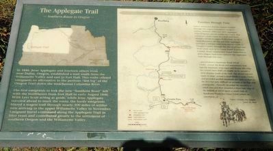
The Applegate Trail
Southern Route to Oregon
Photographed by Barry Swackhamer, September 27, 2017
1. The Applegate Trail Marker
The first emigrants to trek the new “Southern Road” left with the trailblazers from Fort Hall in early August 1846. With Levi Scott acting as guide, while Jesse Applegate traveled ahead to mark the route, the hardy emigrants blazed a wagon trail through nearly 500 miles of wilderness arriving in the upper Willamette Valley in November. Emigrant travel continued along the Applegate Trail in later years and contributed greatly to the settlement of southern Oregon and the Willamette Valley.
Native Americans and fur trappers trekked through this region long before emigrants settlers. Between 1846 and 1853 Applegate Trail emigrants passed nearby on a route that followed Coyote Creek for a mile then crossed a divide to upper Wolf Creek. In 1853 Major Benjamin Alvord and Jesse Applegate surveyed a military road
this page online
...passed down a hansom Brook (Wolf Creek)...crossed the Brook and immediately took (up) the mountain steep ruged and Brushy this ridge has several snow drifts yit visible on its summit a short distance South of the trail. The desent was not Quite so steep crossed a small Brook (Coyote Creek) and assended another mountain not Quite so high as the first but verry difficult on account of the logs and undergrothe...Partially desended the second a small cove and then mounted a third high ridge at the bottom of which opens a small vally of handsome Prairie (on Grave Creek) whare we encamped... -- James Clyman, Fur Trapper June 19 1844
Erected by Applegate Trail Coalition.
Topics and series. This historical marker is listed in these topic lists: Exploration • Roads & Vehicles. In addition, it is included in the Applegate Trail series list. A significant historical date for this entry is June 19, 1844.
Location. 42° 41.718′ N, 123° 23.733′ W.
Photographed by Barry Swackhamer, September 27, 2017
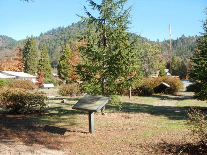
2. The Applegate Trail Marker
The marker is the more-distant marker at the center right.

Regionally, this marker is in Southern Oregon. It is also on the American Pacific Coast, in the Pacific Northwest, and in the Lewis & Clark Corridor. Globally, it is in North America, on the Ring of Fire, on the Pacific Rim, in the Western Hemisphere, in the Western World, and in the Anglosphere. Historically, it finds itself in what was once New Spain.
Other nearby markers. At least 8 other markers are within 5 miles of this marker, measured as the crow flies: Feeble, Hungry, and Haggard (a few steps from this marker); Early Traveler Accommodations (a few steps from this marker); Wolf Creek Tavern (within shouting distance of this marker); City of Glendale (approx. 3.3 miles away); Golden (approx. 3.4 miles away); GOLD! (approx. 3.4 miles away); Grave Creek Ranch (approx. 4.2 miles away); Applegate Trail - Grave Creek (approx. 4.2 miles away). Touch for a list and map of all markers in Wolf Creek.
Another marker is no longer nearby. The Applegate Trail (was approx. 4.2 miles away but has been confirmed missing).
More about this marker. The marker is located in a small park across from the Historic Wolf Creek Inn.
Credits. This page was last revised on March 1, 2018. It was originally submitted on February 28, 2018, by Barry Swackhamer of Brentwood, California. This page has been viewed 746 times since then and 52 times this year. Last updated on February 28, 2018, by Douglass Halvorsen of Klamath Falls, Oregon. Photos: 1, 2. submitted on February 28, 2018, by Barry Swackhamer of Brentwood, California.
