Gwynns Falls Trail
Gwynns Falls Park at I-70/Franklintown
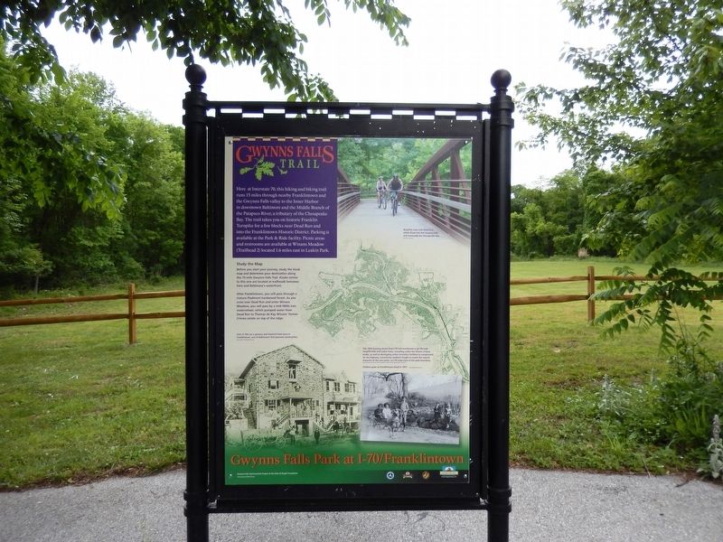
Study the Map
After Franklintown, you will pass through a mature Piedmont hardwood forest. As you cross over Dead Run and enter Winans Meadow, you will pass by a mid-1800’s iron waterwheel, which pumped water from Dead Run to Thomas de Kay Winan’s former Crimea estate on top of the ridge.
(Inscription above the image on the bottom left)
John H. Piel ran a grocery and livestock feed store in Franklintown, one of Baltimore’s first planned communities.
(Inscription in the image at the top)
Bicyclists cross over Dead Run which flows into the Gwynns Falls and eventually the Chesapeake Bay.
(Inscription
this page online
This 1969 drawing shows how I-70 was envisioned to go through Gwynns Falls and Leakin Parks, tunneling under the historic Crimea estate, as well as developing active recreation facilities to compensate for the highway. Community residents fought to retain the natural character of the two parks, so I-70 stops here at the park boundary.
(Inscription over the image in the bottom right)
Children pose on Franklintown Road in 1901.
Erected by Gwynns Falls Trail Council/A project of the Parks and People Foundation.
Topics. This historical marker is listed in these topic lists: Education • Environment. A significant historical year for this entry is 1969.
Location. 39° 18.121′ N, 76° 42.501′ W. Marker is in Baltimore, Maryland. It is in Franklintown. It is on I-70 Park and Ride off Security Blvd.. The marker is at the end of I-70 Park and Ride. Touch for map. Marker is in this post office area: Baltimore MD 21229, United States of America. Touch for directions.
Regionally, this marker is in Central Maryland. It is also in the American Mid-Atlantic, in the Chesapeake Bay Region, and on the Eastern
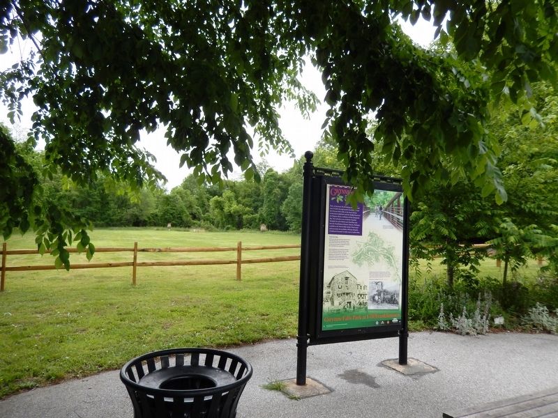
Other nearby markers. At least 8 other markers are within walking distance of this marker: A different marker also named Gwynns Falls Trail (here, next to this marker); Franklintown's Historic Roots (approx. ¼ mile away); Orianda House (approx. half a mile away); Caretaker House (approx. half a mile away); Crimea (approx. 0.6 miles away); Gateway to Leakin Park (approx. 0.6 miles away); Chapel (approx. 0.6 miles away); Crimea Mansion (approx. 0.6 miles away). Touch for a list and map of all markers in Baltimore.
Credits. This page was last revised on November 2, 2020. It was originally submitted on May 27, 2017, by Don Morfe of Baltimore, Maryland. This page has been viewed 304 times since then and 19 times this year. Last updated on March 3, 2018, by Devry Becker Jones of Washington, District of Columbia. Photos: 1, 2, 3, 4, 5. submitted on May 27, 2017, by Don Morfe of Baltimore, Maryland. • Andrew Ruppenstein was the editor who published this page.
