White Haven in Luzerne County, Pennsylvania — The American Northeast (Mid-Atlantic)
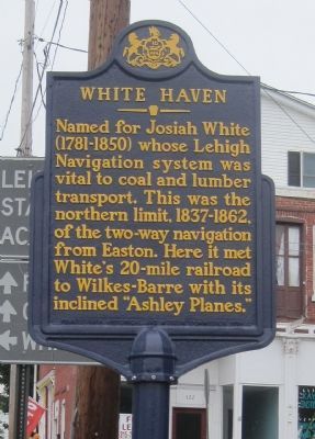
White Haven
Photographed by Kevin W., June 11, 2011
1. White Haven Marker
Erected 1984 by Pennsylvania Historical and Museum Commission.
Topics and series. This historical marker is listed in this topic list: Waterways & Vessels. In addition, it is included in the Pennsylvania Historical and Museum Commission (PHMC) series list.
Location. 41° 3.664′ N, 75° 46.38′ W. Marker is in White Haven, Pennsylvania, in Luzerne County. It is at the intersection of Berwick Street and Main Street on Berwick Street. Touch for map. Marker is in this post office area: White Haven PA 18661, United States of America. Touch for directions.

Regionally, this marker is in Pennsylvania’s Anthracite Coal Region, in the Wyoming Valley, and in Greater Scranton and Wilkes-Barre. It is also in the American Northeast, in the Mid-Atlantic, in Appalachia, and specifically in Northern Appalachia.
this page online
Other nearby markers. At least 8 other markers are within 6 miles of this marker, measured as the crow flies: Thank Josiah White (approx. 0.3 miles away); Exploring The Corridor (approx. 0.3 miles away); Workers From All Nations (approx. 0.7 miles away); River Ran Black (approx. 1.7 miles away); a different marker also named River Ran Black (approx. 1.7 miles away); Disaster at Mud Run (approx. 5.9 miles away); A Revolution in Canal Technology (approx. 5.9 miles away); Engineering Marvel (approx. 6 miles away). Touch for a list and map of all markers in White Haven.
Related markers. Click here for a list of markers that are related to this marker. White Haven
Photographed by Kevin W., June 11, 2011
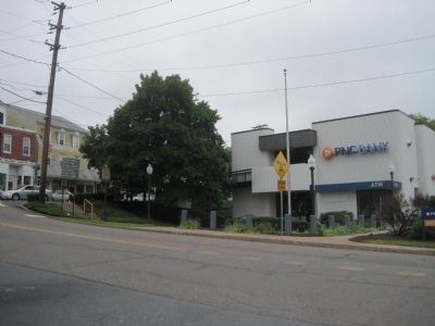
2. White Haven Marker
Photographed by Kevin W., June 11, 2011
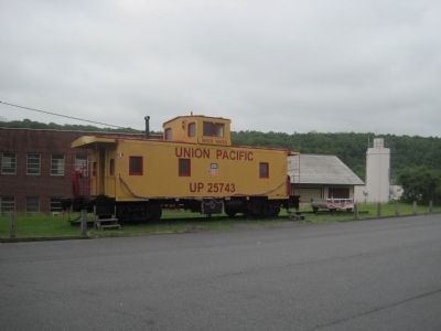
3. Union Pacific caboose on display nearby
Credits. This page was last revised on March 9, 2018. It was originally submitted on July 3, 2011, by Kevin W. of Stafford, Virginia. This page has been viewed 1,488 times since then and 54 times this year. Last updated on March 4, 2018, by Cosmos Mariner of Cape Canaveral, Florida. Photos: 1, 2, 3. submitted on July 3, 2011, by Kevin W. of Stafford, Virginia. • Andrew Ruppenstein was the editor who published this page.
