Near Jim Thorpe in Carbon County, Pennsylvania — The American Northeast (Mid-Atlantic)
Railroad Intersection
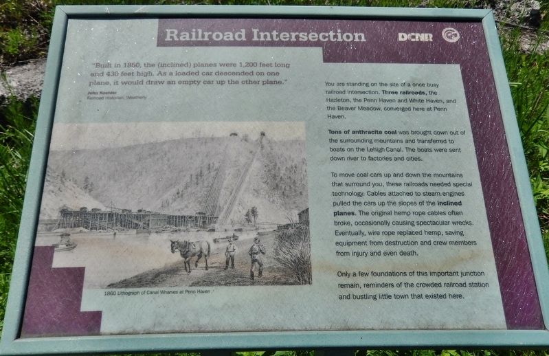
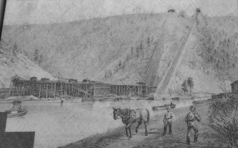
"Built in 1850, the (inclined) planes were 1,200 feet long and 430 feet high. As a loaded car descended on one plane. it would draw an empty car up the other plane."
John Koehler, Railroad Historian, Weatherly
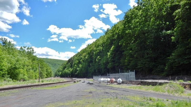
You are standing on the site of a once busy railroad intersection. Three railroads, the Hazleton, the Penn Haven and White Haven, and the Beaver Meadow, converged here at Penn Haven.
Tons of anthracite coal was brought down out of the surrounding mountains and transferred to boats on the Lehigh Canal. The boats were sent down river to factories and cities.
To move coal cars up and down the mountains that surround you, these railroads needed special technology. Cables attached to steam engines pulled the cars up the slopes of the inclined planes. The original hemp rope cables often broke, occasionally causing spectacular wrecks. Eventually, wire rope replaced hemp, saving equipment from destruction and crew members from injury and even death.
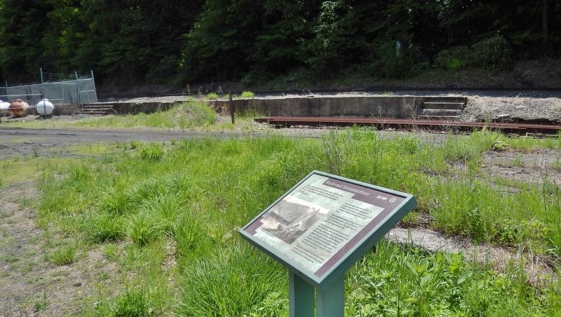
Only a few foundations of this important junction remain, reminders of the crowded railroad station and bustling little town that existed here.
Erected by Pennsylvania Department of Conservation and Natural Resources and Delaware & Lehigh National Heritage Corridor.
Topics and series. This historical marker is listed in these topic lists: Industry & Commerce • Man-Made Features • Notable Places • Railroads & Streetcars. In addition, it is included in the Lehigh Canal series list.
Location. 40° 56.7′ N, 75° 44.797′ W. Marker is near Jim Thorpe, Pennsylvania, in Carbon County. Marker can be reached from Lehigh Gorge Trail, 2.2 miles west of Main Street when traveling north. Marker and subject railroad intersection are accessible only by foot or bicycle, located on the Lehigh Gorge Recreational Trail, about 6 miles north of the Glen Onoko Falls trailhead. Above directions are for the trailhead, which is accessible by vehicle from the town of Jim Thorpe. Touch for map. Marker is in this post office area: Jim Thorpe PA 18229, United States of America. Touch for directions.
Other nearby markers. At least 8 other markers are within 4 miles of this marker, measured as the crow flies. Lehigh Gorge State Park (approx. 1˝ miles away); Audubon Spoke for the Trees (approx. 1˝ miles away); From Rails to Trails (approx. 1.6 miles away); A Revolution in Canal Technology (approx. 2.6 miles away); Pioneer Pipeline (approx. 2.6 miles away); Engineering Marvel (approx. 3.4 miles away); a different marker also named A Revolution in Canal Technology
(approx. 3˝ miles away); Disaster at Mud Run (approx. 3˝ miles away). Touch for a list and map of all markers in Jim Thorpe.
Regarding Railroad Intersection. In the early 1800s, Pennsylvania coal mine operators faced a daunting challenge: how to carry tons of heavy black coal from their mines to the canals and rivers below, upon which it could be transported to market. Gravity railroads were the initial solution, connecting the sources of coal to the Lehigh Canal, Delaware and Hudson Canal, and other man-made waterways that floated the vital fuel to Philadelphia, New York, and other industrial centers.
Also see . . .
1. Carbon's Most Desolate Place: Penn Haven Junction.
The first incline was built in 1850 to try to overcome the continual rockslides and floods of the steep ravine leading from Weatherly to the gorge. The plane was 1,200 feet long and rose over 450-feet in elevation. The first plane installed was the one on the right with two lines. The second incline, a four-track plane, was built by the Hazleton Railroad in 1859. The June 6, 1862 flood proved to show a fatal flaw. The dams and locks necessary to allow the coal barges to travel on the river meant that huge pools of water sat at the ready. Once the heavy June rains began, and dams began
to be breached, devastating tidal waves of flood water burst dam after dam causing a great flood and loss of life. (Submitted on March 4, 2018, by Cosmos Mariner of Cape Canaveral, Florida.)
2. Jim Thorpe, Pennsylvania.
Following the local discovery of anthracite coal in 1791, the Lehigh Coal and Navigation Company laid out the site and there built the first industrial railroad in the United States (1828), a gravity switchback line that hauled coal to the Lehigh Canal. Asa Packer, a coal baron, founded the Lehigh Valley Railroad to replace the canal in 1855. Mining has given way to tourism as the borough’s economic mainstay. Flagstaff Mountain Park and Glen Onoko Falls are nearby scenic spots. (Submitted on March 4, 2018, by Cosmos Mariner of Cape Canaveral, Florida.)
Credits. This page was last revised on July 23, 2020. It was originally submitted on March 4, 2018, by Cosmos Mariner of Cape Canaveral, Florida. This page has been viewed 416 times since then and 31 times this year. Photos: 1, 2, 3, 4, 5. submitted on March 4, 2018, by Cosmos Mariner of Cape Canaveral, Florida. • Bill Pfingsten was the editor who published this page.
