Near Clifton in Fairfax County, Virginia — The American South (Mid-Atlantic)
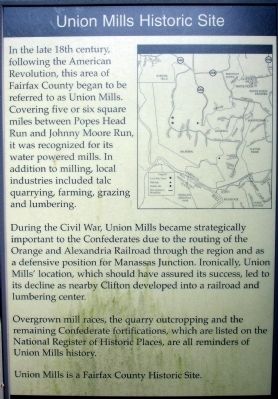
Union Mills Historic Site
During the Civil War, Union Mills became strategically important to the Confederates due to the routing of the Orange and Alexandria Railroad through the region and as a defensive position for Manassas Junction. Ironically, Union Mills’ location, which should have assured its success, led to its decline as nearby Clifton developed into a railroad and lumbering center.
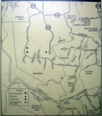
Overgrown mill races, the quarry outcropping and the remaining Confederate fortifications, which are listed on the National Register of Historic Places, are all reminders of Union Mills history.
Union Mills is a Fairfax County Historic Site.
Topics. This historical marker is listed in these topic lists: Industry & Commerce • War, US Civil.
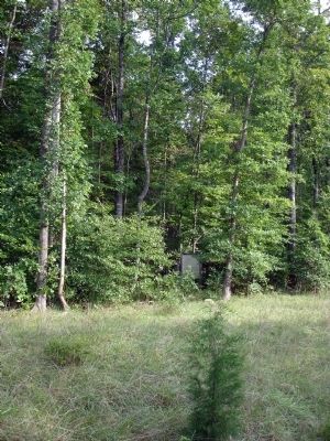
Location. 38° 47.664′ N, 77° 25.697′ W. Marker is near Clifton, Virginia, in Fairfax County. Marker is on Balmoral Greens Avenue, on the right when traveling north. Currently, the only available parking is on the shoulder of the road. Pedestrian access is currently accomplished from the shoulder of the road and along unimproved foot paths. Touch for map. Marker is at or near this postal address: 13772 Balmoral Greens Ave, Clifton VA 20124, United States of America. Touch for directions.
Other nearby markers. At least 8 other markers are within 2 miles of this marker, measured as the crow flies. McLean Farm (approx. 1.1 miles away); Wilmer McLean after the Civil War (approx. 1.1 miles away); Wilmer McLean’s Yorkshire (approx. 1.1 miles away); Ivakota Farm (approx. 1.3 miles away); Blackburn's Ford (approx. 1.3 miles away); a different marker also named Blackburn’s Ford (approx. 1.3 miles away); Civil War Earthworks (approx. 1˝ miles away); Mitchell's Ford (approx. 1.6 miles away). Touch for a list and map of all markers in Clifton.
Also see . . .
1. Confederate Fortifications Historic Site. Fairfax County Park Authority General Management Plan (Submitted on September 14, 2008.)
2. Tour Photo Gallery - Union Mills. From Bull Run Civil War Round Table. (Submitted on February 19, 2010.)
Credits. This page was last revised on March 28, 2022. It was originally submitted on September 14, 2008. This page has been viewed 6,234 times since then and 127 times this year. Photos: 1, 2, 3. submitted on September 14, 2008. • Craig Swain was the editor who published this page.


